With over a decade of GIS experience, Jim Casey uses the power of geospatial technology to advance his philanthropic work. We first met Jim through his passion project at Amache Internment Camp in southeastern Colorado. Mapping Amache is a collaborative mission to preserve Colorado’s forgotten Japanese internment camp using GIS, 3D technologies, and augmented reality. Earlier this year, Eos had the honor to explore the project further with this ArcGIS StoryMap.
Almost a year after working on this StoryMap, Jim now comes under the Eos spotlight to tell us more about himself, his latest philanthropy, and how he uses Arrow Series® GNSS receivers in his projects.
1. Why are you passionate about your job?

My work in GIS and geospatial technology enables me to be involved in a variety of projects. This is one of the reasons I like GIS — because it promotes collaboration between disciplines.
My passions include supporting nonprofit organizations — in general, projects that benefit people. Adding a spatial dimension to any project can really make a difference, by enabling any person, small group, or organization to meet their mission using state-of-the-art tools. Web maps, apps, and visualizations are powerful ways for small entities to present their stories.
Another reason I’m passionate about my work is because I get to work with new technologies. Right now, I’m learning to use 3D and augmented reality. They provide a great way to visualize a story, scene, project, or place from history. Also, drones and 3D-model reconstruction have become a rich source of data collection recently.
2. How did you first find out about Eos Positioning Systems’ GNSS products?
I first connected with the Eos team while at the Esri Southwest User Conference, and afterward through LinkedIn messages. At the time, I was searching for a better field data-collection system for my most ambitious project, the Amache Project.
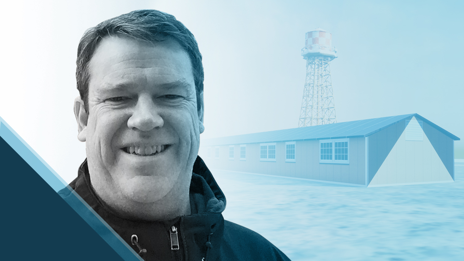
The Amache Project is run in conjunction with the University of Denver archaeology program and involves field data collection, analysis, and visualization. The field work takes place at Amache, one of 10 U.S. Japanese internment camps created after Pearl Harbor. During WWII, thousands of people of Japanese ancestry were forcibly relocated to Amache. Today, I am rebuilding the Amache Internment Camp in 3D and, ultimately, augmented reality. The end product will be a full digital reconstruction allowing people to virtually tour the site, learn about this part of history, and experience the camp as close to reality as possible — from their homes, classrooms, and anywhere else.
 Amache")
After learning about my goals, Eos expressed interest in participating in the project by providing an Arrow Gold® for my work. Since then, I have been using the Arrow GNSS receiver extensively for both Amache and other projects.
3. What do you use Arrow Series® GNSS receivers for?

For me, the Eos Arrow Gold® GNSS receiver has been a technology that glues together everything I do (with drones, 3D tools, augmented reality, etc.) — with accuracy. The Arrow Gold® provides me with RTK accuracy, allowing me to be sure the data quality I collect is highly reliable, so I can focus on other project details.
Most recently, two artists installed prominent street murals in downtown Denver. One mural reads, “Black Lives Matter, Remember This Time” and the other is called “Interwoven.” I used the Arrow Gold® to set ground control points (GCPs), fly both murals, and put the imagery on ArcGIS web maps. Thanks to the centimeter-accurate GCPs, I was able to tie all the imagery together into a single orthomosaic, as if it had been flown in one pass. This is now online as an ArcGIS Online web map and is being used by the City of Denver.
Although the pandemic cancelled plans to return to Amache this year, data collection with the Arrow Gold® at Amache will resume as soon as possible.
4. Do you have a favorite experience or memory from your projects with Eos Arrow?
Two experiences stand out. Once, while setting GCPs and flying my drone at Amache, I had the chance to escort a former internee, Dennis Otsuji, to the site of his birthplace (which was within the fences of the Amache Internment Camp). This was possible only because of the high-accuracy maps and records the Amache Project had created. This experience, and similar ones, will last with me forever.

The second experience that stands out was while I was collecting GCPs with my 10-year-old daughter at the “Black Lives Matter, Remember This Time” street mural. The day after the mural was painted, she and I wore our orange safety vests to the site and did some field data collection. Not only did my daughter learn a little bit about field data collection and setting GCPs, but also she witnessed a historical moment. The street mural has since faded, but the memory has not.
5. Do you have a favorite feature of Arrow GNSS receivers?
My favorite feature of the Arrow GNSS receivers is the fact that it works so easily — it is both fast and accurate. Connecting the Arrow Gold® to my iPad® via Bluetooth® and using ArcGIS Collector is such a simple setup. Training a new user to use an Arrow Gold® couldn’t be much easier.
6. Is there anything we didn’t ask you that you’d like to share with us?
Eos cares. That is the thing that I’ve noticed. In every experience that I’ve had with Eos, they have done their very best to help me be successful in the work that I’m doing. They made it all about me, and have helped me learn and do so much more than I could have otherwise. It’s so good to know that I’m working with a great group of people at Eos who care, and also build awesome technology.
To learn more about Jim Casey and his incredible work, read our full ArcGIS StoryMap, Augmenting Amache!
You May Also Like One of These Success Stories

Haiti Outreach Improves Potable Water Access with Atlas
Haiti Outreach involves locals in its water mission. They use mWater to prioritize work and Arrow Gold with Atlas to model distribution systems in EPANET.

Texas Drone Consultancy Maps Enchanted Rock with UAVs and GNSS
A Texas consultancy provided 3D topo maps and digital elevation models to a park by using Arrow Gold for ground control points, DJI drones & GPS Tracker.
