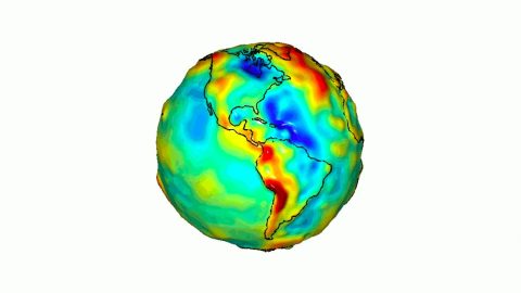
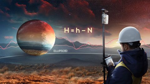
What is the difference between the ellipsoid, mean sea level, geoid, geoid height, and orthometric height? Here’s everything to know about elevation.
What is the difference between the ellipsoid, mean sea level, geoid, geoid height, and orthometric height? Here’s everything to know about elevation.
This article shows you how to set up Eos Tools Pro to collect survey-grade orthometric heights in real time with ArcGIS Collector.