Eos offers real-time orthometric heights as an included feature in the free Eos Tools Pro app (for iOS®, Android, Windows). In this tutorial, we will show you how to configure Eos Tools Pro and the Arrow GNSS receiver to output orthometric height measurements to your chosen data collection app, from built-in GEOID models within Eos Tools Pro.
Eos Tools Pro runs in the background of your chosen data-collection app (e.g., ArcGIS Field Maps) when using an Arrow GNSS receiver. Simply connect your Arrow GNSS receiver to your mobile device and configure the settings to switch from ellipsoidal to orthometric heights, based on your local GEOID model.
View the video tutorial below, or scroll down for a written version of the tutorial!
How to Configure Orthometric Height in Eos Tools Pro
1. Open Eos Tools Pro, and tap on the “Config” tab at the bottom of the app.

2. Select “Altitude” in the upper menu bar. From the “Altitude Reference” drop-down, select “Orthometric”.

3. Now you’ll see a list of the available (downloadable) GEOID models pop up. Scroll down to your country, and select the GEOID model you wish to download. For field work in the United States, you’ll want to select GEOID18 / NAVD88 (NAVD83 2011). Scroll down to the end of the article for a full list of supported GEOID models.
Once you’ve downloaded the correct GEOID model, select it by simply tapping on it. Then tap on “Done”.


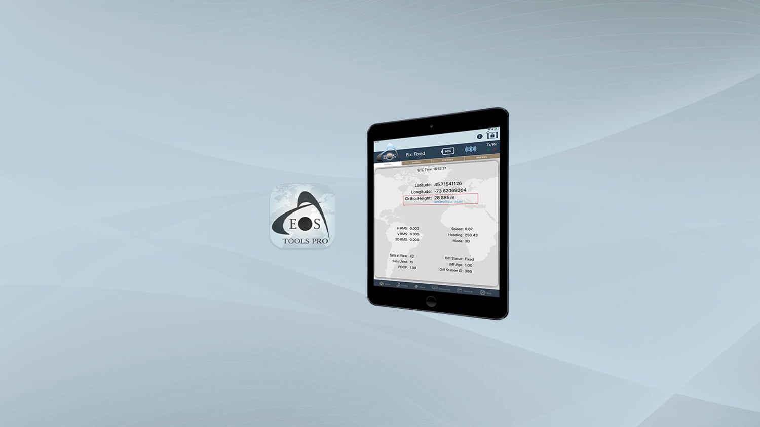
Note: The GEOID model that is in use will be displayed on the main Eos Tools Pro status page, right below the receiver’s coordinates.

Congratulations! Your GEOID model is now set within Eos Tools Pro.
Supported GEOID Models
Australia
- AUSGeoid09 / AHD71 (GDA94)
- AUSGeoid2020 / AHD71 (GDA2020)
Brazil
- MAPGEO2015 / DVB-I (SIRGAS 2000)
Canada
- CGG2013a / CGVD2013 (ITRF 2008)
- CGG2013a / CGVD2013 (NAD83 CSRS)
- HTv2.0 / CGVD28 (NAD83 CSRS)
Iceland
- IceGeoid2011 / ISH2004 (ISN2004)
- IceGeoid2011 / ISH2004 (ISN2016)
- IceGeoid2011 / ISH2004 (ISN93)
Sweden
- SWEN17 / RH 2000 (SWEREF 99)
USA
- GEOID12B / NAVD88 (NAD83 2011/PA11/MA11)
- GEOID18 / NAVD88 (NAD83 2011)
Our technical support team is regularly assessing new GEOID models based on customer demand. This list is regularly updated and was last updated in December 2021.
Don’t see your GEOID model, or have further questions? Contact technical support!
Explore Related Knowledge Base Items
Webinar: Using High-Accuracy Arrow GNSS in Esri’s ArcGIS Field Maps
Learn best practices for deploying high-accuracy Arrow GNSS receivers with Esri’s ArcGIS Field Maps. This webinar includes a customer presentation about his deployment, including demonstrations and Q&A.

How Do I Calculate The Total Antenna Height (Including Antenna Phase Center) for RTK Applications?
This article will show you how to calculate your total antenna height, including phase center, mounting plate height, and range pole, for use with RTK elevations.