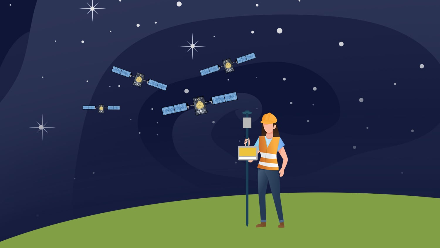
In this video, we’ll be testing the accuracy and convergence time of the new Galileo High Accuracy Service (HAS), a free GNSS correction service from the European Union’s Galileo Programme. Using the Eos Arrow Gold+™ GNSS receiver, we’ll demonstrate how Galileo HAS delivers real-time accuracy of better than 20 centimeters globally, even in remote areas. By walking you through our test setup and equipment, we’ll explore how this correction service operates during its initial Phase 1, with a focus on accuracy, stability, and convergence period time.
Follow along with the video below as we monitor the results! Or scroll down for the full transcript.
Transcript
In this video, we will test the accuracy and convergence time of the new Galileo High Accuracy Service (also known as Galileo HAS) from the European Union’s Galileo Programme.
What is Galileo HAS?
Commonly called Galileo HAS, this free GNSS correction service entered its initial Phase 1 of service in January 2023. Eos Positioning Systems had the first GNSS receiver, the Arrow Gold+, to support Galileo HAS.
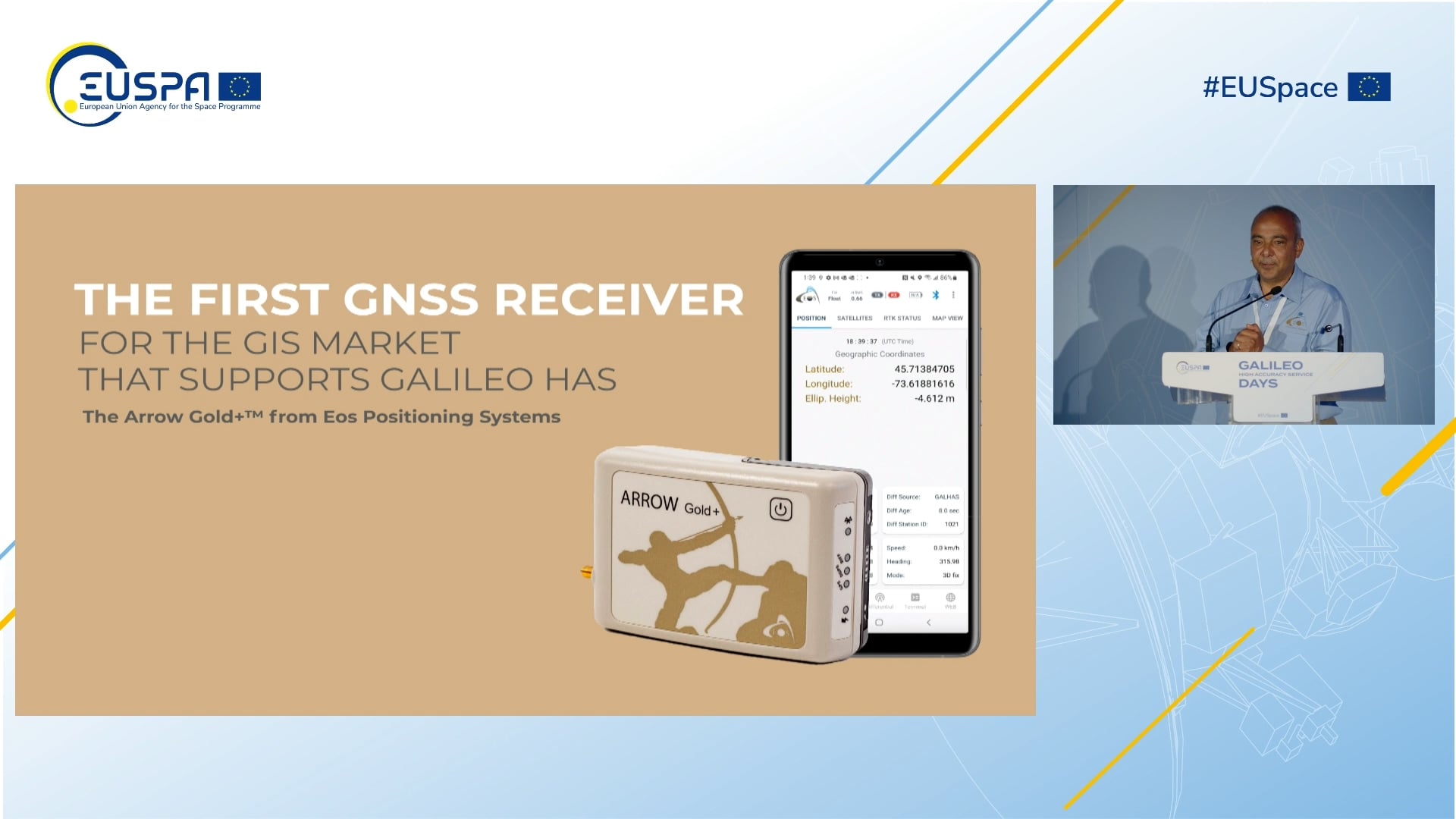
Galileo HAS via Signal in Space (SiS) provides better-than-20-centimeter, real-time accuracy anywhere in the world with 95% confidence.
Real-Time Kinematic (RTK) vs. Precise Point Positioning (PPP) Corrections
The principle is similar to the commonly used real-time kinematic (or RTK) corrections in the sense that a convergence time is required. In the case of RTK, convergence from a float to a fixed location might happen in a matter of seconds because the base stations are local to us.

In the case of Galileo HAS, a different correction technique called PPP (or Precise Point Positioning) is used. PPP does not require a connection to a local base station nor RTK network, but instead uses global corrections, resulting in a longer convergence time. The orbiting Galileo satellites themselves participate in the broadcast of these base station-less corrections while also providing regular positioning signals. This is ideal for remote areas that don’t have access to RTK.
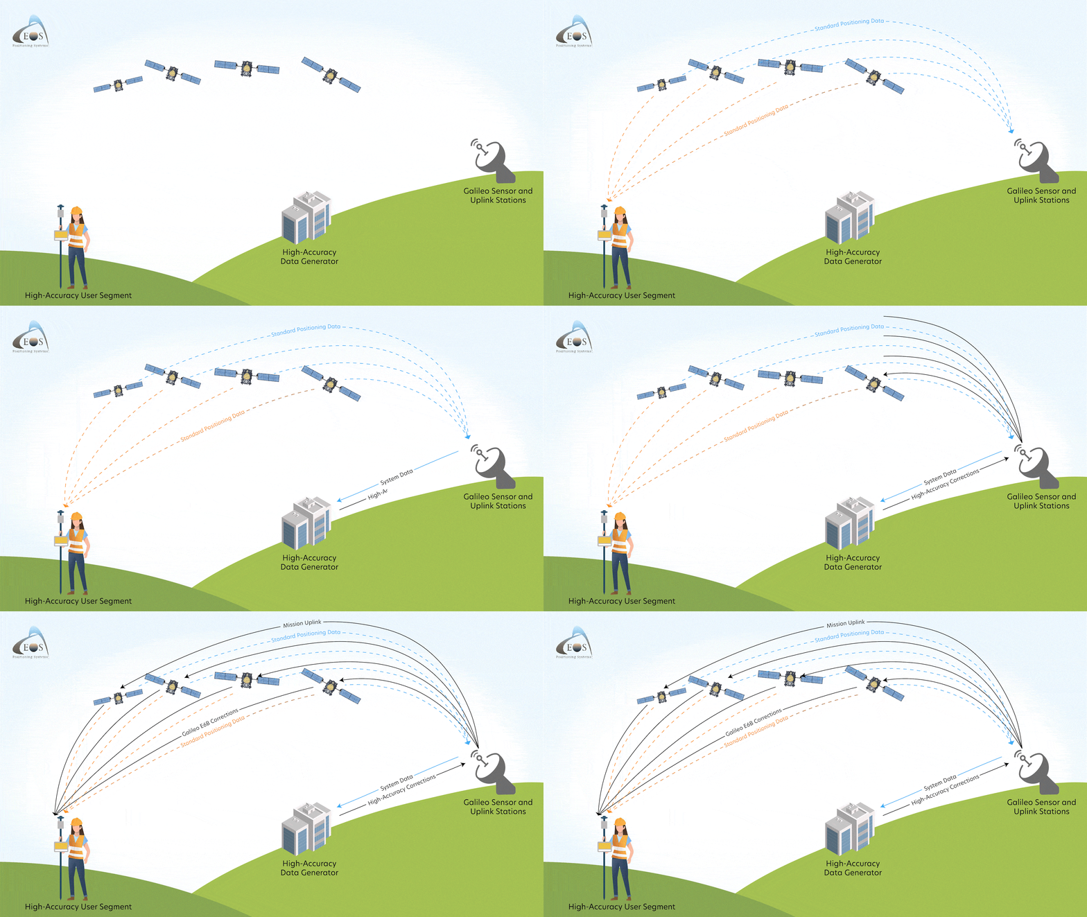
In its initial Phase 1, Galileo HAS requires a longer convergence period than the future operational Phase 2. Current convergence times of Phase 1 vary between 5 to 30 minutes depending on your location in the world.
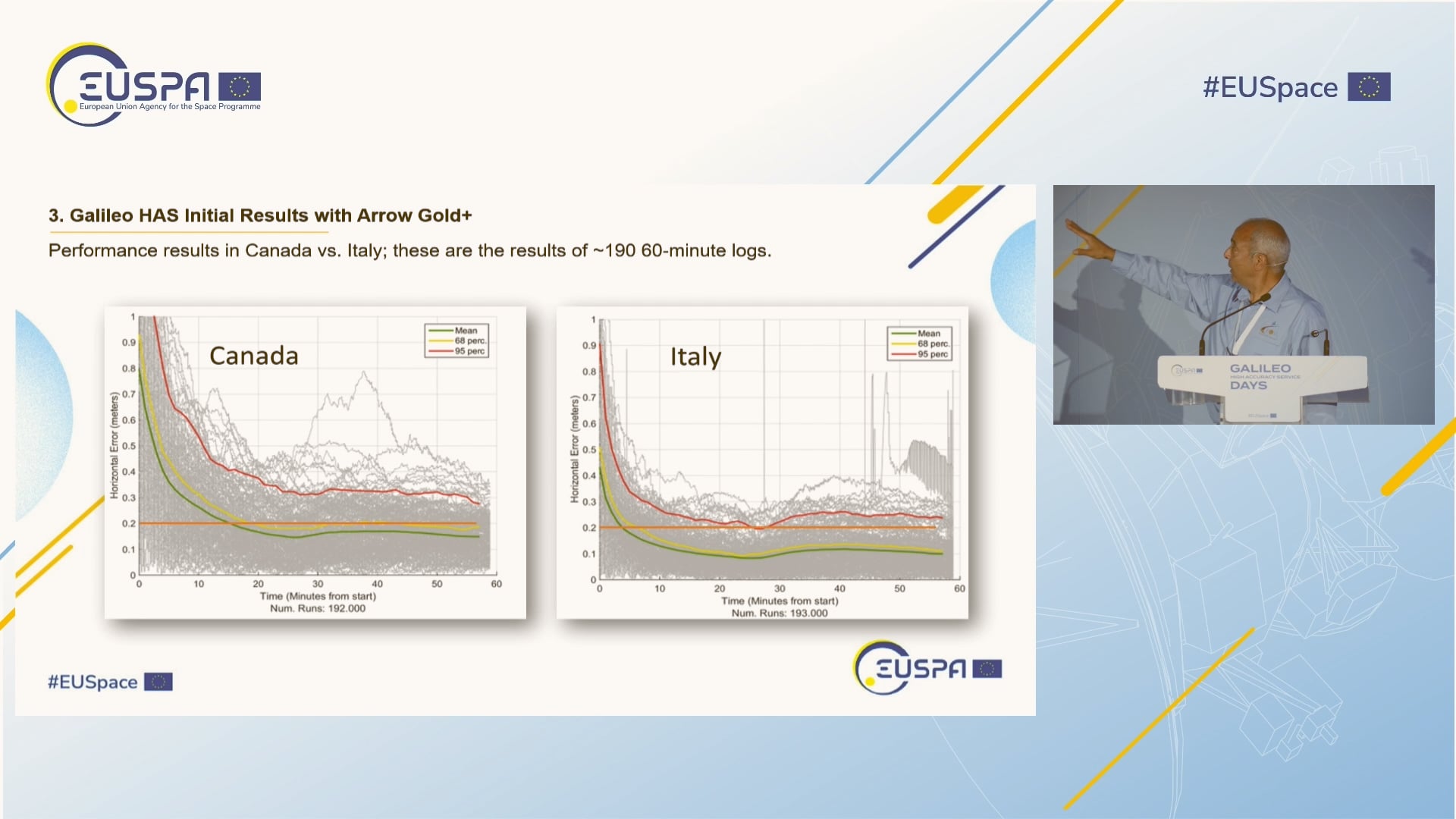
Convergence Period Test: 30 Minutes
Today, we will test our accuracy over a 30-minute period.

Equipment: Arrow Gold+ GNSS Receiver, Eos Tools Pro, and PC Mapper
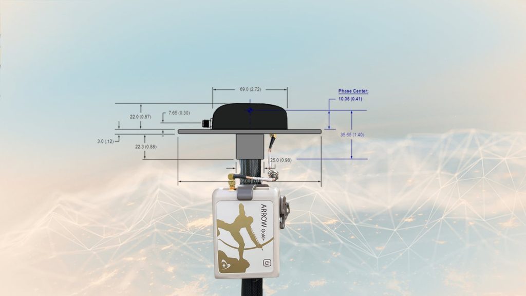
We’ll use an Arrow Gold+ GNSS receiver. Our antenna is located on our office roof in Terrebonne, Quebec, Canada.
We’ll also use two desktop software programs: Eos Tools Pro to monitor our Galileo HAS parameters, and PC Mapper to compare our current location with the reference point.
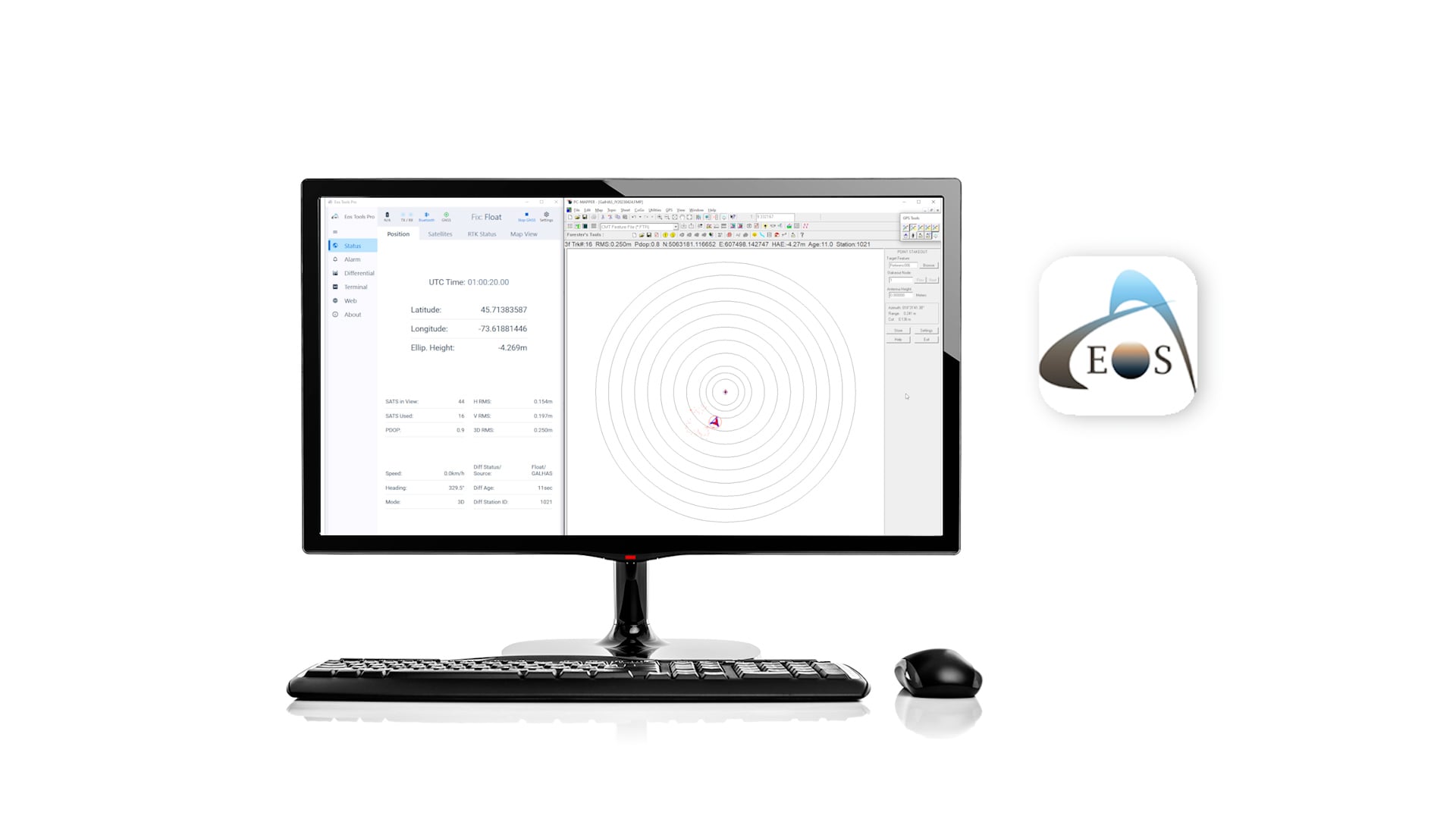
To fit our observations into this video, we applied a timelapse. On the right side of our screen, you’ll see PC Mapper. The red diamond represents the true location of our antenna, mounted to our roof.
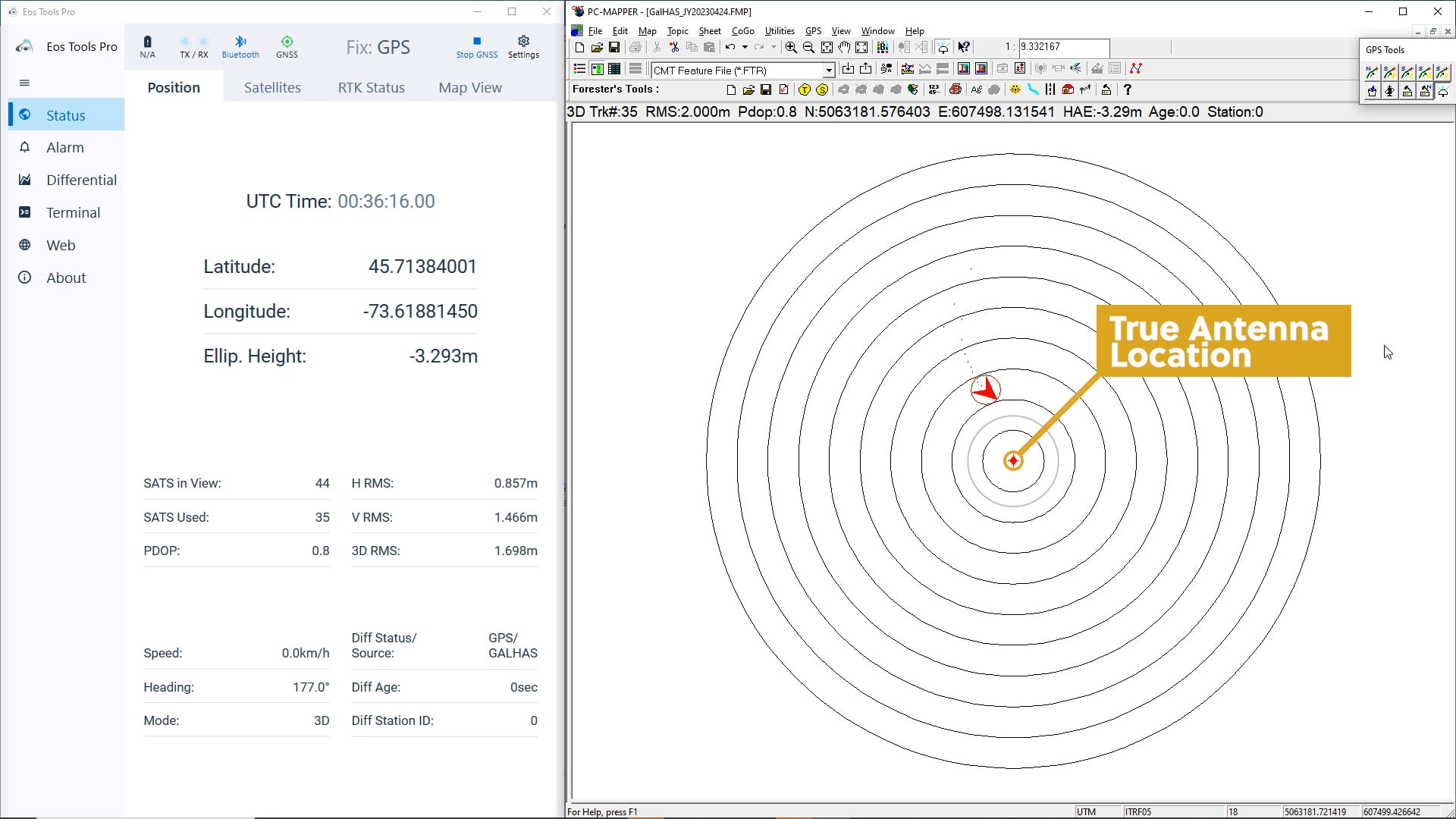
The first (smallest) circle around the diamond represents a 10-centimeter radius from our true location.
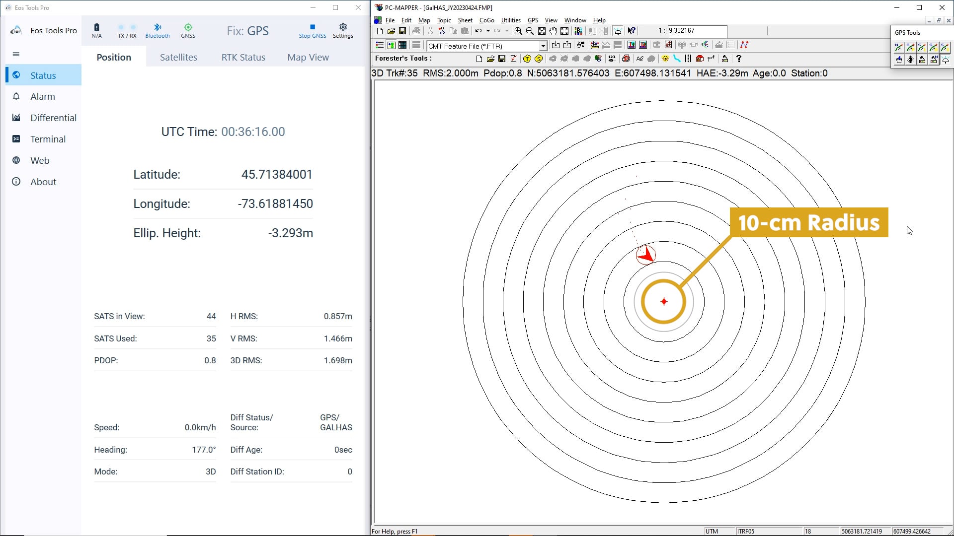
The next circle represents 15 centimeters.
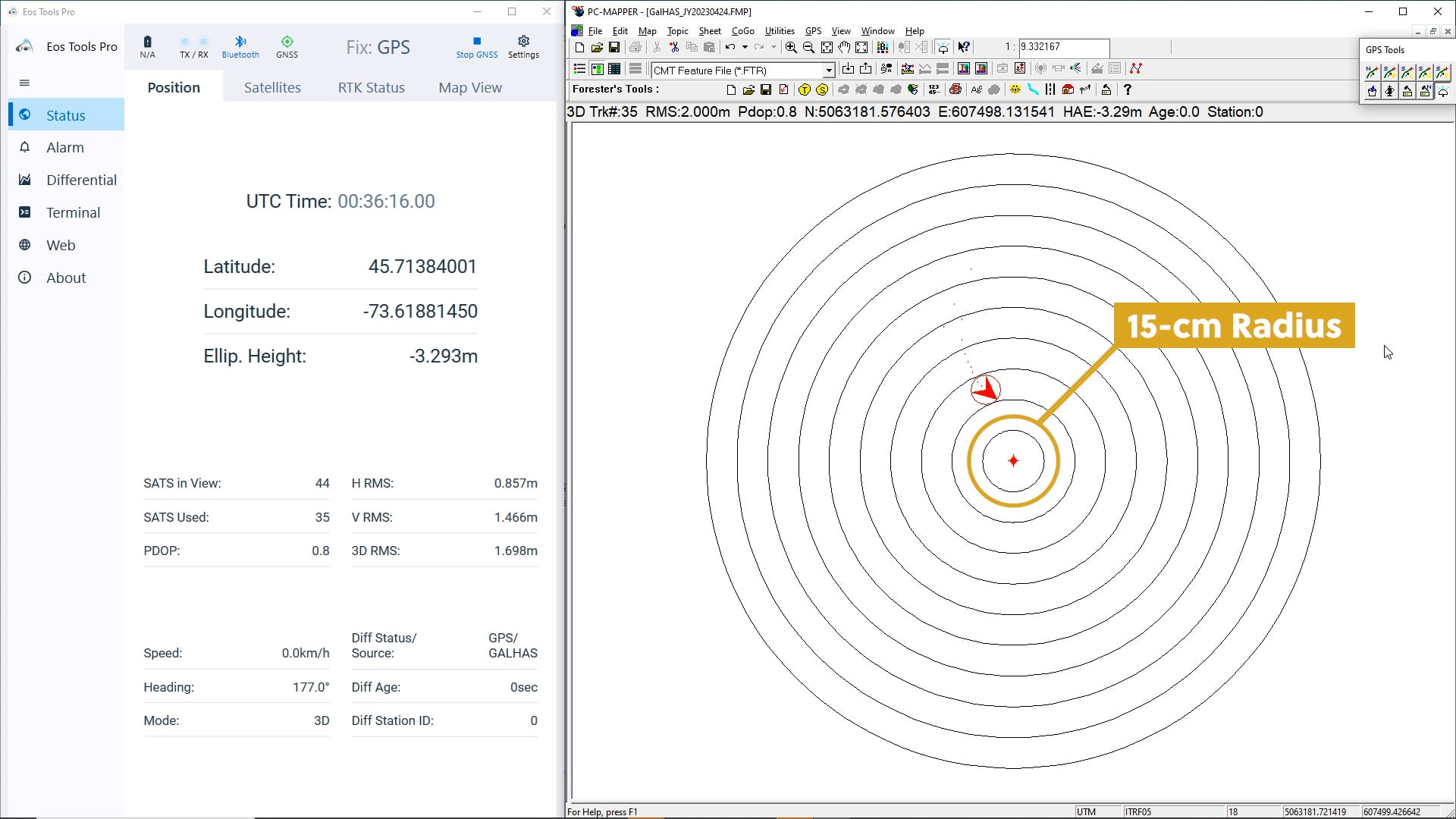
The next, 20 centimeters.
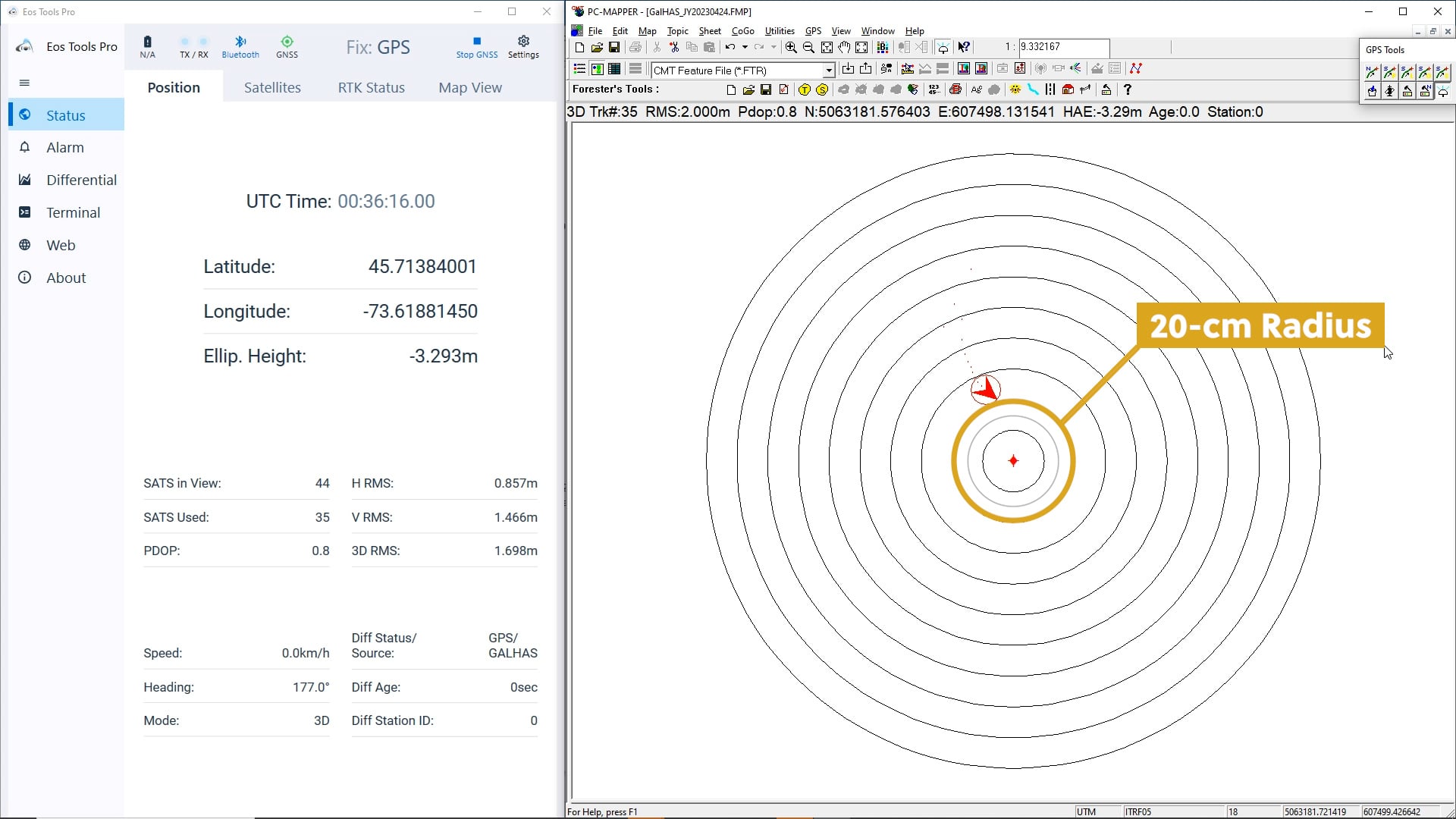
And each circle thereafter represents an additional 10 centimeters.
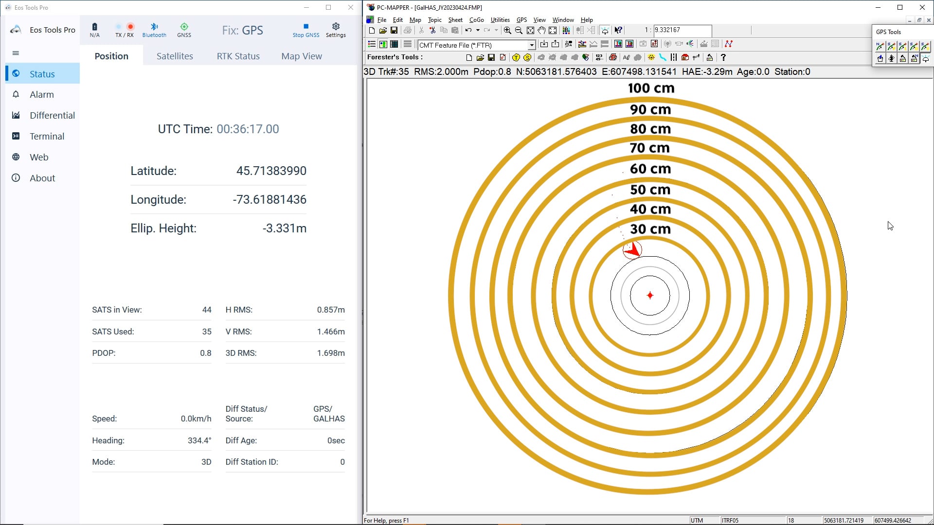
Once our test begins, our calculated position will fall within these circles, and we can compare it to our true location.
Our expectation is that our accuracy will initially rapidly fall within 100 centimeters …
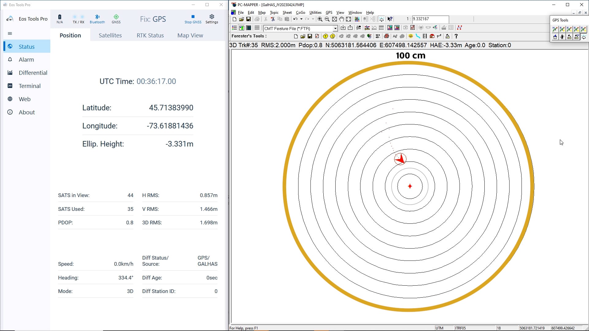
… and finally remain under 20 centimeters once convergence is achieved.
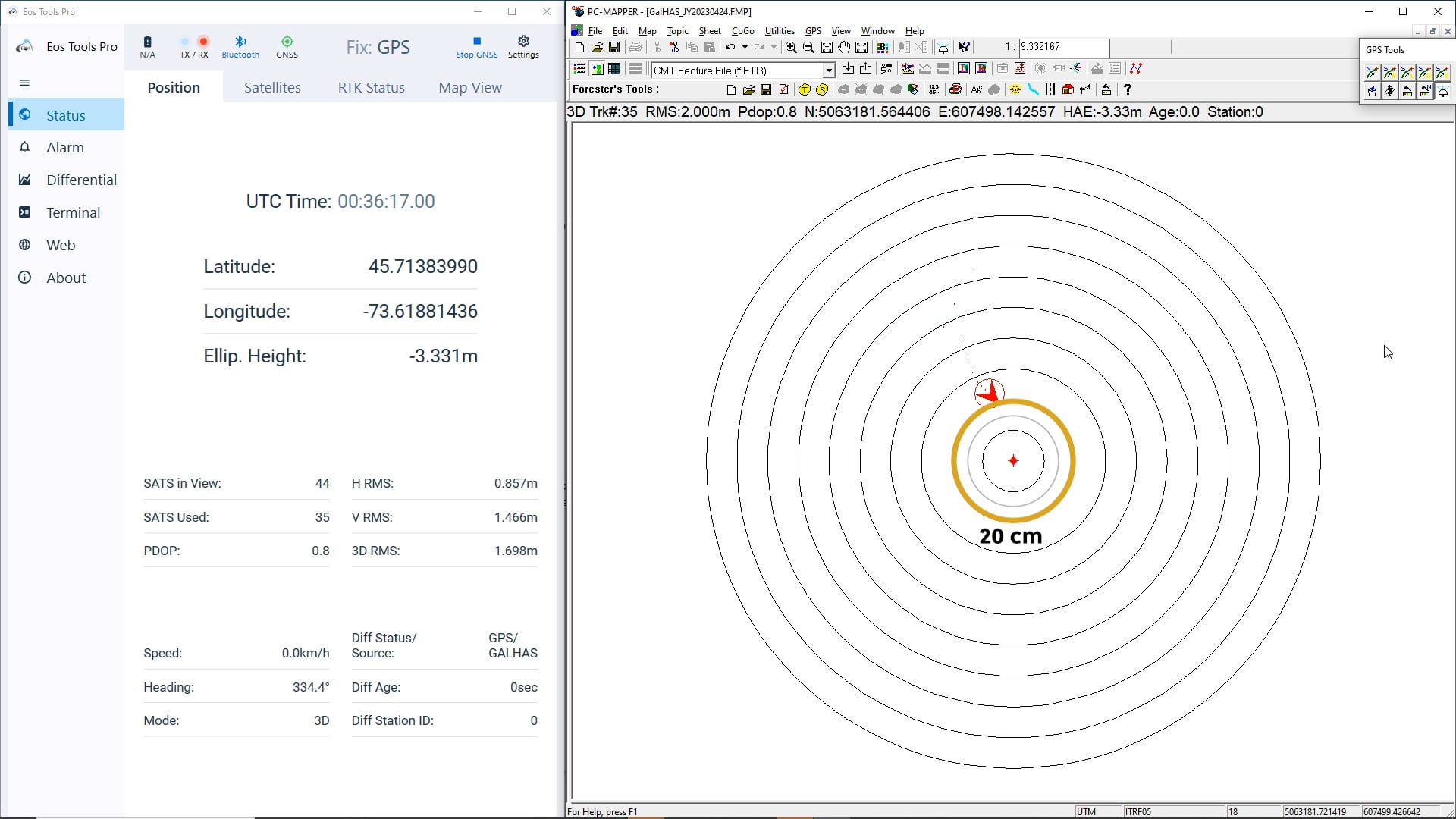
Let’s take a look at some important parameters we will be monitoring during the test.
Important Parameters in Eos Tools Pro and PC Mapper
On the left side of your screen is Eos Tools Pro on a desktop PC, connected via Bluetooth® to our Arrow Gold+.
In the “Position” menu, we’ll look at a few critical pieces of information.
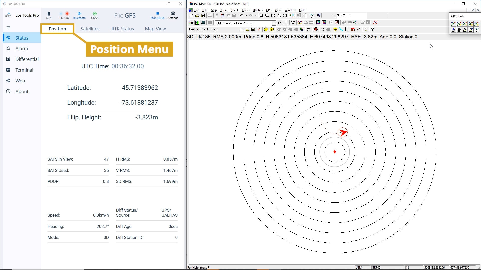
Our “Diff Status/ Source” shows us both the source and status of our differential corrections. It will progress in three phases from receiving, to applying, and finally converging.
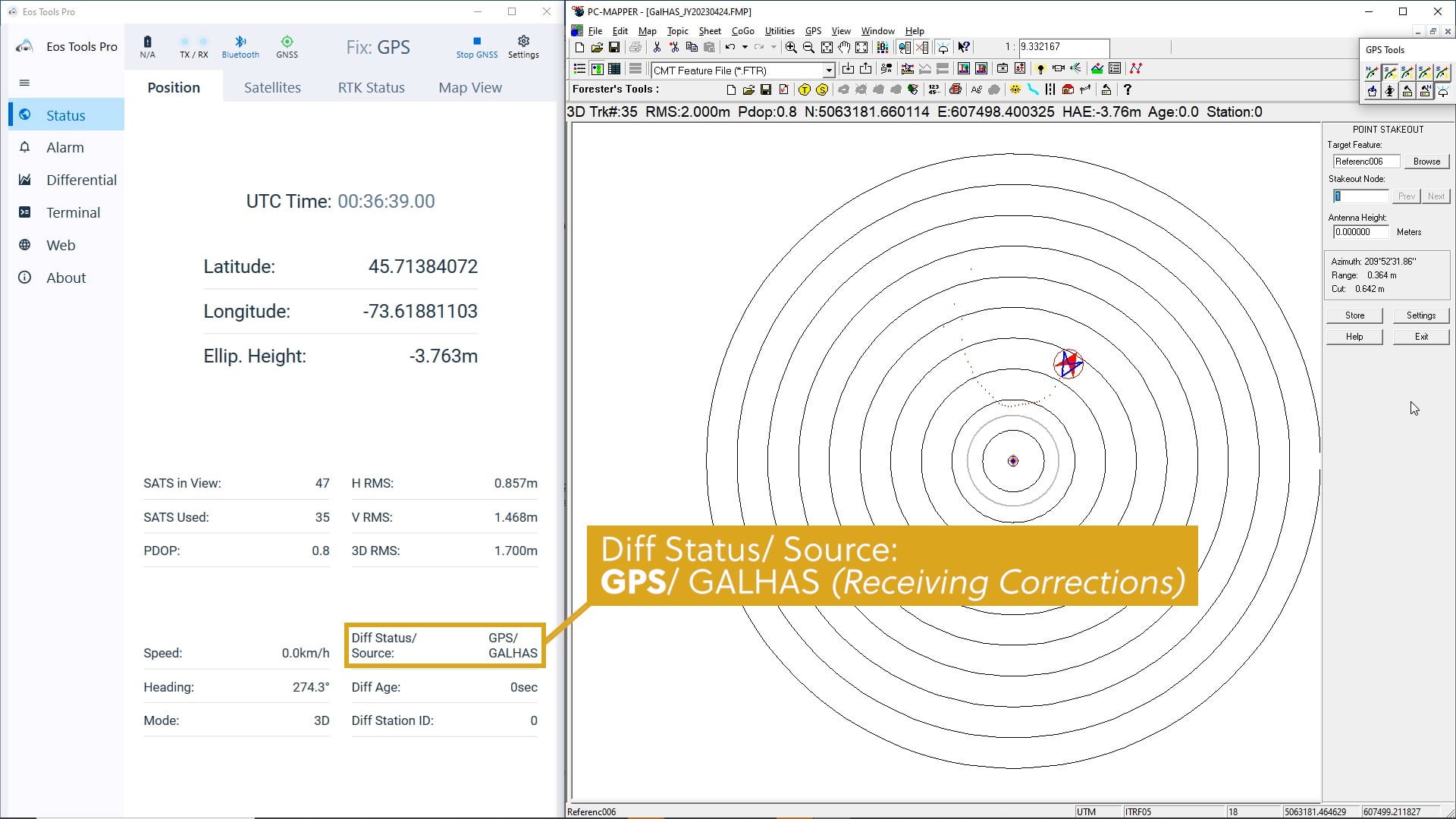
When our Diff Status/ Source reads, “GPS/ GALHAS,” this means our Arrow Gold+ is receiving Galileo HAS corrections, but they have not been applied, nor have we converged.
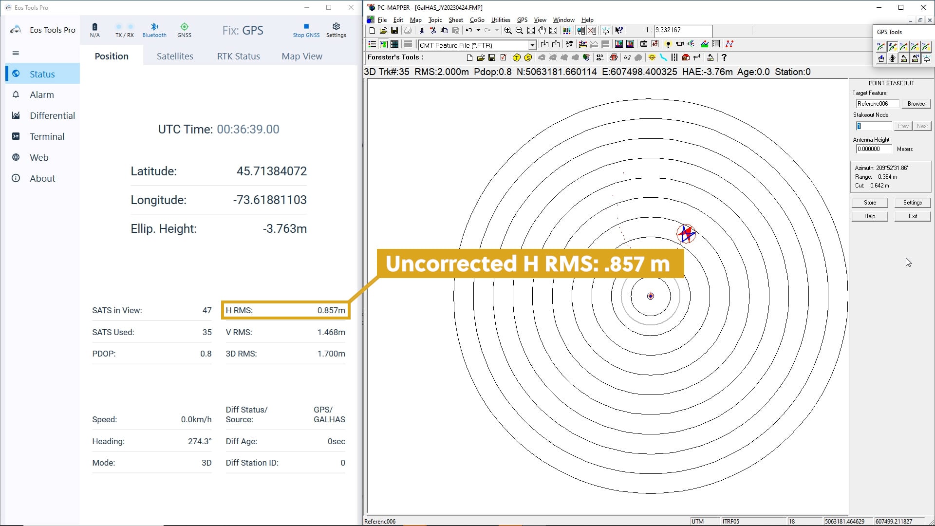
Our “H RMS” represents our estimated horizontal accuracy in meters. During the GPS / GALHAS phase, our location has an H RMS of .857 meters.
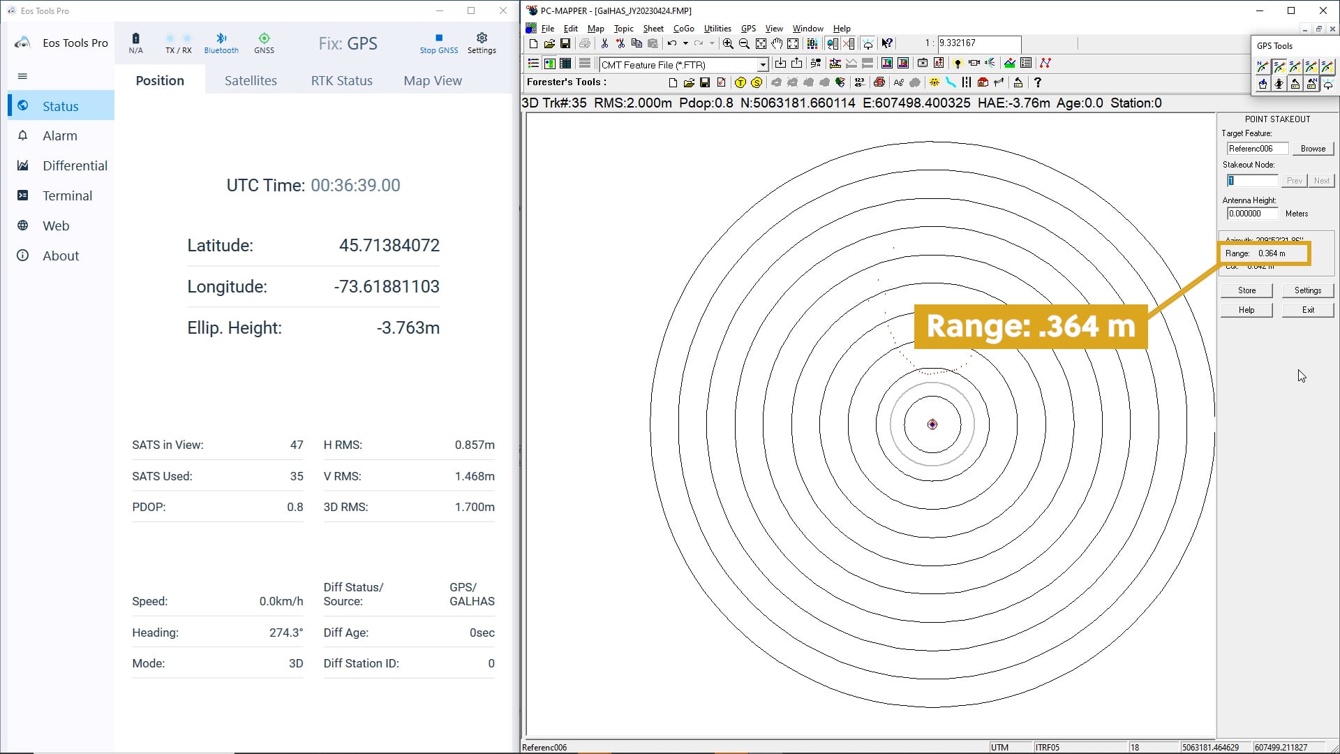
Now note our “Range” in PC Mapper. The range represents the difference between our H RMS location and our true antenna location. Our range is currently .364 meters.
Let’s see how these values improve as we progress toward convergence.
Monitoring the Galileo HAS Convergence

Watch our “Diff Status/ Source” in Eos Tools Pro.
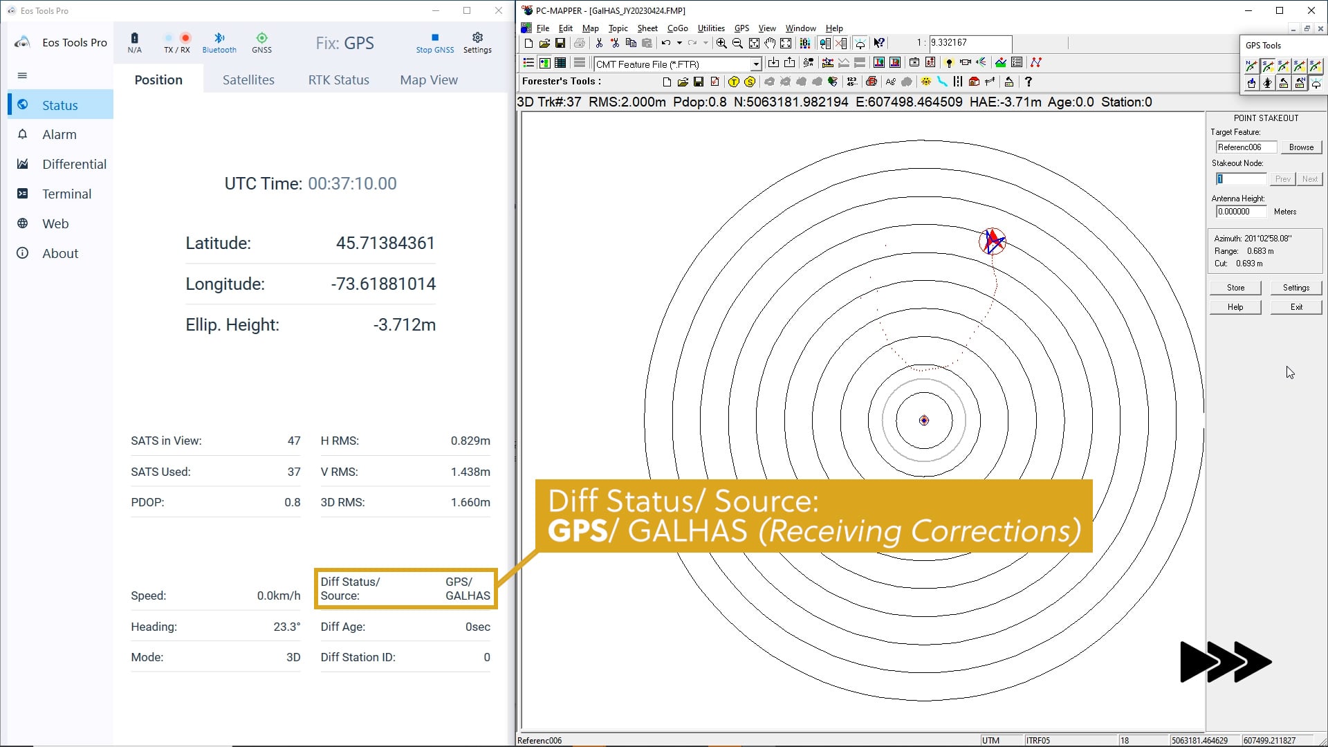
Our “Diff Status” changes from “GPS” to “Float” as the Arrow Gold+ starts applying the Galileo HAS corrections. The key word here is applying. Although we have not yet achieved a fixed convergence, we are on our way!
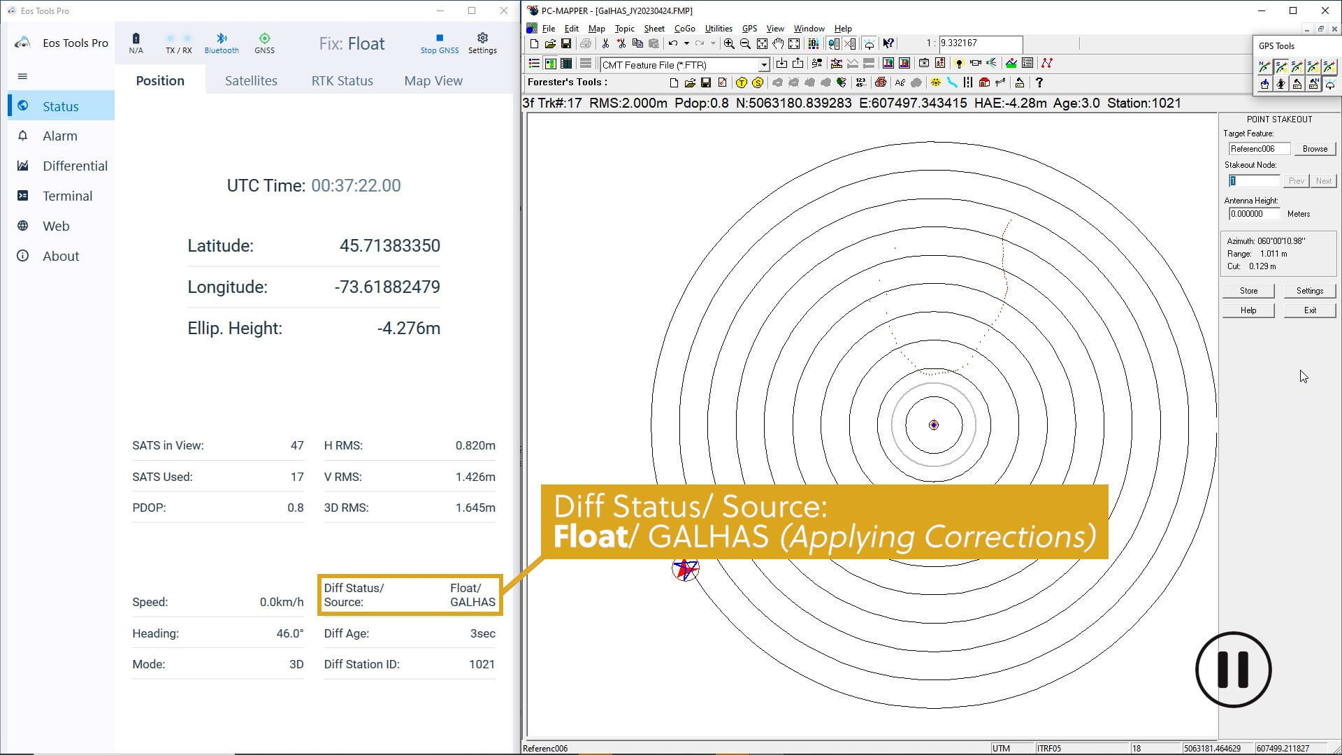
As we converge, we can monitor our GNSS metadata.
In the “Satellites” menu of Eos Tools Pro, we see the number of satellites we’re viewing, tracking, and using.
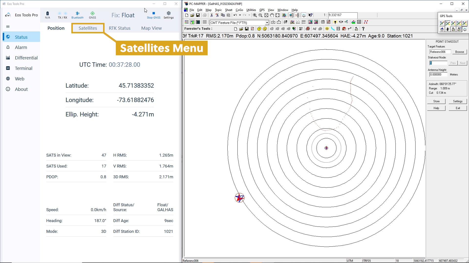
In the “RTK Status” menu, we see data and diagnostics about the signals that are receiving corrections from Galileo HAS.
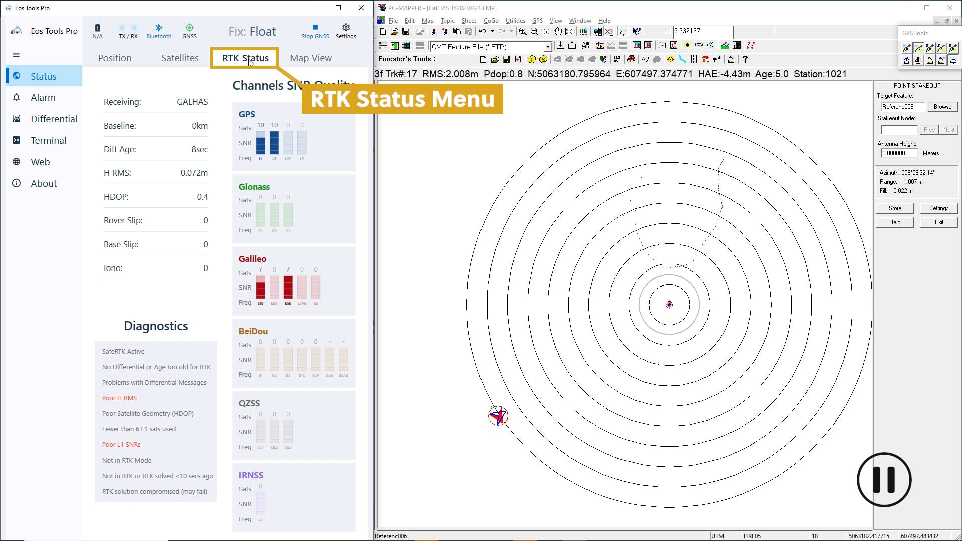
Finally, in the “Map View” menu we see our horizontal coordinates, elevation, and other data.
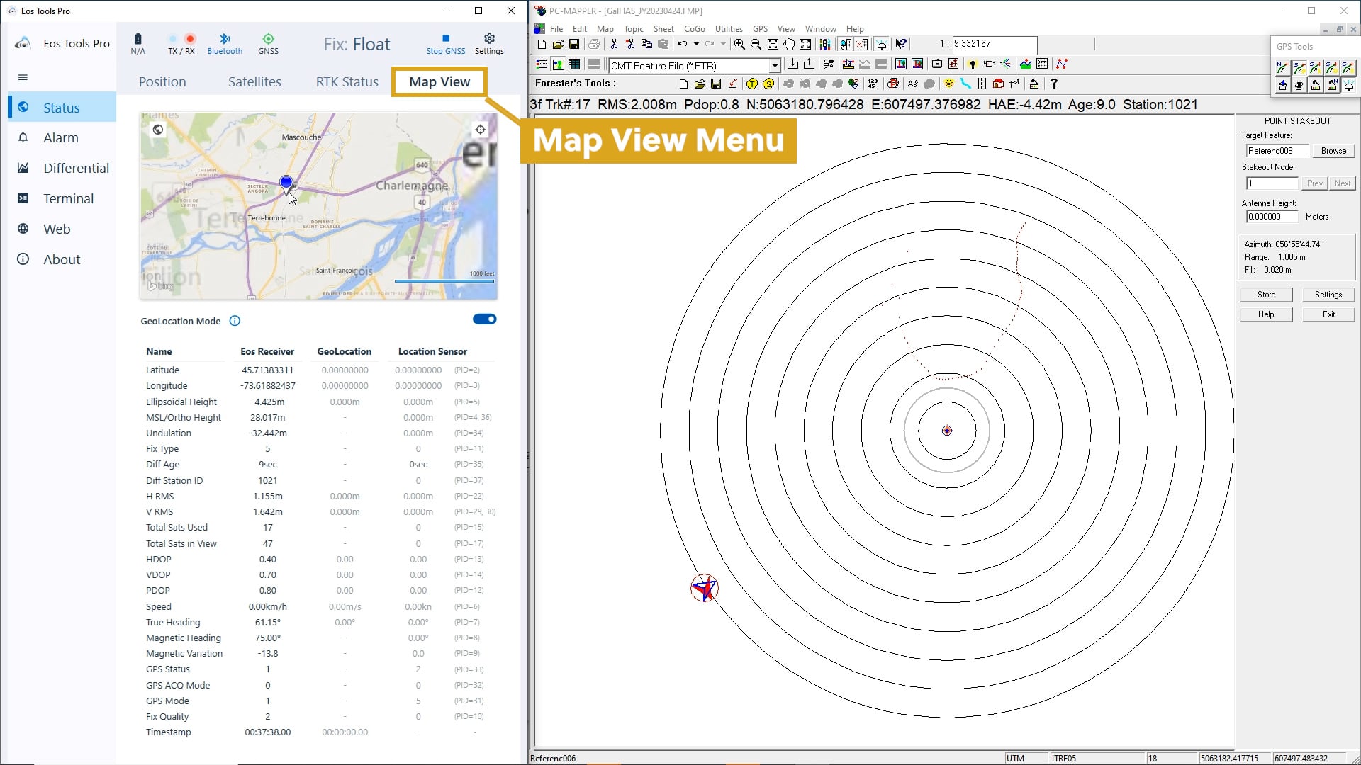
Note that when converging with a source of corrections, your antenna does not need to remain static in one location. It can move around, as long as it has a clear line of sight to the sky.
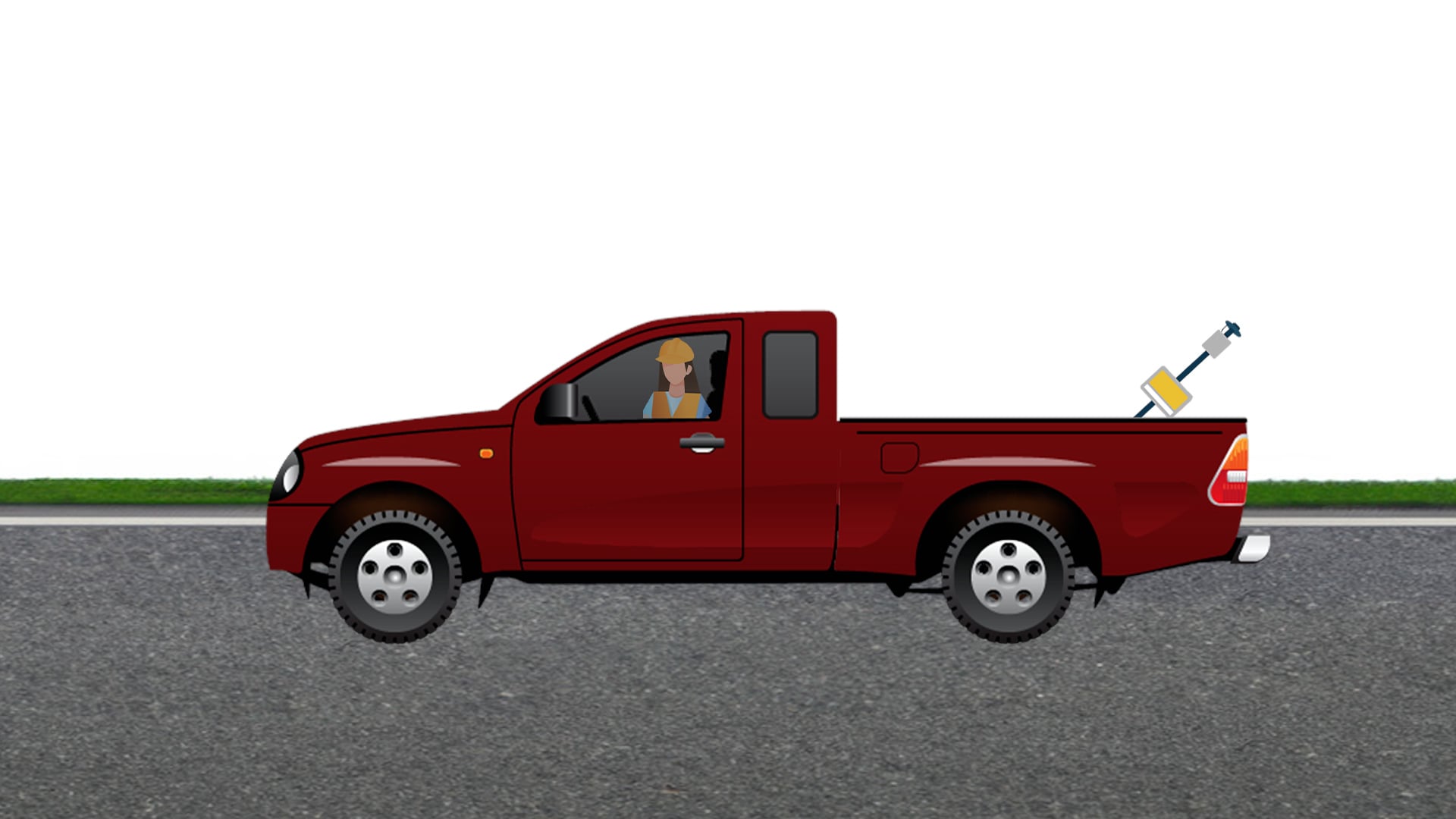
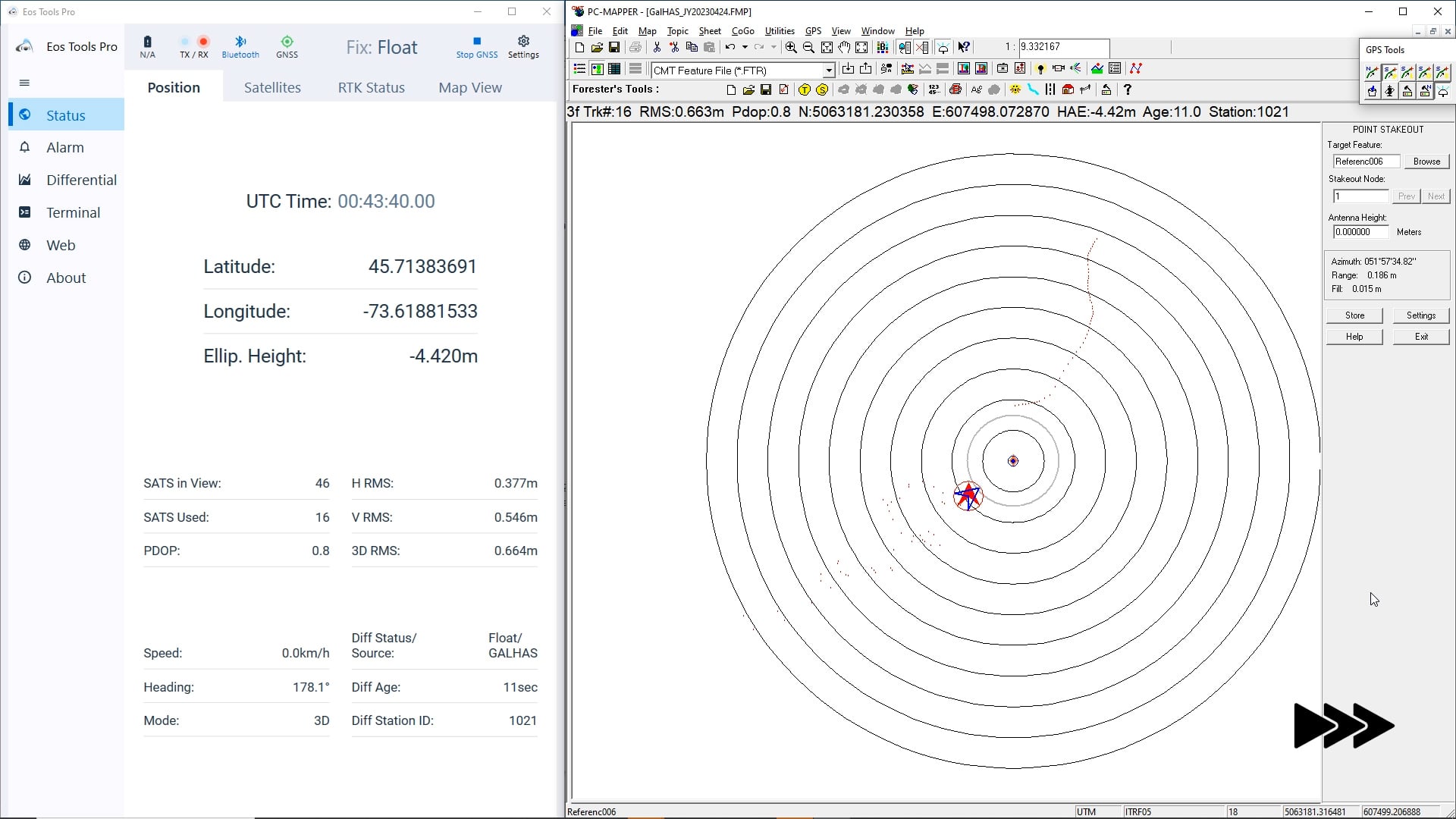
In PC Mapper, notice how our calculated position is moving closer to our surveyed antenna location.
After about 30 minutes, our location enters the 20-cm level of accuracy.
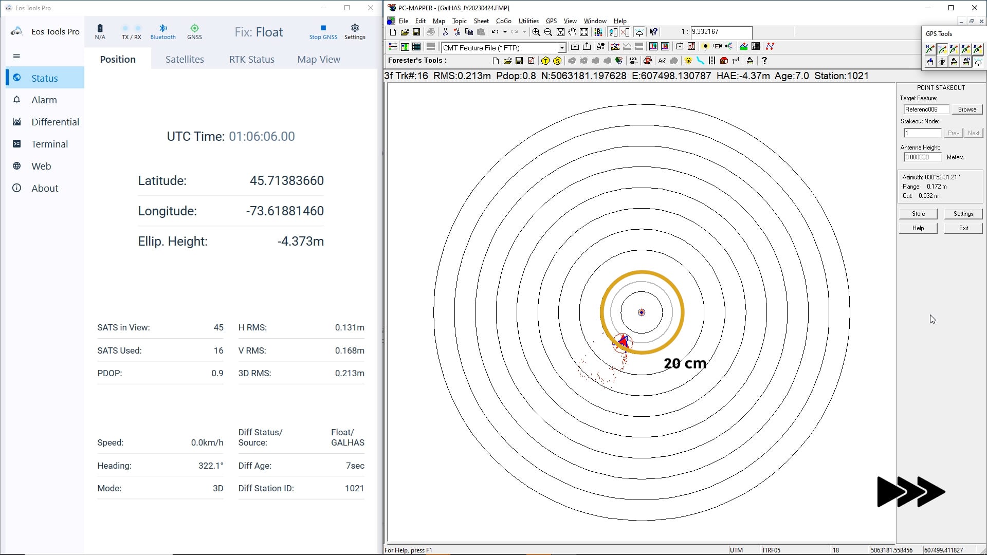
Keep watching our “Diff Status” in Eos Tools Pro.
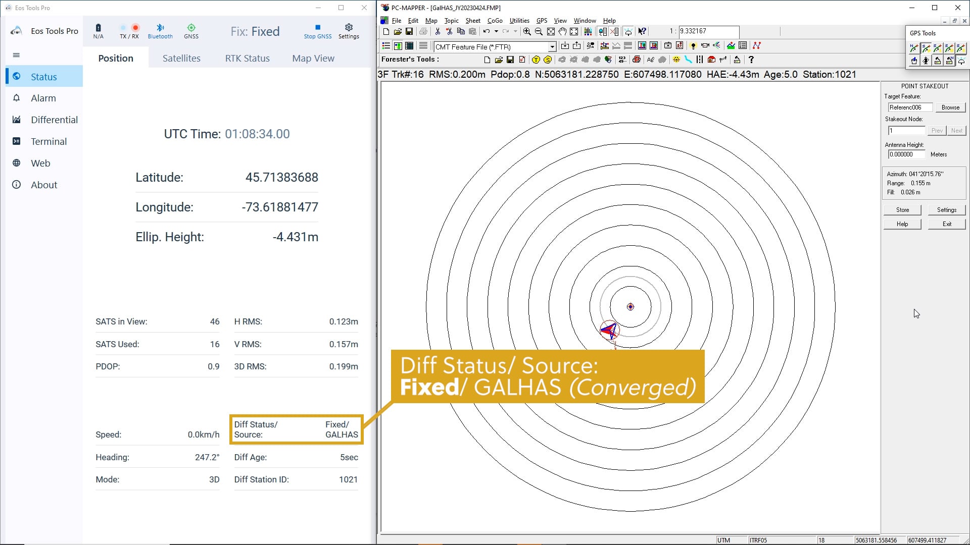
Our “Diff Status” switches from “Float” to “Fixed” status. We have now converged using Galileo HAS as our corrections source!
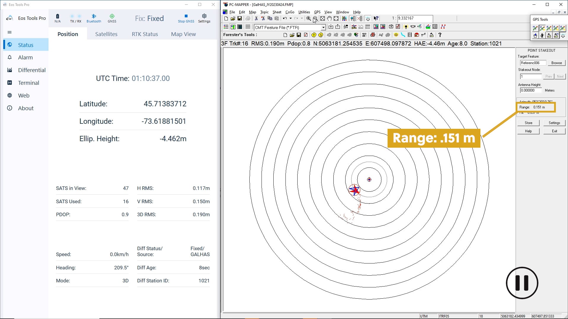
Our range to the reference location has decreased to .151 meters, or 15.1 centimeters.
And our receiver-reported estimated H RMS has lowered to .117 meters, or 11.7 centimeters.
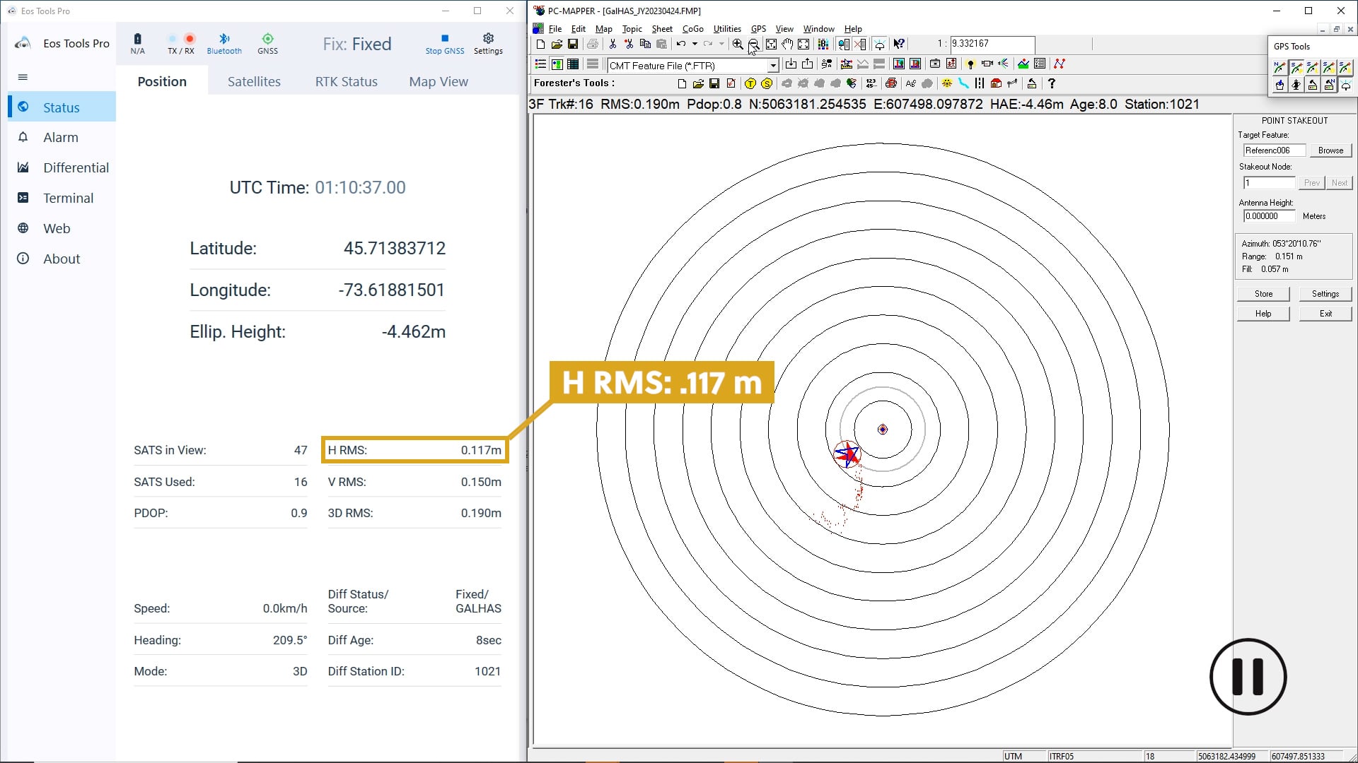
This falls well within the 20 centimeters of accuracy we were expecting!
We are very happy with these preliminary results of Phase 1 of the Galileo HAS. Performance is continuously improving while Galileo HAS is ramping up to Phase 2.
Want to learn more about Galileo HAS? Subscribe to our newsletter!
And stay tuned for more updates as Galileo HAS enters its operational phase, currently estimated in 2025.

