Centimeter-Level Accurate GNSS Receiver with RTK Capability
The Arrow 200® GNSS receiver is a robust, reliable, and repeatable RTK receiver. With support for all global GNSS constellations (GPS, Galileo, GLONASS, and BeiDou) and SBAS and RTK differential correction sources, this is one of our most accurate and productive receivers on the market. The Arrow 200® balances performance and reliability with flexibility and affordability, making this one of the best-value GNSS receivers in the world.
Accurate, Robust, Flexible
Survey-Grade GNSS Receiver
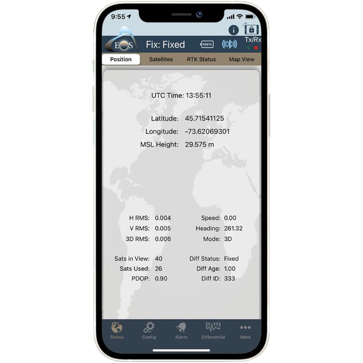
The Arrow 200® delivers 1 cm accuracy to any device when connected to an RTK network or base station. For areas where no RTK network or base station is available, it can provide 30-60 cm accuracy with SBAS.
Productive Positioning
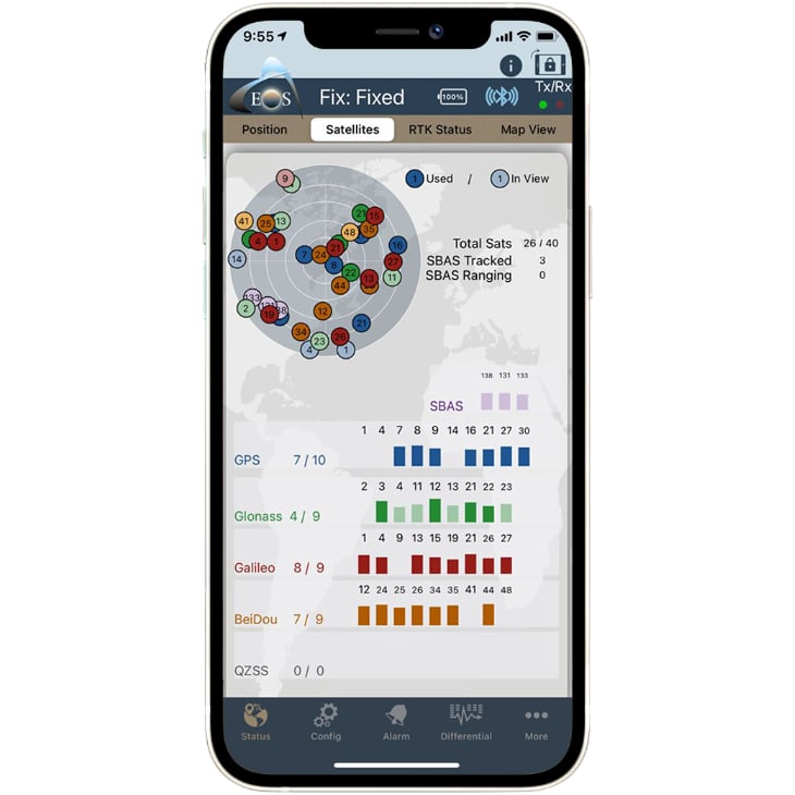
The Arrow 200® is an extremely productive receiver, supporting all global GNSS constellations (GPS, GLONASS, Galileo, BeiDou), two frequencies (L1, L2) and 372 channels for unique and robust field productivity.
Full Flexibility
The Arrow 200® GNSS receiver is compatible with all consumer mobile devices (iOS®, Android, Windows) and any third-party data collection app, whether it be your current, future, or even proprietary mobile app.
What Do You Get with the Arrow 200® GNSS Receiver?
What’s Included?
Open the box of this versatile Bluetooth® RTK GNSS receiver!
The Arrow 200® RTK GNSS receiver is a complete survey-grade positioning kit. Included with the standard kit are:
- Arrow 200® GNSS receiver
- Arrow 200® antenna: Multi-frequency GNSS surveying antenna
- Antenna mounting plate
- Antenna cable
- Hard shell carrying case
- Pole bracket and clamp
- LI-Ion battery pack (field replaceable battery)
- 12VDC power supply
- Access to Eos Tools Pro
What Accuracy and Flexibility look like with the Arrow 200®

- 1 cm accuracy with RTK
- Easily integrate with any mobile app
- Access all GNSS constellations
- Compatible with all mobile devices
Use with Many Differential Correction Source
RTK Network & Base Station
The Arrow 200® GNSS receiver provides 1-3 cm horizontal accuracy and 2-4 cm vertical accuracy with any RTK network or local base station, up to a 50 km (31 mi) radius.
SBAS
If no RTK, base station, or Atlas® service is being used, the Arrow 200® will work with regionally available free SBAS corrections when available. Using SBAS, this will provide ~30 cm horizontal accuracy (HRMS).
Try Arrow Gold® for Atlas®
When no RTK network, base station, or SBAS is available, yet survey-grade accuracy is required, consider the Arrow Gold®, which additionally supports Atlas® subscriptions for 4-30cm accuracy worldwide.
Explore the Arrow 200® in 3D
Bring the Arrow 200® to life on your screen. Click the play button to launch the Arrow 200® 3D model. Select any numbered button to access helpful tips about this survey-grade GNSS receiver.
Arrow 200® Technical Specifications
- GNSS multi-frequency RTK with carrier phase
- 372-Channel, Parallel Tracking
- GPS: L1, L2
- GLONASS: G1, G2
- Galileo: E1
- BeiDou: B1, B2
- Autonomous Accuracy: 1.2 meters HRMS1
- SBAS (worldwide) Accuracy: < 30 cm HRMS1 , < 60 cm 2dRMS
- RTK (long-range, up to 50 km): 8mm1+ 1 ppm Horizontal HRMS, 2 cm1 + 1 ppm Vertical
- 3-Channel, Parallel Tracking (with SBAS ranging)
- WAAS (North America)
- EGNOS (Europe)
- MSAS (Japan)
- GAGAN (India)
- SouthPAN (Australia / New Zealand)
- Fully Bluetooth® Pre-Qualified: Bluetooth® 2.1 + EDR
- Supported Bluetooth® Profiles: SPP and iAP
- Bluetooth® Transmission: Class 1, 300 m typical range2 (up to 1 km)
- Bluetooth® Frequency: 2,400-2,485 GHz
- Data I/O Protocol: NMEA 183, RTCM SC-104, Binary
- Port: Bluetooth®, USB 2.0, Serial (optional)
- Power
- GNSS
- DGNSS
- DIFF
- Bluetooth®
- Operating Temperature: -40°C to +85°C (-40°F to +185°F)3
- Storage Temperature: -40°C to +85°C (-40°F to +185°F)
- Humidity: 95 % Non-Condensing
- Compliance: FCC, CE, RoHS and Lead-Free
- iPhone® and iPad®
- Android smartphones and tablets
- Windows, Windows Mobile
- Battery Type: Field Replaceable, Rechargeable Lithium-Ion Pack (rechargeable inside unit or separately)
- Battery Capacity: 9 hours3
- Charging Time: 4 hrs (vehicle charger available)
- Enclosure Material: Xenoy
- Enclosure Rating: Waterproof, IP-67
- Immersion: 30 cm, 30 minutes
- Dimensions: 12.5cm x 8.4cm x 4.2cm (4.92″ x 3.3″ x 1.65″)
- Weight: 372 g (0.82 lbs)
- Data Connectors: Mini USB type B receptacle
- Antenna Connector: SMA female
- Autonomous Datum: WGS-84, (G1674) (current year epoch)
- SBAS Datum: ITRF08 (current year epoch)
- RTK Datum: Same as RTK Base
- Impedance: 50 Ω
- Gain (without cable): 30 dB (± 2 dB)
- LNA Noise Figure: 2.5 dB
- Voltage: + 2,5 to +16 VDC
- RF Connector: SMA female
- Dimensions (mm): 68 Diam. x 20 H
- Weight: 170 g (0.37 lbs)
- Operating Temperature: -40°C to +85°C (-40°F to +185°F)
- Humidity: Waterproof
GNSS Receiver Specification Footnotes:
- Depends on multipath environment, number of satellites in view, satellite geometry, baseline length (for local services) and ionospheric activities. Stated accuracies for baseline lengths of up to 50 km
- Transmission in free space
- Lithium-Ion battery performance degrades below -20°C (-4°F)
Featured Arrow 200® Case Studies
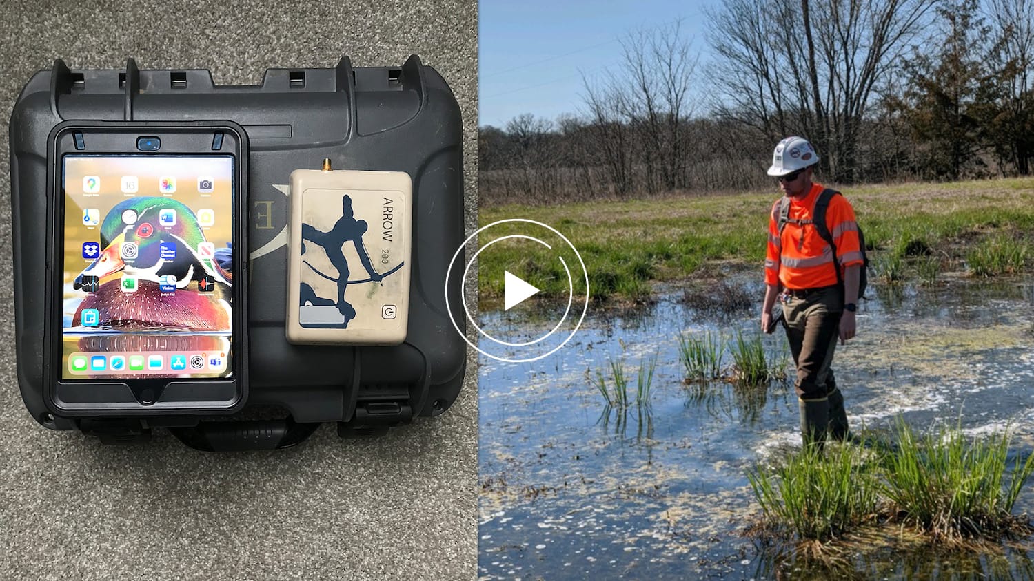
ESI increases wetlands mapping project profits by 20% using Arrow GNSS and Ecobot
Environmental Solutions & Innovations switched to Ecobot app and Arrow GNSS to replace a slow and cumbersome legacy mobile mapping solution.
More Info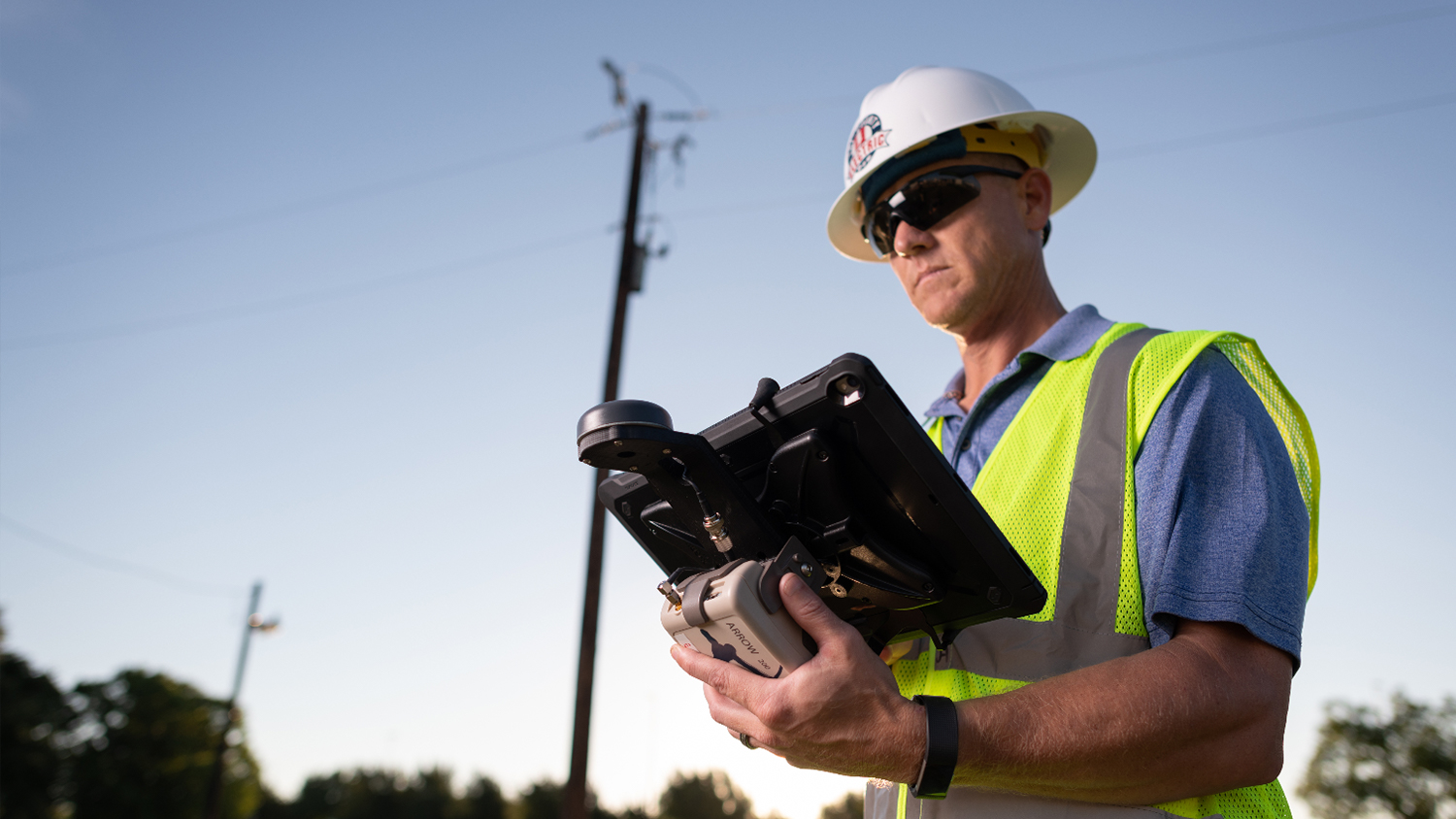
Texas Co-op Improves Customer Service with Futura and Arrow
Real-time access to enterprise ArcGIS via Futura & FieldPro helped TCEC achieve 4-hour as-builting. They used Arrow Gold for field staking GNSS locations.
More Info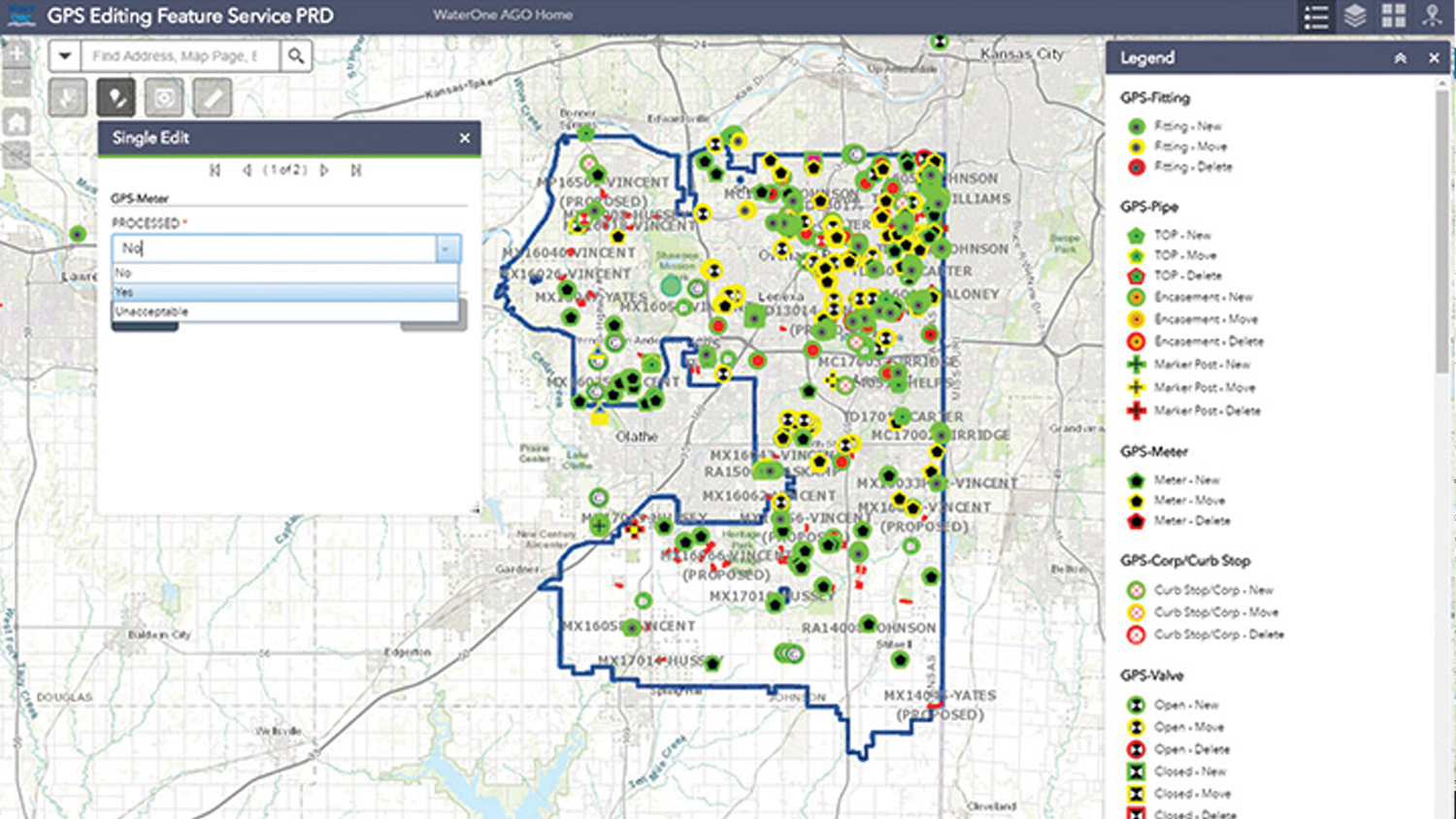
Kansas Utility Modernizes Mobile Workflow
WaterOne in Kansas revamped its outdated field workflow by switching to Panasonic ToughPads and Arrow 200 for water-asset collection on Esri ArcPad.
More InfoWhat Customers Say about the Arrow 200®
Images from the Field: Arrow 200® in Action


Resources for Current Arrow 200® Customers
Get Started
Ready to get started with your new Arrow 200® GNSS receiver? Follow along with this Arrow Quick Start Guide to power on, Bluetooth® pair, and mount your Arrow 200® GNSS receiver.
Check Your Firmware
The latest firmware for the Arrow 200® is either 5.9Aa08 or 6.1Aa01, depending on your serial number. Check your firmware in the Eos Tools Pro “About” menu, then check against your serial number. If your firmware is not current, contact our technical support team for upgrade instructions.
Browse Resources
A variety of informative articles, how-to guides, and video tutorials are available in the Eos Knowledge Base. Browse content to make sure you’re getting the most out of your GNSS receiver.