The Customer: ADF Haiti
About 3.5 hours west of Port-au-Prince in Fond-des-Blancs, the nonprofit ADF Haiti was established in 2016 with an interesting mission: seeing the heavy presence of other NGOs in Haiti, ADF Haiti strives to empower Haitians themselves with the decision-making power to drive their own economic, cultural, and social development.
“Our mission is to help existing regional organizations achieve more,” ADF Haiti CEO Josiah Thomas said. “One of the biggest challenges in Haiti is that local organizations suffer from a lack of information to base decisions on. We aim to change that.”
Born and raised in Fond-des-Blancs, Josiah Thomas comes from a family rooted in philanthropy. His father Jean Thomas founded the nonprofit Haiti Christian Development Fund (HCDF). Josiah Thomas established ADF Haiti in part to combine his inherited attraction toward philanthropy with his other passion: geospatial technology.
“One critical piece of our work is to collect highly accurate geospatial information and then make that data available to local organizations,” Josiah Thomas said. “This helps them work to further develop our communities.”
Recently, Josiah Thomas put the ADF Haiti mission to the test in a project that benefited local farmers in Fond-des-Blancs as well as HCDF.
The Challenge: Physical Parcel Markers Created Inefficiencies
“Our machinery cannot get to, or through, that mango tree. So one hectare of land might wind up yielding only .75 hectare of harvest.”
— Jean Thomas, Founder, Haiti Christian Development Fund (HCDF)
Jubilee Farms is an agricultural co-operative of landowners, created as an offshoot of HCDF. These farmers operate a combined 76 hectares of land. HCDF’s goal is to help the farmers increase production by deploying large-scale mechanized agricultural techniques across all parcels. This includes new tools for plowing, planting, and harvesting, among others.
“All of the innovations we bring are mechanical, except for weeding and insecticide application,” Jean Thomas said. “But we are looking to mechanize those as well.”
Replacing manual techniques with mechanized ones stands to improve crop yield, increase harvesting frequency, guarantee an irrigation system, and more. Not only can the co-operative produce more total food for the Fond-des-Blancs community, but also in the case of high-demand crops that are sold for a profit, farmers can improve their financial gain. Portions of the profit are determined by the landowners’ total parcel sizes.
“If I’m a small landowner, I can retain ownership of my land, but hand over some operations to the co-operative,” Josiah Thomas said.
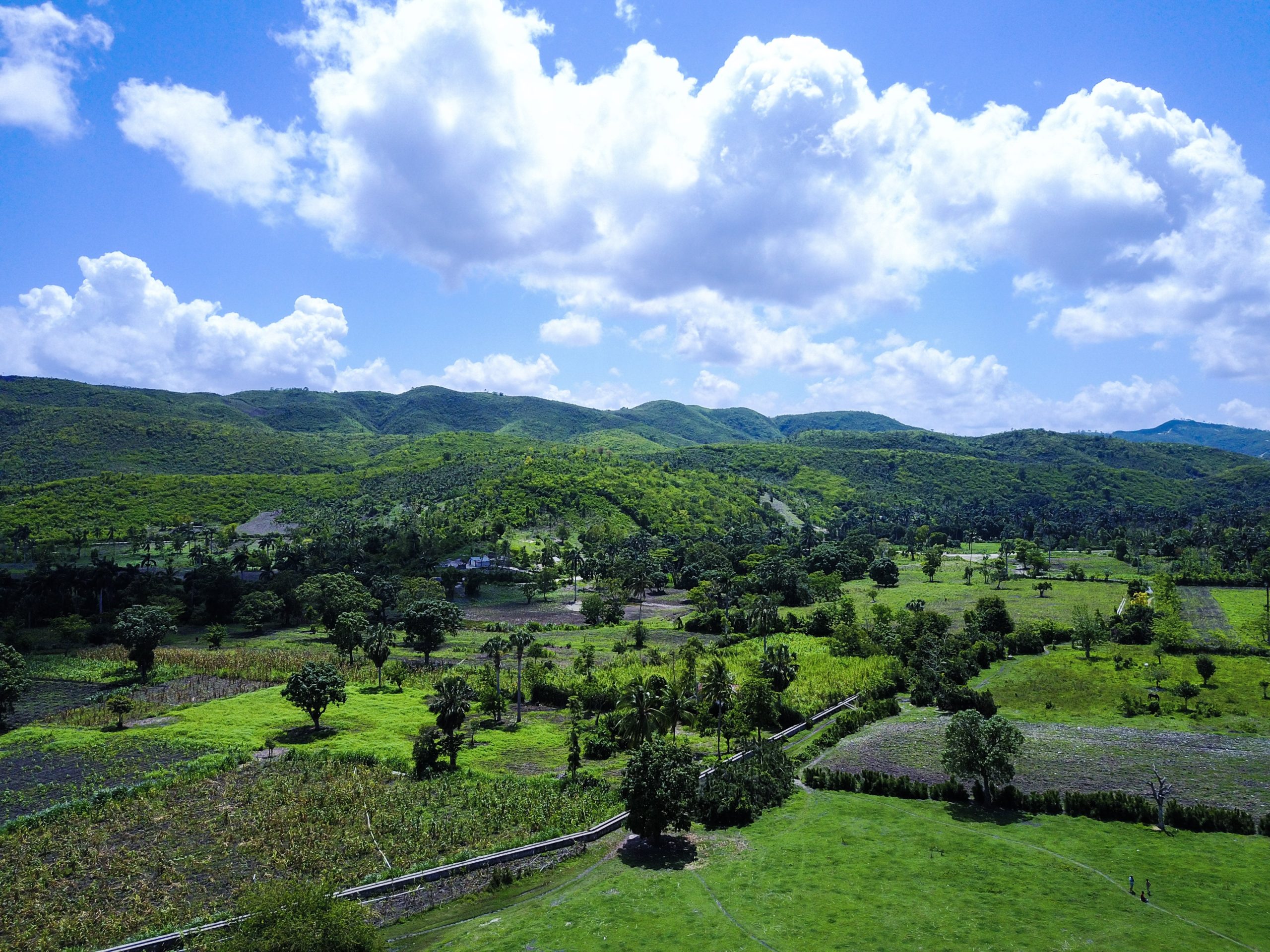
Trying to deploy these new methods, however, presented challenges. The main challenge was that parcel boundaries were traditionally marked with physical objects (e.g., concrete blocks, stones, fences). These physical markers defined ownership, but they prevented machines from seamlessly crossing from parcel to parcel. Similarly, other natural obstacles (e.g., irregular terrain, trees), posed the same threat: a farmer planting yams might have mango trees on his land, for instance, which would prevent the co-operative’s machines from harvesting all the possible yield.
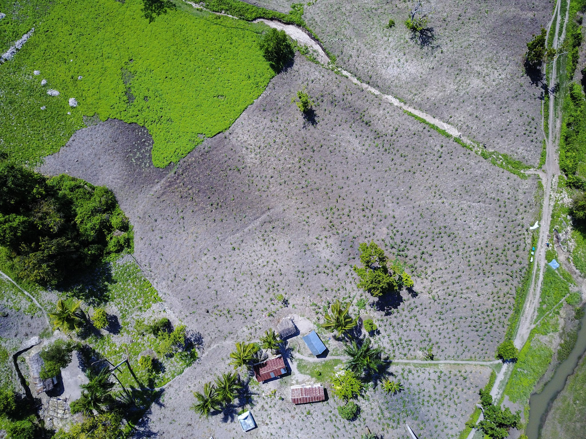
“Our machinery cannot get to, or through, that mango tree,” Jean Thomas said. “So one hectare of land might wind up yielding only .75 hectare of harvest.”
To overcome these constraints, ADF Haiti decided to deploy digital markers to replace the physical obstacles. But to gain buy-in, they needed to prove the accuracy of their proposed digital land boundaries. Doing so would establish trust and confidence in farmers putting their land into the co-operative.
“We need to provide the landowner with confidence that what we are measuring is actually their land,” Josiah Thomas said.
Legacy geospatial hardware and software were too inaccurate to provide reliable digital maps, so ADF Haiti sought improved mapping tools.
The Solution: Arrow GNSS Receivers, Atlas® Subscription Service, ArcGIS Apps, and Drone Imagery
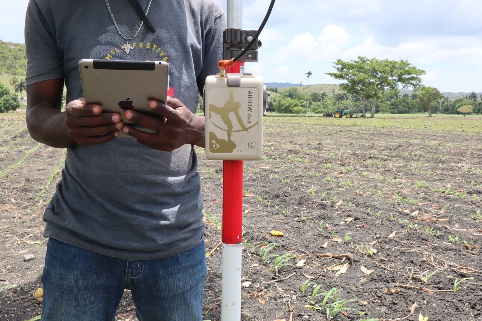
The desired accuracy threshold was set at subfoot (about 30 centimeters) or better. ADF Haiti first looked for GPS hardware that could provide this.
On a recommendation, ADF Haiti tested the Arrow Gold® GNSS receiver made by Canadian company Eos Positioning Systems. The Arrow Gold® provides real-time location accuracy to within about two to six inches (five to 15 centimeters) in the Fond-des-Blancs territory when used with an Atlas® H10 satellite-based differential correction subscription.
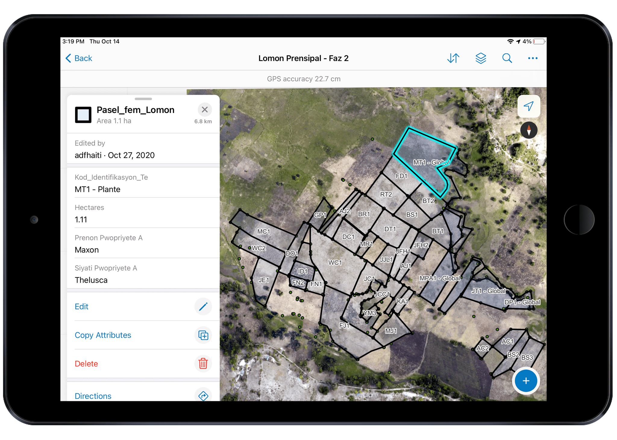
Since the team was already familiar with Esri’s ArcGIS apps, they chose ArcGIS Field Maps as their data collection software. Field Maps runs on iOS®, and the team already had on hand a variety of iPhone®s and iPad®s. Not only did Field Maps work with the Arrow Gold® GNSS receiver, but it also required little training and supported easy analysis of the collected data in ArcGIS Pro.
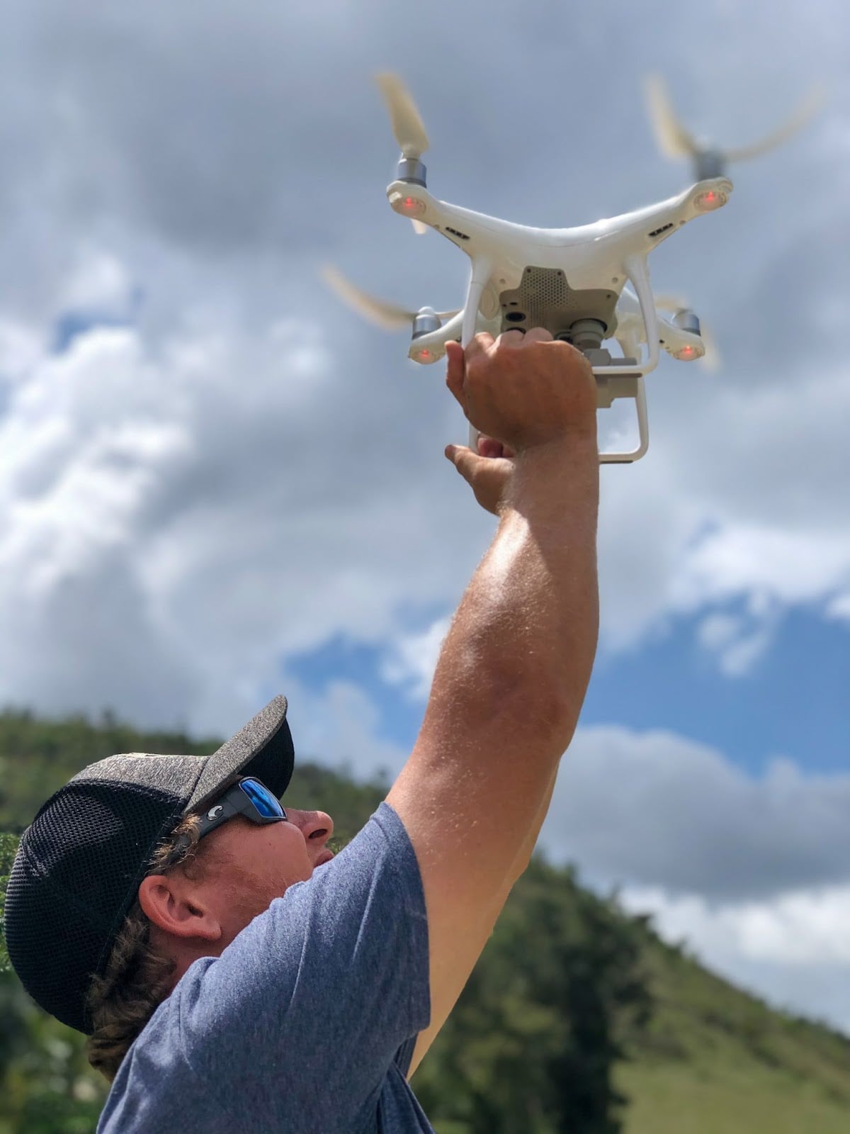
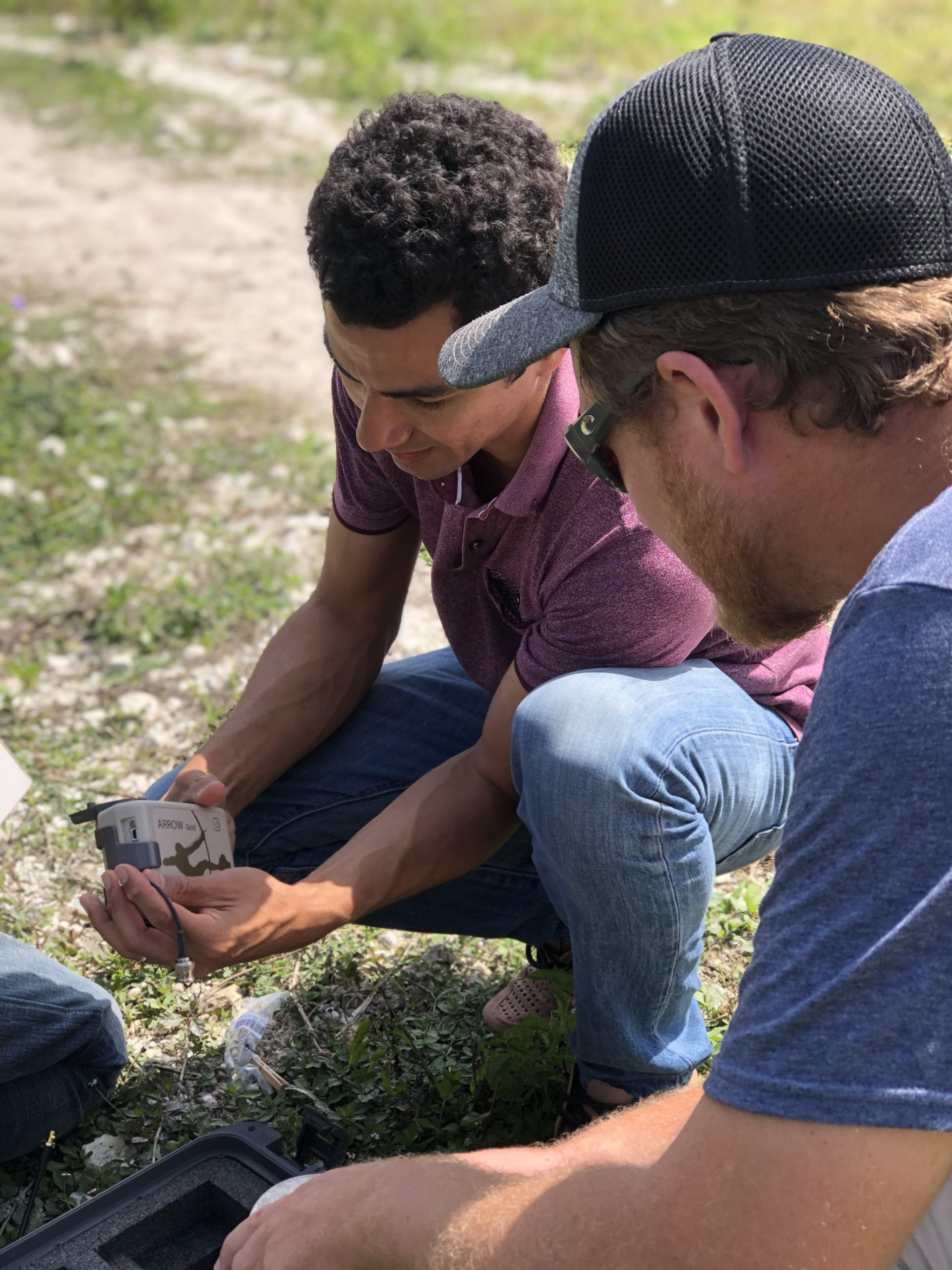
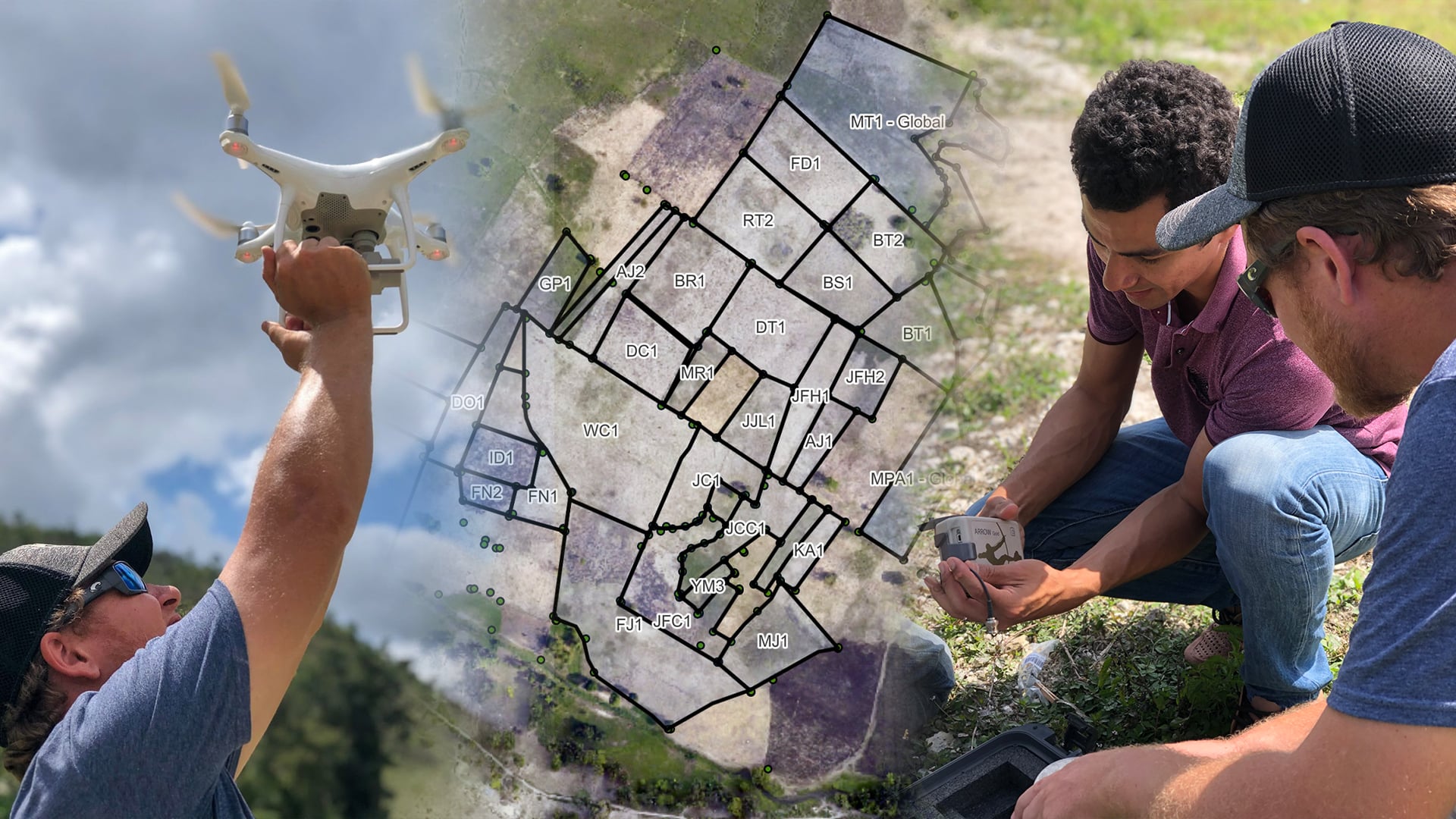
To generate high-resolution imagery of terrain-based obstacles, ADF Haiti decided to use a DJI Phantom 4 Advanced drone. They created flight plans using DroneDeploy software and set ground control points (GCPs) using their Arrow Gold® GNSS receiver. They then used Pix4D to create orthomosaics that could be loaded into ArcGIS Pro.

The Workflow: Replacing Physical with Digital
“At this point, we can remove physical boundary markers, such as fences, that would otherwise be a hindrance to mechanized harvesting tools. So we can have smoother and less interrupted harvests.”
— Jean Thomas, Founder, Haiti Christian Development Fund (HCDF)
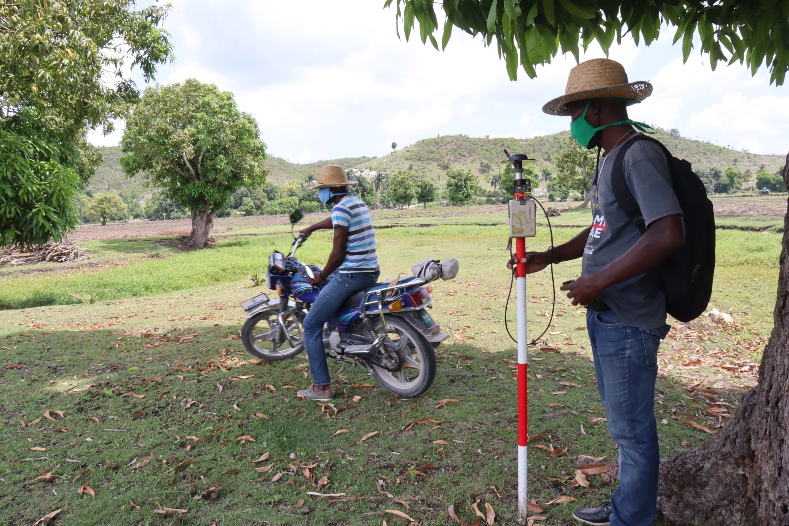
To map the boundaries, ADF Haiti sent employees to each parcel. Landowners guided the employees to their parcel corners, which were captured in Field Maps. These points were labeled with the farmer’s initials and a unique numeric identifier.
Subfoot real-time location accuracy streamed to the iOS device from the Arrow Gold® GNSS receiver, which was mounted to a surveying range pole to ensure the highest possible accuracy.
The Atlas® differential correction service worked in even the most remote and rugged Haitian terrain. Meanwhile, Field Maps captured all this GNSS metadata and finally provided the team with the confidence to remove the physical markers. On average, ADF Haiti achieved 20-centimeter accuracy using Atlas®.

“At this point, we can remove physical boundary markers, such as fences, that would otherwise be a hindrance to mechanized harvesting tools,” Jean Thomas said. “So we can have smoother and less interrupted harvests.”
Processing the Data in ArcGIS Pro
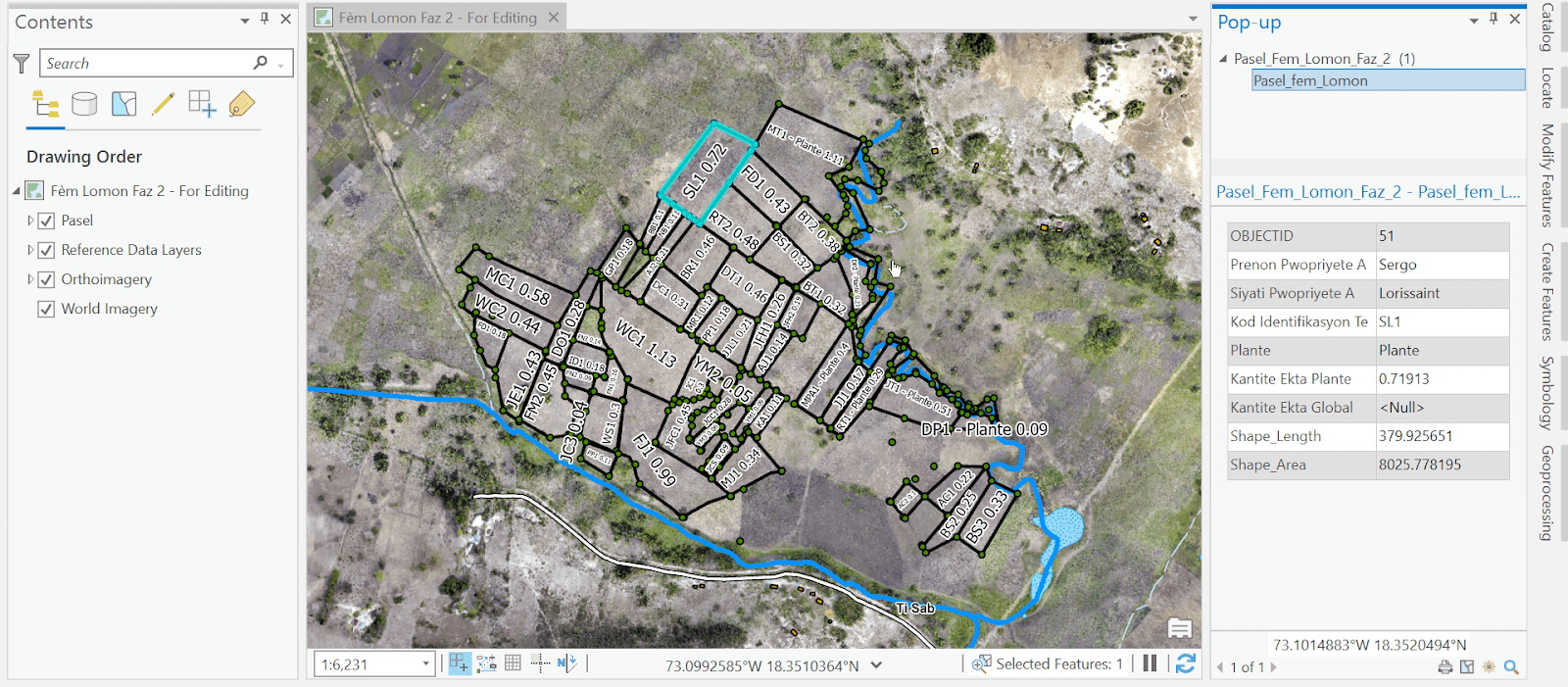
Back in the office where Wi-Fi is reliable, the data collectors synced their data to a web-map feature layer. They used ArcGIS Pro to connect the corner points into polygons representing parcels. Attributes such as landowner identities, parcel IDs and acreage are retained. By overlaying this data onto the drone orthomosaics, they then identified any remaining physical obstacles (e.g., trees, ravines) that could impact the mechanized harvest.
Finally, ADF Haiti exported this data to a Microsoft Excel spreadsheet. HCDF uses this spreadsheet to calculate each farmer’s portion of the total harvest. All the information is transparent and verifiable.
The Results: Accurate Digital Maps Improve Total Harvest and Ensure Fair Compensation
“Together, we are producing crops that can be consumed locally or sold internationally. This is a great model to help our communities farm in ways that are both more sustainable and more ethical.”
— Josiah Thomas, CEO, ADF Haiti
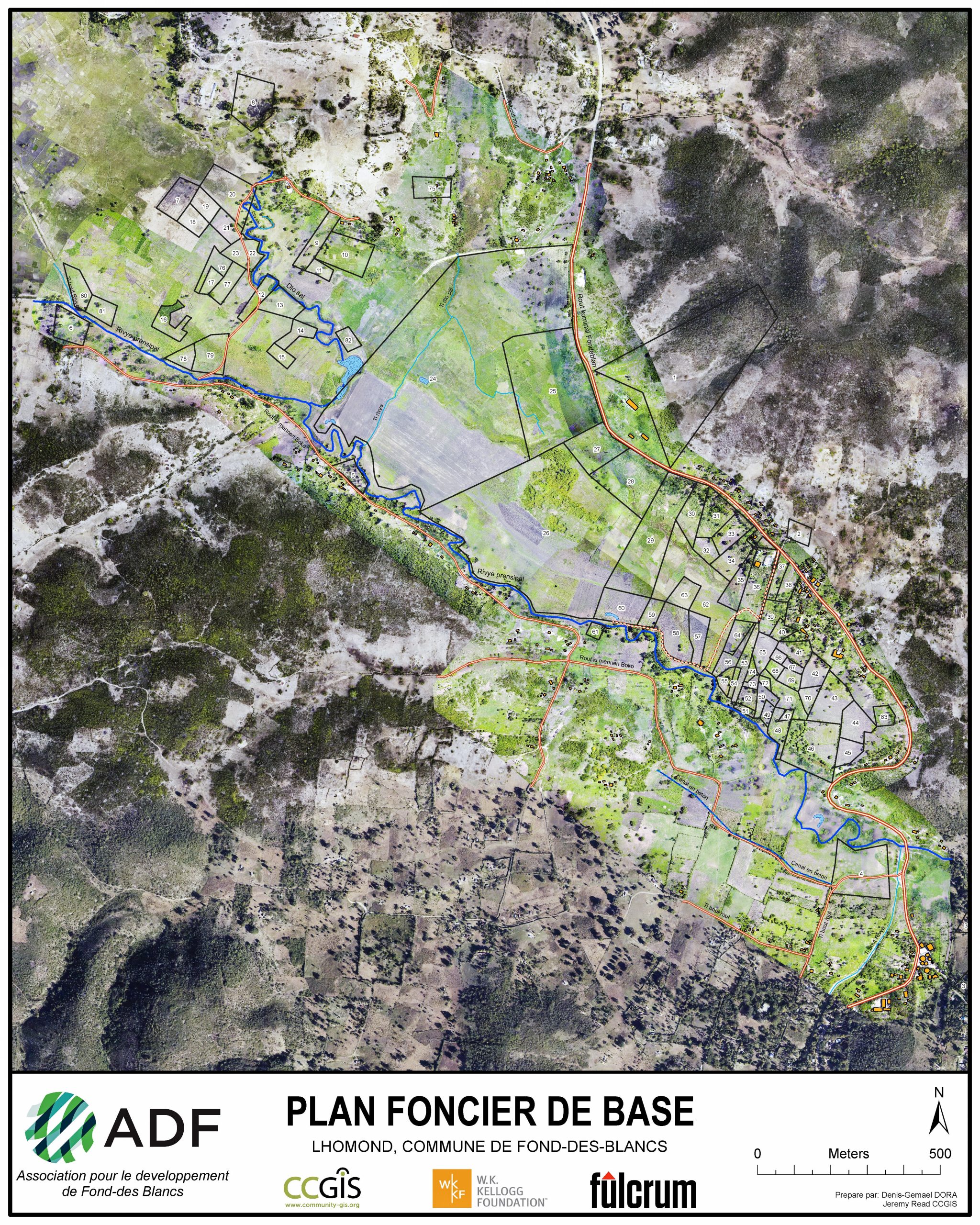
Jean Thomas estimates the mechanized techniques are yielding roughly four times more food than the manual methods used just years ago. Meanwhile, accurate documentation of the landowners’ boundaries ensures farmers can trust the portions of yield and profit returned to them.
The ultimate vision is twofold: Jubilee Farms members can now produce even more food across Fond-des-Blancs, and they can work toward ensuring generations of profitable farming.
As new farmers join the cooperative, the project is rapidly expanding. ADF Haiti hopes to capture countless more parcels and, overall, empower Haitians to produce even more from the fertile Caribbean land they own.
“Together, we are producing crops that can be consumed locally or sold internationally,” Josiah Thomas said. “This is a great model to help our communities farm in ways that are both more sustainable and more ethical.”

