Authors: Ella Voorhees, Mary-Ella Lee, and Kerry O’Hare; AmeriCorps members serving as GIS Interns at Great Smoky Mountains National Park
Editor’s note: This story was originally published in the National Park Service Geospatial Newsletter in Q1 2025. It is republished here with permission.
Great Smoky Mountains National Park is world renowned for its scenic natural beauty, but the dense canopy that covers the park year-round poses significant challenges for field data collection. Evergreen vegetation at higher elevations and deep, deciduous and densely vegetated valleys interfere with satellite signals used by Global Navigation Satellite System (GNSS) receivers to acquire precise geospatial data essential for restoration and conservation work. Collecting accurate data in such a challenging environment like the Smokies requires innovative solutions and cutting-edge technology. The Andrews Bald georeferencing project highlights the creative ways GNSS technology is being used to overcome these challenges.
What are Appalachian Balds?

Appalachian Grassy Balds are rare ecologically important features of the Smoky Mountains offering unique habitats for flora and fauna. Without active management, these open areas can quickly become overgrown by surrounding forests. Restoration of the grassy Andrews Bald requires identifying the historical boundaries of the open area to determine the extent of forest encroachment.
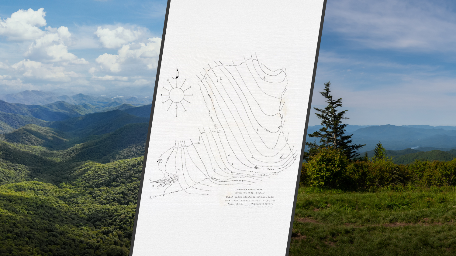
Restoring Andrews Bald

The restoration project began with a 1937 hand-drawn sketch map identified by National Park Service (NPS) Forester Jesse Webster. The sketch map outlined the boundaries of Andrews Bald as it existed nearly a century ago. Knoxville – Knox County Community Action Committee (CAC) AmeriCorps members serving as GIS Interns created a field data collection layer for use in Esri’s ArcGIS® Field Maps to collect sub-meter accurate data points depicted on the sketch map.
Overcoming Canopy’s Challenges with Laser Rangefinders, an Arrow Gold+ GNSS Receiver, and GalHAS

The initial trip to Andrews Bald took place on September 10, 2024. Located near the middle of the 800-squared-mile (about 2070 squared km) park, Andrews Bald is far from cell coverage and the opportunity to use the park’s base station broadcasting real-time differential corrections. With the intent to capitalize on the support for Galileo High Accuracy Service (GALHAS) available on Eos Arrow Gold+™ GNSS receivers, GIS Interns and vegetation management staff set out to collect the location of trees, rocks, and other features referenced on the 1937 map. This initial trip underscored the challenges of working under the Smokies’ dense canopy. The new impenetrable growth since 1937 made it impossible to access the GALHAS satellites and achieve sub-meter accuracy deep in the canopy.
Enter the TruPulse® 200X laser rangefinder. Under open skies in the middle of the bald and using real-time corrections from GALHAS and the Eos Arrow Gold+, the laser rangefinder allowed the team to work around the dense canopy by using an offset method. The laser measured the distance and angle to the target, enabling the team to calculate and record its precise location in Field Maps. After syncing to the NPS GIS Portal, the points were then used to georeference the hand-drawn map and establish a historical boundary layer. This layer will be used by field staff to clear trees and re-establish the historical boundaries of the bald.
Key Takeaways
The success of the Andrews Bald georeferencing project underscores the value of laser range finders supplementing real-time differential correction data collection in remote environments. These tools enable high accuracy data capture under dense canopy and in hazardous or hard-to-reach locations. This approach improves safety and efficiency while supporting critical conservation efforts, such as restoration work in sensitive habitats in Great Smoky Mountains National Park.

You May Also Like One of These Success Stories

GNSS Data Helps National Park Clear Snow from Unmarked Alpine Roads
National Park Service is using Arrow Gold® RTK GNSS receivers at LAVO national park to clear tens of feet off alpine roads with cm accuracy.

Resort Municipality of Whistler Empowers Departments with Accurate GNSS Data
The Resort Municipality of Whistler equips departments with a high-accuracy mobile data collection workflow to support grant applications.
