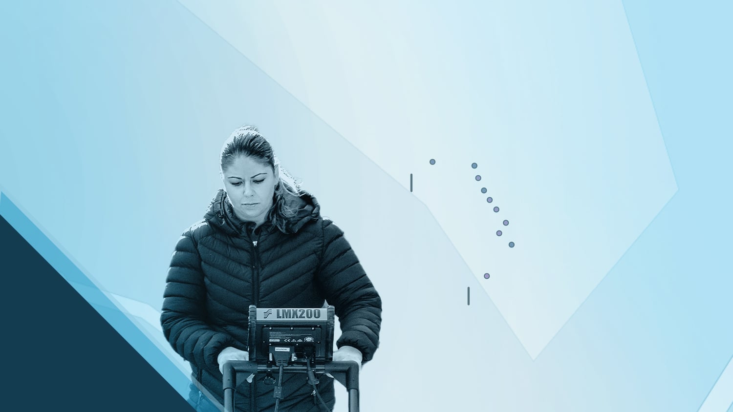
Dr. Sarah Beaulieu is committed to uncovering historical truths through modern technology. As an Assistant Professor in Anthropology and Sociology at the University of the Fraser Valley in British Columbia, Canada, Sarah is renowned for her knowledge in conflict anthropology. In her previous research, she became the first to excavate and map unmarked graves at Canadian World War I internment camps, which between 1914 and 1920 forcibly confined civilians of ancestry from enemy nations. Recently, she applied this expertise to Indigenous Residential School (IRS) sites across Canadian provinces, aiding in shining light on a heavy history. Sarah assists Indigenous communities in mapping potential unmarked burial sites of children at these schools using advanced, high-accuracy technology.
Leveraging ground-penetrating radar (GPR), an Arrow 100® global navigation satellite systems (GNSS) receiver, and Esri’s ArcGIS Field Maps data collection app, Sarah assists Indigenous communities in mapping these sites with precision and respect. By using oral tradition to guide modern technology, Sarah ensures the documentation and preservation of these potential burials while honoring communities’ desires for privacy. Her unwavering commitment to this work reflects a deep dedication to truth, reconciliation, and healing for Indigenous communities.
1. Why are you passionate about your job?
It’s important to me that we are affecting positive change in the world. If we can do this through our work, it makes life that much more fulfilling.
For me, I have been able to honor Indigenous communities’ traditions while simultaneously incorporating technology that can help gain recognition of and validation for their past, especially by engaging their communities and delving into their history through oral tradition and survivor testimony. The Tk’emlúps community describes this as walking on two legs: upholding both western laws and science and Secwepemc laws as laid out in oral histories and songs.
2. How did you first find out about Eos Positioning Systems’ GNSS products?
When I realized I needed higher accuracy than the built-in GPS of my GPR device, I asked my archaeological colleagues what they were using. They recommended the Eos Arrow 100. It has submeter accuracy, which is very important for my archaeological work.
3. What do you use Arrow Series® GNSS receivers for?
I use the Arrow 100 for many different types of surveys, including recording in-field artifact locations, important landscape features, excavation units, and GPR features. In recent years, I began using the Arrow 100 to survey the grounds of former IRS sites, where Indigenous communities have been recording evidence of unmarked gravesites.
For these tasks, accuracy is essential, whether it’s for commemorative purposes, to make sure people do not walk across these graves, or if excavations are to ever happen at any site. This type of work needs to be slow and methodical. There is more to this work than just looking for burials. Communities are coming together to decide what these next steps will entail, and this takes time. Using a high-accuracy GPS unit enables us to mark in the targets, or features, while knowing that community will be able to continue with future work by returning to the precise locations when they are ready.
5. Do you have a favorite feature of Arrow GNSS receivers?
I appreciate being able to combine photographs and notes in the field while simultaneously taking GNSS coordinates. Being able to layer numerous features, refer back, and incorporate them into reports adds a more nuanced perspective.
Explore Related Content

Mapping Unmarked Graves at Indigenous Residential Schools
Sarah Beaulieu combines GPR and GNSS to locate grave locations at Indigenous Residential Schools across Canada.

Customer Spotlight: Mike Markowski Uncovers Archaeology with High-Accuracy GIS
Mike Markowski turns to modern technology to learn about stories of the past. Learn how he uses high-accuracy Arrow 100 GNSS® to uncover archaeology!
