
Introductions to Eos’ Esri IMGIS session:
Jessica Valenti (Esri): Good morning and thank you for joining us at IMGIS (the Esri Infrastructure Management and GIS conference). We could not be more thrilled to be joined by this incredible panel this morning. This lively “ask the panel anything” session is hosted by Esri partner Eos Positioning Systems, a 2020 IMGIS award winner. Joining the panel are two Esri product leaders – Jeff Shaner and Ismael Chivite, alongside data collection power-user Zac Petix of Palmetto Engineering, who just returned from months collecting data in harsh environments in the Sonoran Desert. Moderating today’s panel is Eric Gakstatter – to you, Eric.
Eric Gakstatter (Discovery Management Group): Hey thanks a bunch Jessica and great to be here for this high accuracy mobile interactive panel. Boy it’s a great panel, with a lot of experience here. You’d probably call it even world class or at least I do. But first, I’d like to thank Eos for sponsoring this and bringing us all together.
I’ve been in the GNSS industry for about 30 years now, and I’m joined by Jeff Shaner, Ismael Chivite, Zac Petix, and Jean-Yves Lauture from Eos. So let me pass off for a couple minutes’ intro to each guy. Jeff, why don’t you start us off.

High-accuracy GIS / GNSS panel: Speaker introductions

Jeff Shaner (Esri): Sure, thanks Eric and thank you to Eos for this panel discussion. My name is Jeff Shaner, and I’m the field apps product engineering lead at Esri. I’ve been with Esri for 25 years now; surprisingly I’m only 35 years old. I don’t know how that happened, I mean it started when I was young, and I work closely with our product development team, kind of filling the backlog of new development work we do so that’s me.
Eric: Thanks, Jeff! Ismael?
Ismael Chivite (Esri): Hey, thank you Eric and Jean-Yves for the opportunity to be with you today. My name is Ismael Chivite, and I work at Esri as a product manager. Specifically, I’m focusing these days on ArcGIS Survey123 and ArcGIS QuickCapture.
Eric: Great, thanks Ismael! Zac?
Zac Petix (Palmetto Engineering): Good morning everyone! My name is Zac Petix and I’m with Palmetto Engineering. I’ve been using what I like to call the vanilla Esri solutions now since they were launched. We’ve had a lot of success. We’ve enjoyed using the apps, we’ve enjoyed watching the technology grow, and we’re looking forward to pushing into the future.
Eric: Well, I can relate to you Zac. I’ve been a power user for a lot of years and spent a lot of time in the field. It’s been fun to watch the evolution. Jean-Yves?
Jean-Yves Lauture (Eos Positioning Systems): Good morning everyone and thank you for being here. I first want to thank everybody on the panel for being present, and Esri for the “ask me anything” session. My name is Jean-Yves Lauture, I’m based in Montreal with Eos Positioning Systems. I’m the CTO of the company, and I’ve been involved since the very early days of Bluetooth®; I’ve been designing Bluetooth® receivers since the early 2000s, and at Eos I handle a lot of the product development and app development also and we will be waiting for your questions.
Eric: Great! And so just by the way, a background I’m Eric Gakstatter. I’ve been in the GNSS industry, like I said, for about 30 years now as a product manager developing hardware and software. I wrote for GPS World magazine for about 10 years. As a high-accuracy GIS person I spent a lot of time in the field, and mapped a lot of golf courses, believe it or not.
The Esri ecosystem’s evolution for mobile mapping

So anyway, the format here that I’d like to follow is that we’ll do a an Esri mobile apps overview, and then really focus on questions from the audience. We really want to follow an “ask me anything (AMA)” Reddit style format, because it’s really all about the audience and making sure your questions are answered. Then we’ll fill in between those Q&A sections with some case studies. We may or may not get to all of them, but they’re great discussion points if we need to spur a conversation.
So, this is the Esri ecosystem, and from my perspective, it’s been fantastic to watch this ecosystem develop. As I developed software back in the ‘90s for field data collection and PC post-processing, or data processing and mapping, and now today Esri has an entire suite. Just from a user perspective, I want to talk about what this means to us as users, and for our clients, and then maybe have comments from Jeff and from Ismael about their specific products (within this relatively new ecosystem).
So first, there’s the ecosystem from a field perspective, involving ArcGIS Field Maps and ArcGIS Collector. So, Collector’s the current deployment and then Field Maps is an extended deployment of the next-generation deployment. Then under ArcGIS Survey123, which is field forms based, and QuickCapture a fast application for recording fast data, like a breadcrumb trail navigator. And you have all these apps here and I’ve got a next slide here that Jeff can comment probably on is how he’s bringing a lot of these apps together in Field Maps under one umbrella. But really the center point of this slide, as you see, is ArcGIS Online – or this could be Portal if you’re if you’re on-premises – but how these apps all work together to feed into that central Esri ecosystem. It’s really a powerful tool. I think that the shift that Esri President Jack Dangermond made from going from a client-base local computer to the cloud has really been, I think, impressive. The result is it just builds this amazing platform that all these apps feed into. You could have Survey123 and Collector open at the same time with an Eos Arrow GNSS receiver and be populated in the same database so it’s cool. Jeff, would you like to talk a minute about anything that I missed in there, or just to summarize?
Jeff: Yeah, that’s well-spoken, Eric. I think a few of us have been around in this business on the mobile side for a long time and that a big shift came I think when Apple really introduced the iPhone®. Right? We Google with Android devices kind of rocket off into new development. And before that, we were really just focused on an all-in-one handheld for mobile data collection, perhaps running a Windows Mobile, right? And for a long time, that’s what most organizations used. We (Esri) had a couple of products back then, like ArcGIS for Windows Mobile and ArcPad, which were used for field data collection. But when the smartphone and tablet industry took off in the 2000’s, we (Esri) engaged quite heavily in building a suite of mobile applications that were focused on each individual activity that people engage in during mobile work, as you see in the slide: planning, navigation, and using maps to understand what’s happening in the field — and keep them up to date. That ecosystem is still evolving today, and that’s what we’re building on with Field Maps.

We’ve kind of stepped back and looked at the industry trends, and we’ve been thinking about how to best deploy solutions and workflows in the field. And we’ve taking the capabilities of each of these individual apps that we’ve been focused on and bringing them together in a unified experience. Now, we’re just waiting on some Apple approvals, but the first launch of ArcGIS Field Maps will happen soon, so we were hoping it might be Thursday this week.
Closer look at ArcGIS Field Maps

Eric: As you were talking, I popped up the Field Maps slide just to show what it’s going to combine: Collector, ArcGIS Workforce, ArcGIS Navigator, ArcGIS Tracker, and ArcGIS Explorer. All of these will be under one umbrella, one app.
Jeff: Yeah, and this this update that we’re doing, either this week or early next week, we’ll bring three of those five apps together: the mapping capabilities that are part of Explorer, the data collection capabilities that are part of Collector, and that breadcrumbing you mentioned the location tracking capabilities of Tracker. Those three combined capabilities are part of this Field Maps first release that’s happening.
Closer look at ArcGIS Survey123 and ArcGIS QuickCapture
Eric: That’s great, Jeff. Hey Ismael, can you give us an update on Survey123 and QuickCapture – is there anything new coming out or talk about the new stuff that’s coming out?
Ismael: Yes, absolutely we have an ambitious plan for the next few years for Survey123 and QuickCapture.
First, QuickCapture is basically an application for rapid and at-speed data collection, so it’s very lightweight and focused on that task. Some of the things that are coming up very soon in this app’s development include integration with oriented imagery, so you can snap photos from the field and then have a great experience with oriented imagery tools from ArcGIS Pro, or even from a web browser. We also just released integration of QuickCapture and Survey123 in some workflows. So, if you want to quickly drop a few points as you are moving, or capture very quick field observations, but sometimes you want to go a little bit deeper with forms, now QuickCapture lets you do that. It now integrates very nicely with Survey123, and we just released this a couple weeks ago on the Survey123 form.
The two fundamental areas where we are working for next year are integration with machine learning, so you can automate field data collection tasks from Survey123 smart forms. We are also developing an extensibility framework, so you can integrate more easily smart forms with your own sensors, but also you can control the workflow of the user as they complete the smart forms and manage their own assignments for the day.
Eric: I tell you guys are doing a great job of extending the capabilities of these applications. You know, it’s fun from my perspective, watching this happen, because we were so limited even five to six years ago. We were so limited with the field tools we could take out on an iOS® or Android device, and it’s just very powerful today. Zac, what would you say about that? I mean you know you’ve been around quite a while too, from a field data-collection perspective, and in an office perspective too – how have you seen the evolution of these mobile apps from your standpoint?
Zac: Well, it’s been interesting, Eric. In my background, I was working and developing field stakers for telecom and electric utilities for the past 10 years. I’ll be honest with you: People told me that Esri would never be able to offer the type of field solutions that some of the specialized third parties can do, and you know I think a lot of people are pleasantly surprised that this wasn’t true. Even if you don’t really want to remove one solution, maybe you can use Collector or Survey123 to enhance the data collection workflows that already exist. But I will also say this: These Esri ArcGIS apps have been a game changer, and a lot of utilities right now are legitimately looking at these solutions to add another tool in their toolbox of gathering good data. Eric, the other thing too is that with the high-accuracy Eos Arrow GPS receivers, what I’m seeing right now is, well – you know, the reason we map things is so we can manage them. But when you map things in high accuracy, you are managing them in high accuracy. So just the quality of data and tools are easy now, the days of studying at the altar of GIS to join the priesthood to deploy these apps are over. You can be successful in the field right now without years of training.
User question: Acquiring vertical accuracy within Esri ArcGIS mobile apps
Eric: Hey, that’s awesome Zac. Thanks so much.
So I’m going to the first AMA question, for Jean-Yves. I was sharing my ask anything questions screen there for a minute, sorry folks.
There was a question about vertical accuracy, and Jean-Yves I wonder if you can address that: Among these different Esri mobile apps, how is that vertical accuracy available in the applications? How does that work?
Jean-Yves: Yes, thanks Eric. So, you can get elevation in every single of one of the Esri mobile ArcGIS apps. The Arrow GNSS receiver provides you with an elevation, and this accurate elevation depends on the type of receiver you’re using, as well as the source of differential correction. So, if you’re using a submeter receiver you’ll get a vertical accuracy of anywhere from 0 to 3 times the accuracy of your horizontal. That’s generally the rule of thumb.
So, if you’re using a submeter receiver, expect anything from 0 to 2-meter elevation. If you’re using a centimeter GNSS receiver, you’ll have 1-3 centimeter horizontal, and you can expect anywhere from 0–5-centimeter vertical accuracy. This elevation can be stored in the Esri mobile app you’re using.
There is also one thing that we have added specifically for our Arrow GNSS users: A lot of people were asking to implement support for various GEOID models around the world, to get a more accurate elevation that fits the national vertical data. In the USA, for example, our GEOID model is NAVD88, and for this we use a GEOID model to convert from the GPS’s natural elevation, which is taken in an ellipsoidal height, automatically into the heights of the NAVD88. So, we do this on the fly within our free app that Arrow GNSS users can use in the background of their Esri ArcGIS mobile apps. And we support quite a few GEOID models around the world, not just in the United States and Canada. And we keep on adding more, on demand.
Eric: So that’s a good point. I think, to be clear, you’re saying the Eos Arrow GNSS receivers can provide survey-grade elevation accuracies within all the Esri apps. Is that correct?
(Jean-Yves unmutes himself.)

Jean-Yves: Yes! We take care of everything within the Eos Tools Pro free app running in the background, and then you push everything into the ArcGIS apps. Whether you’re using iOS, Android, or Windows, we take care of that.
Also, another challenge our users were having is that they needed to do a post-processing afterwards in the office, so that when they got the elevation of the receiver – which was usually mean sea level, which is not very accurate – or they got the ellipsoidal height, they had to transfer it back from ellipsoidal to orthometric heights. So, they had to go into ArcGIS in the office and do all these transformations, to manually apply the orthometric height. But now, when you have it directly in the field, there’s no post-processing needed. So, the idea with offering these real-time GEOID height conversions is to match Esri’s philosophy and vision of having a real-time solution, where you’re in the field, you press a button, and you’ve got nothing left to do back at the office. Meanwhile, people in the office can see everything that you do live in the field. So, we are embracing this real-time workflow that Esri has first envisioned, and by providing the orthometric height in real time, we can help bring this vision to life.
Eric: I think as a field user, being able to consume that metadata into ArcGIS Online or Portal really means a lot, because if you need to do an audit trail, to go back and say, “We know what was going on with this point at the time it was collected. We have all this GNSS metadata, in addition to the survey-grade elevation,” that really makes it a traceable solution.
User question: Using ArcGIS Field Maps and the Esri Utility Network
Eric: So, there’s a question another question about Field Maps and the Esri Utility Network. I wonder if you could comment on that, Jeff.
Jeff: Yeah, that’s a great question, and I think it’s an important one, given the infrastructure (IMGIS) conference. So today, I think one thing that’s important to understand about Field Maps, and even Collector, from that perspective is that it works with your transaction mode. So, in order to collect information – and especially update information – that’s stored inside of your enterprise GIS, you want to be able to leverage the transaction model that’s applied to your feature layers.
And with the Utility Network Management (extension for ArcGIS), which is employing branch versioning (if you’re not familiar, there’s traditional versioning and branch versioning, both of which are part of that enterprise approach), Field Maps and Collector both use the “sync” framework feature services. And the sync framework handles the management of versions for you. So right now, if you wanted to work offline, disconnected in the field, and edit features that participate in your new Utility Network, you can do that. And the edits will go into that branched version. But we do treat it as simple features; we don’t execute any logic of the Utility Network in the field. We have some development work that’s planned; we’re going to start prototyping it in the last quarter of this year and hope to release it early next year, where we’re going to extend the capabilities of our field apps, and of ArcGIS Field Maps specifically, around the Utility Network. The most important things we’re going to do first is the viewing of associations and containment in the map, so you can see that connectivity in the network be able to support the inspection against those associations, be able to support in the map the subtype group layer and the utility network layer, and by doing that we’ll start to bring in additional capabilities. We’re also looking at adding support for tracing against the Utility Network as well, so that you can do all those troubleshooting workflows on those design workflows while you’re in the field. So, we’ve got a lot of work coming for utilities with support of the Utility Network.
And I’d say that one other thing that’s important around that topic, and perhaps even more important than just the Utility Network — and it’s coming into hosted feature services, and it’s coming into the Runtime, and when it’s there we’ll be supporting it with our forms work and Field Maps — is the attribute rules capability. That’s associated with the development of the Utility Network, as well as contingent values, so if you’ve been asking about or looking for those capabilities, they’re coming. And they’re coming in the early-next-year time frame, by the time it gets plumbed into the rest of the system.
Esri apps overview: Highlights on the new ArcGIS Field Maps, including new smart forms
Eric: Good stuff, Jeff. So, I’m going to move on to the next slide. It’s about Field Maps. We already went over this a little bit, but just maybe give a 30-second highlighting on that Jeff, please, on Field Maps?
Jeff: Well, we kind of talked a little bit about it already. You know, we are bringing together these individual apps that I mentioned. For this fall release, it’s really focused on Collector, Explorer and Tracker. But we’re also doing more than just merging those apps together with this release. There will be a couple of key additional pieces that have been worked on.
One is support for indoor mapping. I know we’re all focused upon outdoor here, but I’ll just mention that we’ve added support for the indoor information model with Field Maps, so if you do have a facilities layer inside of your map, and your map layers have been authored to support the indoors model, a floor picker will appear when those facilities are in view, and this will let you filter based on floors. It will show floor information, and that’s just a starting point of deeper integration with ArcGIS Indoors. The second phase of that will be bringing in the indoor position as well, and that’s going to unlock a whole bunch of new, streamlined editing workflows for indoor mapping as well.
So, we’ve done that, and we’ve started on the integration points. It’s a platform integration of smart forms, so we’re bringing in the ability to extend beyond what the pop-up definition does for editing on a layer, and we’re introducing a new forms concept. And that form information is stored as a part of the web map. Field Maps is just kind of this tip-of-the-spear for that, because it is driving the field aspects of the form data-collection effort. So, we’re doing some basic things to start with, like organizing your attributes into groups and supporting conditional visibility. But next year we’ll be doing calculations and much more, growing that capability by putting that form content into the web-map spec, as an ArcGIS “smart forms” capability. In the new ArcGIS viewer that’s in beta today, it also supports it too. And so you’re going to start to see forms everywhere in the platform, not just in one app. It’s going be all over the place so and that’s a that’s a huge advancement in the whole platform. I think and a lot of the smarts underneath it are going to take advantage of that Arcade expression language. So, if you haven’t invested in learning about Arcade as a GIS professional, I think now is the time to really invest in it. Not only is it affecting these forms moving forward, but it’s also how you all can alter symbology, perform labeling – there’s just a lot of advancements you can make with Arcade, in terms of how you manage and work with maps.
User question: Using high-accuracy GNSS metadata with ArcGIS Survey123
Eric: I know our folks around the office here talk a lot about Arcade, so I’m with you there.
Hey Ismael, there’s a question from the audience: When collecting high accuracy point data using Survey123 with an Eos Arrow GNSS receiver, do I need to add the GNSS metadata fields to the connect form? Are those fields stored in the geo-point?
Ismael: Yes, first, regarding the elevation: From day one, the elevation went into the geometry field in Survey123, so that has always been there. Then regarding the metadata, you don’t have to add the Esri GNSS fields necessarily. You can choose on what fields (metadata) you want to store. In Survey123, we work with this notion of calculations, so you can build logic induced in your smart form. So as the NMEA sentences come from the Arrow GNSS receiver, we can extract values, manipulate them, and put them into whatever attribute you have in your own feature layer. So, you are not constrained to a particular schema. You can use the Azure schema, but you can also use your own schema, to store this metadata — and even to create data-validation rules in the application itself. So, it’s not just about storing the GNSS metadata; it’s about using it in real time. While you are capturing the data, you can use those values to create your own constraints for data capture.
Eric: Just to be clear, so that we answer the second part of that question: Are these fields stored in the geo-point?
Ismael: Yes, okay perfect. If you want to store a GNSS metadata field, for instance the number of satellites, or the fix time, or another attribute, then those go into the attributes. But the XYZ coordinates all go into the geo-point.
Zac: To add to that GNSS question too, we ran the tools to populate those metadata fields into our field collections, so that our field collectors could see those fields. We did this because we were tasked with testing the accuracy in real time in the field. So, it was good for our people in the field to see those GNSS metadata fields being populated in the Esri apps right away, so that when you’re collecting at high-precision or high accuracy, the quality of the data they collect is known to be at a decimeter scale or better. There’s a lot of advantages to having those GNSS fields there. You know, we were working with multiple GNSS receivers in the field, and we were working with different schemas, so I was having to map some of the data to different fields, and with very little programming we were able to do all that and be very successful.
Eric: And I think the serial number of the receiver is uploaded too so you know specifically which crew is tied to which data, right Zac?
Zac: That’s correct. And we were able to use the built-in analytics in Survey123 to engage and plan in the field, and that was a huge for this last project.
User question: Enabling raw GNSS metadata for line and polygon layers in ArcGIS Collector
Eric: And Jeff another question for you um when accurate GNSS data will be oh see can you explain in the session when accurate GNSS raw data will be enabled for line and polygon layers in ArcGIS Collector?
Jeff: Yeah, that’s a great question, Eric. We’ve talked about taking the GNSS metadata and applying it for lines and polygons, since it’s there for points, but not vertices.
Eric: Right yeah it is not there for the vertices.
Jeff: Right. There really isn’t vertex-level metadata inside of ArcGIS right now. We don’t have that concept. We could store the raw data, which might be also the question. But that would be independent of the data collection. It would be like taking a GPS session of information, just storing the raw GNSS data that’s logged, and then somehow matching that back up. This is something we’ve been asking ourselves about, and we’re looking for more information on what’s the intended purpose. Is it that you want to take that raw GNSS data and post-process afterward? That has historically been done, but we haven’t taken that approach with smart forms yet.
Eric: Right. Yeah, I’ve thought about the question more, and I think that they mean that for point data, you get all the GNSS metadata, for example PDOP. But for a virtual reality, you don’t get all that information, and that’s what people are after.
Jeff: So in in that context, I guess the question is whether you want to see that averaged, right? And then what would you do in the instance where maybe it’s a linear geometry or a polygon geometry, and someone were to modify it with a map? We’ve talked about constraining, in Field Maps, so that you can only collect and update using GPS, and then we could enforce that. But in this mixed mode of being able to pick up and move, or delete, a vertex of a geometry, that can really impact what the true measurement would be. It’s not really then a GNSS measurement, right? So, there’s some considerations there. I think knowing the intended end goal is important.
Ismael: To add to that, we just had an experience with a user who had a similar request. So, the way this was done for them with Survey123 was that, basically, when you start digitizing your line or your polygon, you don’t use the polygon tool or the polyline tool, but you rather start adding vertices to your geometry. And then the polygon or polyline is calculated on the fly. So, what happens is that while the vertices of the polygon or the polyline don’t have the GNSS metadata, there are corresponding point features that coincide with these vertices that do, right? So, that’s kind of a simple approach that you can model with Survey123 smart forms. Similarly, with QuickCapture, we had this scenario or some guys from Canada mapped mountain bike trails, and they wanted to have a GNSS metadata for every vertex along those polylines, these trail tracks. So, they similarly configure QuickCapture to not only create a polyline, as these guys were riding the bicycle, but they were also dropping points at every vertex of the line, and that vertex of the line contains all the GNSS metadata.

Eric: Gotcha. That’s a great concept there, so if I understand correctly, in the end you have two layers, right?
Jeff: Yeah, we did a similar method with Collector for a Dutch cadaster project, with the workflows around data capture were such that you could simultaneously capture point features along with the polygon geometries. I think that is a valid approach. And then it becomes a question of, “How do you manage that content effectively, and maintain that improved accuracy in your GIS after?” For instance, would you use a topology to manage that, or what do you do with it after, right? I think that’d be something to understand better too.
Zac: And Jeff, that’s interesting you mentioned that. With the high-precision data collection that we were using in the field, especially in our telecom work, an interesting side effect is we wrote some scripts using our Arcade and Python to do stationing on the fly, in our as-builts. But once the guys were in the field and collecting these high-accuracy points, we were doing updates, in additions, from field collections — instead of having to re-run and manually calculate all these stationing fields, which in the telecom businesses that they live and die by. Instead, we were able to automate that. And so, if the client had a request to do a work-order change, or if there was some issue in the field, we could look at the high-precision points and kind of recalculate. So, it’s a game changer, really, having that certainty that your data in the field is correct.
Eric: That audit trail is a big thing I hear about.
Zac: Eric, I’ll say that we had to have that metadata in there, because most of our clients are asking us for, well they use the term loosely, but survey-grade data, right? But I wanted to be able to go in and say, “We maintain these data-level precision and accuracy through the entire collection.” And in areas where, if we couldn’t get, for whatever reason, we still wanted to have that data there, but we want to be able to say, “Hey, this is literally a red line that we’re creating on the fly. This was not a field collection.” And we can differentiate that for the client. And I think the GIS world still has a hard time wrapping their arms around the fact that you can get survey-grade horizontal and vertical accuracy within all these mobile apps. It’s just something that’s totally new, that we haven’t really seen before in years past. The technology is moving very fast now, and again I’m seeing a lot of clients asking me if they need to have these very elaborate base stations and all this stuff, and I tell them it depends on the project and the area you’re working in. But now you have more tools in your toolbox to be able to do these type of field collections.
User question: Is installing your own base station better than using an RTK service?
Eric: So that leads into the next question, which is for Jean-Yves. This person in the audience is saying that they attended a session earlier at IMGIS where a utility had installed a base station. Is this (base station) a better option than using an RTK service? Jean-Yves, while you think about your response, I’m going to skip a slide here and show a picture of a base station. There’s one right there, so folks know what they look like. This is one of them at least.
Jean-Yves: This is a very good question. My simple answer is, if there is an RTK network available, especially if it’s free, go for it. That would be the best option.
A lot of states have free RTK networks. I think for example, New York, Oregon, Florida – they all have free RTK networks. So why would you install your own base station? There might be a couple of reasons for that.
The first one is: Let’s say you have multiple receivers in the field. Let’s say you’re operating 50 crews in the field, and you’re in a state that does not provide a free RTK network. If you add the cost of what it would be per receiver to get an activation to a paid RTK network (so, multiply the per-user fee by 50), then this gives you a yearly budget. For probably, usually, a very small fraction of that investment, you could install, operate and own your own base station. You could provide about one centimeter-level error per 10 kilometers’ baseline, for an unlimited number of users. We’ve been providing this solution to some customers, like what the person who asked the question had probably seen with the utility they mentioned having its own base station. If you install, for instance, an Arrow Gold® receiver as a base station, it will provide anywhere from 1–3-centimeter accuracy on average, when you’re 50 kilometers away. That’s about 30 miles or so.
I personally do test from Montreal with the New York base station. I’m about 108 kilometers away, and I still get about 8-centimeter accuracy. So, what you choose to do depends on what you’re looking for in terms of accuracy. One strong reason to install your own base station is if your local RTK network is not free, and/or if you have a lot of receivers in the field. If you’re covering a large area, too, you can even install multiple base stations, and still save a chunk of money every year.
Four-constellation GNSS base stations
Jean-Yves: One other reason that is becoming more common nowadays has to do with GNSS itself. Base stations today, including those using the Arrow GNSS receivers, can utilize not just the U.S. GPS constellation, but also the Russian GLONASS constellations and others. You can now support all four GNSS constellations, and so you can crank up the number of usable satellites in the field from about seven or eight GPS-only satellites to about 30 to 35 GNSS-inclusive satellites.
So, what does that do for you? Does it increase the accuracy? Not necessarily. But it allows you to have more productivity in the field.
Let’s say you’re under a light canopy and you still you have access to more satellites thanks to the four-constellation RTK base station. So now, you’re being extremely — and I mean phenomenally — being more productive than if you were using just GPS and GLONASS alone. So, this is another reason a lot of RTK networks are still supporting GPS and GLONASS only. But we’re seeing the Florida DOT RTK network as the first one which has integrated BeiDou phase-three satellites in their differential correction. So, they provide all four constellations right now. They’re still in testing for BeiDou Phase Three, but some station you can connect to and have all four constellations. New York is doing only GPS, GLONASS, and Galileo.
So the decision is yours. If you’re in wide open skies, you have no challenging conditions. So just go with the existing free RTK network. If you have one receiver, you could get a paid RTK subscription, so go with that, since maybe it’s not worth investing in a base station.
Eric: I’ll echo your comments is that it really is a productivity question with having more GNSS constellations. We did a study here in Oregon where we tested 2constellation versus 4constellations. We found a productivity increase of about 50 percent when you go from two constellations to four constellations in challenging environments. In the wide-open sky, it’s sort of irrelevant. But once you start to get near buildings, under canopy, or in those kinds of areas, having your own base station with four constellations will start to pay for itself quickly with those kind of productivity increases.
User question: How can we format or structure our forms to increase the acquisition of data acquired in the field?
Eric: Gotcha. Okay back to Ismael. It was mentioned when the crews know they are collecting high-accuracy data, they input better-quality data. What best practices can you share about how you format or structure your forms to increase data accuracy?
Ismael: There are multiple techniques, and we actually have some blocks that describe this. I think there is a lot to say about warnings in your form. For instance, if you want to keep your form clean, but if the horizontal accuracy is not met, or if the GPS has disconnected, or if the GPS doesn’t have the proper fix type – all of these are warnings that you can issue to the user, to prevent them from capturing data in the wrong conditions.
Case studies with high-accuracy mobile GIS
Eric: All right so what I want to do now is I’m going to the first case study. We have New Jersey American Water (AmWater). I presented this story with Chris Kahn in the full on-demand sessions of the IMGIS conference, where we go into a lot more detail about this project. It’s really a great project, but I’d like to give Zac enough time to present his project as well. So first, Zac would you please take over here?
Tohono O’odom Utility Authority in Arizona

Zac: Sure, so we were doing we were contacted by the Tohono O’odom Utility Authority, which is a tribal utility in the southern part of Arizona. They’re the largest tribal utility in North America. Their service area is about the size of Rhode Island, but they were updating from paper maps and basically a lot of legacy data, and they wanted to move into GIS.
The whole idea was to go out there and basically shoot their system and fill in the gaps of a lot of blind areas where they had no data or bad data. And this was going to prep them basically for deployment in the Esri Utility Network. So, you know we went out there and we used Survey123, QuickCapture, and Collector. We built a workflow and shot the system. Unfortunately, COVID-19 hit right when we were getting ready to go out. So, we found ourselves getting backed into the deep of the Sonoran Desert in the middle of August as a result. So not only were we you know battling with the setting up the devices, but we were working in 130-degree heat.

So, what we found out was if it’s going to fail, it’s going to fail in that environment. There’s a lot of considerations, a lot of little gotchas that you don’t think about when you’re sitting at the office and filling out your forms or deploying your schema. But for us this became an exercise in, how can we squeeze as much efficiency out of this, and how can we speed up collections in an environment where after 30 seconds in the sun, your device is going to fail? And when I say the device, we were using iPad®s and iPhones initially. There are some limitations with what the thermal range that those devices can work in, and we quickly went through failure. I mean we bought all sorts of cooling fans and everything, and what we found out was we had to back our collection. So, in the wee hours of the morning, we would go out 2 a.m. and start shooting the system. And we were looking for ways, like I said, to squeeze out the highest number of collections in a day in the minimal amount of time. And that means having receivers and equipment that could do fast acquisition, fast forms, and make it as simple as possible. You really want to utilize all of the domains and pick lists and everything that you can in your data. But I was telling some of the folks from Eos, you know 30 seconds in the sun feels like an eternity when you’re standing in a cactus patch. And you know, when it becomes uncomfortable for the guys in the field, their level of detail and attention drops, and so we were looking for fast acquisition devices. As Jean-Yves was saying, maintaining high-precision in the field required us picking up some RTK signals from Phoenix North and Tuscon, so we leveraged that in the field as well. But we were also located in areas on the border where we couldn’t receive those signals, so we were using differential corrections out there. We were still able to maintain decimeter accuracy with fast acquisition times too, so it was an interesting project overall.
Eric: To add to what Zac is saying, there’s an SBAS system in areas where you can’t get RTK in the States, and in that environment, Zac is describing, with clear skies, your SBAS can be pretty good. Probably a couple feet or even less than that.
Zac: That’s right. And I will say just, and this is anecdotal but when we are going through and looking at the data, we were still able to maintain submeter corrections in those cases. But overall, on average, we got about one and a half feet. We were still getting, you know, 6-to-8-inch accuracy out there in the field with SBAS.
Eric: So, here’s the yeah next slide it was just more details about what you’re talking about. I’ve been down there in Arizona myself, in the summertime, collecting data. And it can be brutal. And you’re right: it’s all about getting stuff done fast.

Zac: Yeah, like I said we were not prepared to go into the field. We really were depending on using our vehicles and air conditioning to keep the iPads cold, and we had an over reliability on that. Because in this one slide, right here I don’t know you can see the power line going down on the right side. But way back there in the back is the truck, so as you’re selecting the information, you’re walking 300 to 500 yards. I wanted people to understand the scale of the of the area we were collecting in internally, but also for people attending this presentation: It’s 125 degrees Fahrenheit, and that’s probably 9 a.m. in the morning. So that device is going to overheat, fast. We tried lot of stuff and, originally, when we went out there, we were looking at collection times, we were only getting about 50 shots a day at the initial part of it. My goal was 100 locations a day, so we made some erroneous assumptions about how quickly we’re going to be able to make the collection happen. And again, we had to come back and reevaluate our forms and our devices in the application. Some of these guys were doing poll inspections and basically had two teams following each other. We quickly realized that um we were not going to do that. What we did is we embedded links to Collector or Survey123, depending on what the app the person was using in the field, and so they could make a damage assessment, or they could make a telecom update, even if they were working in the electric Collector.
User question: Navigating to points for staking and other use cases, with high-accuracy mobile location data
Eric: I’m interrupting to say that we got another question, primarily for Jeff and Ismael: “What solutions are available for navigating to specific points with high-precision for use to replace stakes in the field?” And Zac may be able to comment on that too, but I’ll start with Jeff.
Jeff: Yeah, so in Collector, Explorer and Field Maps, we added a compass tool. And the compass tool lets you navigate to a GIS feature, like a point you drop, or something you’ve searched for using a bearing and distance. Important to note here though is that we’re leveraging the compass that’s inside of your smartphone, so it’s only as accurate on the bearing side of it, based upon the compass we’ve been looking at. We evolve that functionality, you know, to applications like I perhaps TerraSync and others, which have always had that capability to navigate to a point. We’ve been thinking about a couple of these evolutions. One is providing local notifications on a device, which you convert into an audible or haptic feedback, by taking advantage of smart devices like a watch or whatnot. So, you can keep your head up as you’re moving while navigating to a location. That kind of comes back to the discussion earlier about 3D content. Should we start to look at an Augmented Reality, or AR-based, solution? And how viable is that with an accurate GPS system today? And would you use that as a heads-up display on your device or not? There’s lots of great questions on that. We’re not sure we want to jump into the AR side of things quite yet. It seems like good eye candy, but I don’t know how practical it is in the real world yet.
User question: Machine learning and voice-based data collection within ArcGIS Survey123, QuickCapture
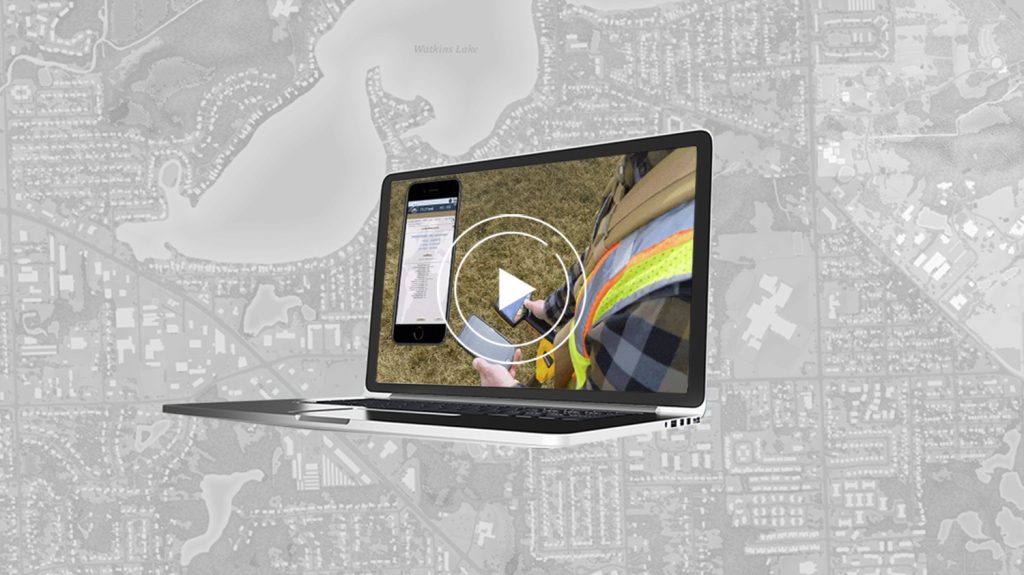
Eric: There’s a question for you Ismael: An audience member says that Ismael had mentioned machine learning capabilities being introduced in Survey123. Will this include voice-based data collection like some of the QuickCapture demos previously showed, and before you answer that Ismael, I’m going to play a video this is from Zach this is kind of a neat thing here.
Eric: So that’s slick. Zac, can you comment about how you used that in the field?
Zac: Yeah, we really wanted to speed up our field work, and flag areas that needed immediate inspections. And we also wanted to be able to take a picture without having to jump out of the truck and do all that. So, we basically leverage the voice recognition capability of iOS devices with QuickCapture. And basically, everybody in the company has that on their phone. So basically, everybody becomes a bird dog at that point.
Eric: So, Ismael the question from the audience was will you be introducing this capability into Survey123?
Ismael: Not in the same way. And let me explain a bit that this was kind of our goal with ArcGIS QuickCapture – to reduce the user interaction with the device as much as possible for capturing data, so you can capture data quickly. That’s the holy grail of the app, really.
In the case of Survey123 and other applications, our goal is to enhance that interaction. So, we know the user is going to interact with the device, and we want to make that interaction bridge, so completely operating the application using your voice – I don’t think this is practical in the case of Survey123. However, when say you want to enter a descriptive text in a question, then yes it makes sense for you to speak, and then let the application transcribe what you are saying. That’s already supported, in all the Esri applications by that matter. So again, to reinforce the idea of fully operating Survey123 with your voice is not in our agenda now. And Eric, if there are any requirements someone has, as a follow up question, I would love to learn about those.
User question: Performing a polygon workflow from Survey123 (without combining ArcGIS Collector and ArcGIS Survey123 capabilities)
Eric: So, another question from the audience if we’re on the Survey123 track here: Ismael, how would you approach performing a point in polygon workflow from Survey123? I haven’t been able to find any documentation on how to do this besides combining Collector and Survey123 workflows, which hasn’t seemed to have worked yet for me.
This is a good question because also we can talk about running Survey123 and Collector at the same time.
Ismael: So, there are different approaches to that. Also, as an aside, I’ll be happy to connect with this user and share a couple of articles. But in short, you can do pointing polygons from the application using custom JavaScript functions. You can also use web hooks to do the pointing polygon queries.
Eric: Gotcha, and Jean-Yves I’m going to shift over to you so that question with regards to running Collector and Survey123 at the same time — can you comment on that?
Jean-Yves: Yes, we have headed capabilities on in our app Eos Tools Pro in order to support both apps running simultaneously. So basically, you can have Collector or Field Maps running and at the same time as you’re running QuickCapture and Survey123. You can have all three of them running if you want, at the same time, and have access to the same data from the Arrow GNSS receiver.
User question: How can we format or structure our forms to increase the acquisition of data acquired in the field?
Eric: Gotcha. Okay back to Ismael. It was mentioned when the crews know they are collecting high-accuracy data, they input better-quality data. What best practices can you share about how you format or structure your forms to increase data accuracy?
Ismael: There are multiple techniques, and we actually have some blocks that describe this. I think there is a lot to say about warnings in your form. For instance, if you want to keep your form clean, but if the horizontal accuracy is not met, or if the GPS has disconnected, or if the GPS doesn’t have the proper fix type – all of these are warnings that you can issue to the user, to prevent them from capturing data in the wrong conditions.
User question: Exporting a setting from Collector to import onto another device
Eric: Another question from the audience this is for Jeff: Is it possible to export the settings from Collector – for example the local location profile provider, and so on – and import this into another device?
Jeff: Hey, Eric, yes, we are working on this. So, part of ArcGIS Field Maps that we haven’t talked about is that there is a web app component that’s accompanying it. When we were taking a lot of the complexities of deploying maps to the field, away from the office so that it simplifies everything, one of those things that we’re going to do is start to bring settings in. So, the intention with settings, like the ones that are mentioned here, is that they’re attached to your user profile, and they can follow you where you go regardless of the device that you’re using. We do have plans to add that into the web map, so it’ll be coming soon. It’s not there today; right now, it’s kind of per device that you must do that entry, so this is not very palatable for a multi-device scenario. But you’ll be able to manage these settings, including a location profile, in the future.
Eric: Okay yeah so is there is it a Mobile Device Management (MDM) type of approach, like an admin sort of thing, and I think you and I have talked about this personally in the past. So that if someone’s got 100 users out there, are you able to control settings, or for instance deploy location profiles, specific for devices via an admin kind of role?
Jeff: Well, you can think about what I’ve just talked about with the Field Maps web app for the GIS administrator, who can set that up. And you’ll be able to deploy it as a part of the user, who signs into the application.
On the MDM side of it, we can approach it that way too. The challenge we find with MDMs is that quite often it’s the GIS professional who doesn’t have much influence in the MDM management, right? So, it’s rare you get into that IT group, and you don’t want to pass through too many hands. So maybe one time, for an app configuration, you do it once when it’s first deployed. And we’ve got a bunch of settings around some of those configuration keywords, so I don’t know that that’s such a great approach.
There are very few organizations that that want to go that way more of a user-centric approach. Especially regarding things like a location profile, so you might have a field workforce that’s distributed, and they’re going to use different entry connections. They’re going to potentially have different location profiles. And you want that to be kind of more focused on the user, like a map or an organization-wide deployment.
Closing remarks about high-accuracy mobile GIS data collection
Eric: Right yeah well this we could go on for another few hours, but our time is up already. It went fast! I really appreciate your time, Jeff, Ismael, Zac, and Jean-Yves. We’ve got to sign off for now, but I really appreciate it folks.
Jessica: I want to thank everybody, really, for that presentation, and Eric for moderating. So, thank you, everybody, and we will be answering the questions that were not answered. We had a lot of questions out there, so we will get back to you.
Eric: Great thanks, Jessica. Thank you, everyone!
Eos: If you have questions for Eos or Esri’s apps team that were not answered during this session, please contact us right away. Our technical support team would be happy to assist you in finding the answer to your question(s). Please contact us today: https://eos-gnss.com/contact-us
You May Also Like One of These Success Stories
Bring Your Buried Assets to Life: Webinar with Esri Electric and OHM Advisors
In this webinar, Esri, OHM Advisors and Eos explore underground utility mapping with Eos Locate™ for ArcGIS®, including a utility case study.
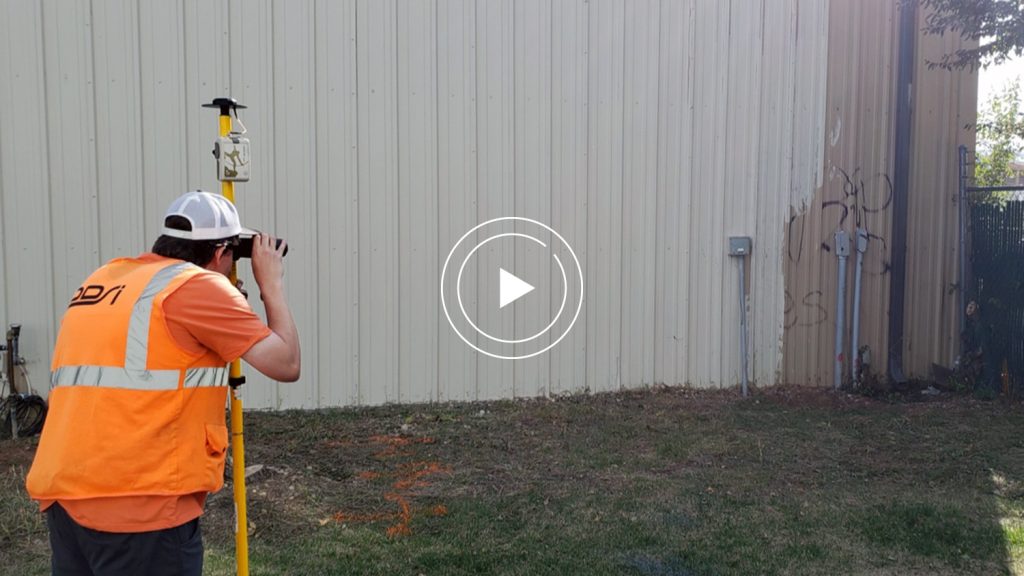
Capturing Hard-to-reach Assets with Decimeter Accuracy
In this Esri AEC webinar, DDSI Global shares how per-project ROI increased by 20% thanks to the use of Eos Laser Mapping for Collector during site surveys.
