Feature Story
/// Tohono O’odham Utility Authority Transforms Utility Services with High-Accuracy GIS

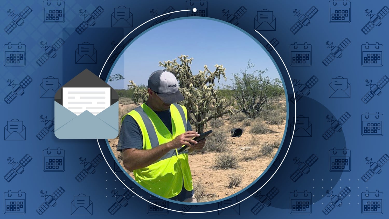
In the Arizona desert, Tohono O’odham Utility Authority beat the heat with a modern mobile mapping solution! Their team collected accurate geospatial data for 710 miles of distribution conductors in the extreme temperatures of southern Arizona.
In this new case study originally published by Esri, discover how TOUA transformed their utility services through the use of Eos GNSS receivers and ArcGIS mobile apps.
Industry News
")
[NEW GUIDE] Eos Tools Pro App Configuration for Mobile Device Management (MDM)
Do you manage multiple field workers? Last fall, Eos announced support for mobile device management (MDM). In this new guide, we walk you through every step to configure Eos Tools Pro for MDM deployment — including sample code.

Interview with Chris Kahn, Founder, AlphaRTK
Video by GISCafé
AlphaRTK is a new RTK network available in New Jersey and the New York City and Philadelphia metropolitan areas. Earlier this year, AlphaRTK made headlines for offering several local universities free access to its services. Learn how AlphaRTK is disrupting the market with its affordable, accurate network.

Mapping Seaside: Protecting Sea Turtles with GIS
Podcast by D’Maia Curry and Josh Clifford, Esri
Have you listened to the latest Field Notes Podcast episode? Go behind the scenes of conservation with Amber Kuehn, who uses Eos Arrow 100 GNSS receivers and ArcGIS Field Maps to protect endangered sea turtle hatchlings.

New Jersey Utility Goes Mobile
New Jersey American Water saves over $2 million each year from field-operations efficiencies. They have equipped over 350 mobile workers with Arrow GNSS receivers and ArcGIS Field Maps. Read about their proactive technology evolution — and striking results — over the past decade.

Esri Releases Cemetery Management Solution
Do you use Arrow GNSS receivers to collect information about cemeteries? Earlier this month, Esri released a new Cemetery Management Solution to help local governments and related organizations streamline cemetery and gravesite inventory, operations, and information-sharing with the public.
Al’s Corner: Technical Tips
Current GNSS constellation status for April 21, 2023:

Customer Spotlight

Emily Jane Murray Preserves Florida’s History with High-Accuracy GNSS
As erosion threatens archaeological sites along the Florida coast, Emily Jane Murray works to preserve the valuable history they contain. Using Eos GNSS receivers with Esri’s ArcGIS Field Maps, Emily Jane maps coastal-erosion rates to help prioritize the documentation of these at-risk sites. Explore the important work Emily Jane does at the Florida Public Archaeology Network in this latest Eos customer spotlight!
Upcoming Events

ERGIS (formerly PUG)
April 26-27 | Texas, USA
Join Eos in Houston for the annual Esri Energy Resources GIS event. Our local representatives and GNSS experts will be on hand for any GNSS questions, including about the brand-new Galileo HAS service! You can also attend a live presentation about Galileo HAS both days of the expo.

Ohio Rural Water Conference
May 9-10 | Ohio, USA
Find Eos with Esri at the Ohio Rural Water Association event in Dublin, Ohio. We’re pleased to return and bring you two brand-new sessions! Join our mapping experts to learn everything you need to get started with basic to advanced field data-collection workflows.

Esri UK Annual Conference
May 16 | London, UK
Eos is pleased to sponsor the Esri UK AC in London. Join our team at stand #12 and ask us about exciting new developments for mobile GIS in Europe. Our experts will be on hand to answer any questions about mapping in the UK.

Arboriculture Australia National Conference
May 28-30 | Sydney, Australia
Join our friends at 4D Global at the annual AANC conference in Sydney. GNSS experts will be at the expo to answer any questions about using GNSS throughout Australia. Also, don’t miss Peter Terrett’s session on May 29 to learn about innovations in GNSS and mobile tablets that assist arboriculture professionals.