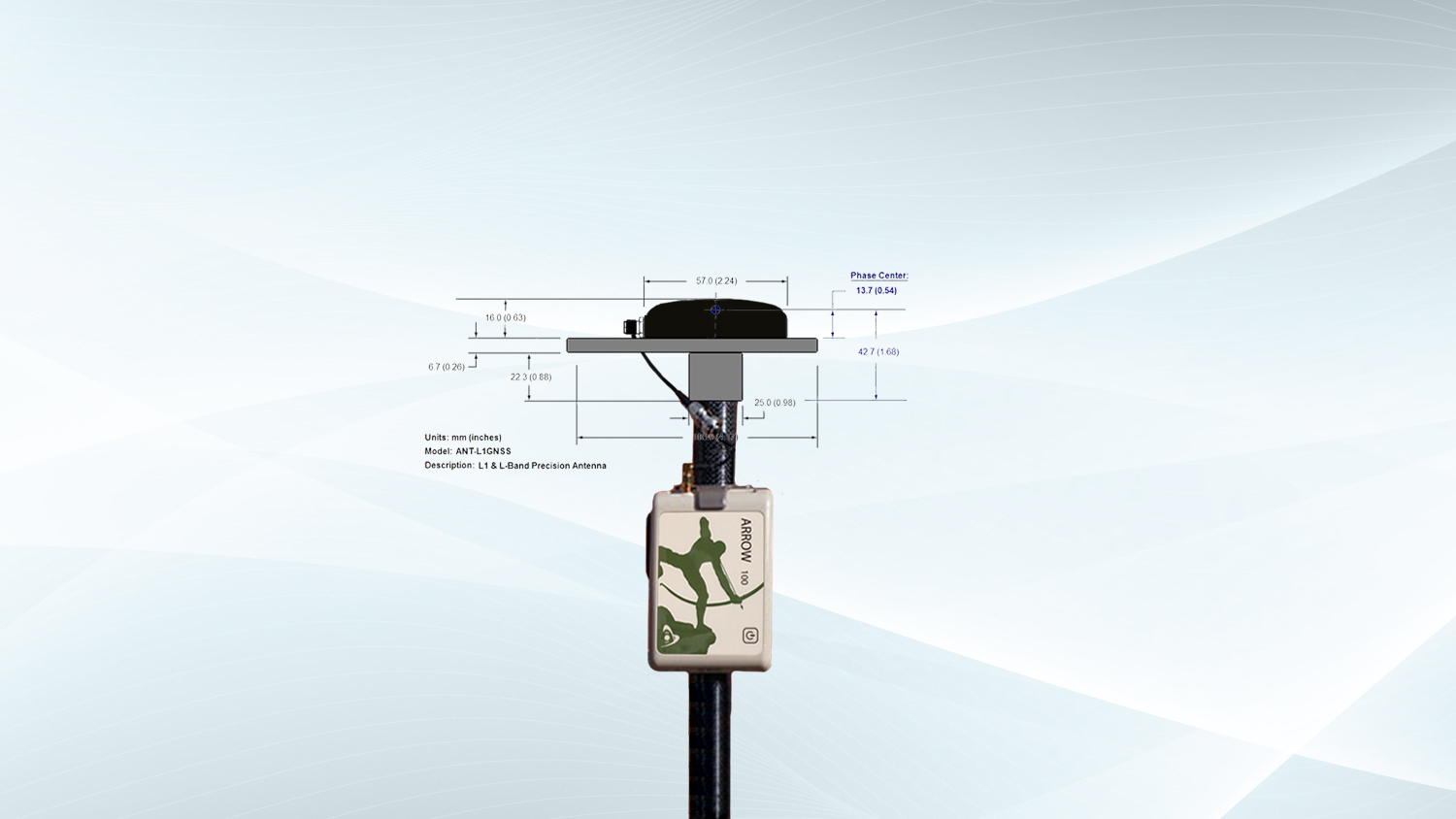
Sometimes, a field data-collection app will allow or ask you to input your total antenna height. While this is required for survey-grade mapping at the centimeter level of accuracy, we also recommend it when possible, for mapping-grade, or submeter-level, applications. By telling your data-collection app what your total antenna height is (in meters), you can ensure that you are computing your location at ground level (i.e., where the tip of your survey range pole touches the ground) for high-accuracy elevations. If you are using an Arrow 100® or Arrow 100+™ GNSS receiver with a range pole setup, we recommend following the steps in this article to calculate and set up your total antenna height. The antenna used for both of these GNSS receiver models (Arrow 100, Arrow 100+) is the same, so you will follow the below steps no matter which model you have.
Let’s get started …
What You Will Need to Consider
When calculating your total antenna height, you will want to consider the following three values:
- Range pole height
- Antenna mounting plate height
- Antenna phase center if doing single frequency RTK
You must know each value to calculate your total antenna height. In the next step, we will assume you are using the accessories provided by Eos Positioning Systems.
What is the Total Antenna Height Value to Use for Arrow 100 and Arrow 100+?
The total antenna height formula is as follows:
Range Pole Height
+ Antenna Mounting Plate Height
+ ANT-L1GNSS Phase Center Height
= Total Antenna Height
Now let’s assume you are using an Eos 2-meter sectional rangepole, a standard Eos L1 antenna mounting plate, and the default ANT-L1GNSS that comes issued standard with each Arrow 100 and Arrow 100+. The values for each of these components is as follows:
- 2 m = Range Pole Height
- 0.029 m = Antenna Mounting Plate Height
- 0.0137m = ANT-L1GNSS Antenna Phase Center Height (if receiving RTK corrections)
Therefore, our total antenna height that we will calculate for the Arrow 100 and Arrow 100+ is the following: 2.0427 m. We calculate this by adding the three values above:
2 m + 0.029 m + 0.0137m = 2.0427 m
This is the value you will want to enter into your data-collection app before beginning data capture.
Where Should You Enter This Value (Total Antenna Height)?
It is important that you add your total antenna height to the correct field application. Importantly, we recommend that you do not add the antenna height in both Eos Tools Pro and your data collection app. The preference goes toward entering your antenna height only in your field app — if it offers this feature. For instance, if you are using Esri’s ArcGIS Field Maps, we recommend you add your antenna height to the Field Maps antenna height field, rather than entering into Eos Tools Pro. Only if your field data collection app does not offer a place to enter antenna height should you enter this value into Eos Tools Pro. Entering the value into both Eos Tools Pro and your data-collection app could cause miscalculations in your elevations.
You are now ready to get started with field data collection.
However, if you’d like to learn more about each of these values, keep reading …
Where Did These Values Come From?
How did we calculate each of these values? Let’s start with the range pole.
Range Pole Height
The range pole is the easiest figure because our 2m Eos range pole is exactly 2 meters. If you are not using an Eos-supplied range pole, be sure to get the accurate range pole height from your chosen manufacturer. If not, you can measure it with a meter-friendly measuring tape.
Antenna Phase Center and Mounting Plate Height Values (ANT-L1GNSS)
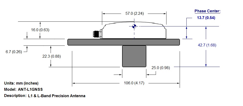
The phase center for all Arrow 100 and Arrow 100+ antennas (ANT-L1GNSS) is 0.0137 m from the bottom of the antenna. The Eos supplied mounting plate height is 0.029 m.
For the very curious, the calculation we used to get this phase center and mounting plate looks like this:
Now that you understand how to calculate your total antenna height, you can simply input this figure into your mobile app(s) and begin your data collection. If you’d like to learn a little bit more about antenna phase center specifically, and why it is important, keep reading.
What is Antenna Phase Center?
Antenna phase center is the electrical (nonphysical) location where the receiver computes its location. The phase center is derived by a tedious calibration process, performed by organizations such as the U.S. National Geodetic Survey (NGS).
The antenna phase center values for Eos GNSS receivers are constant values.
Takeaway Notes
If you are using an Arrow 100 or Arrow 100+ receiver with the Eos-supplied accessories, the value you will enter for total antenna height in any field app is this: 2.0427 m.
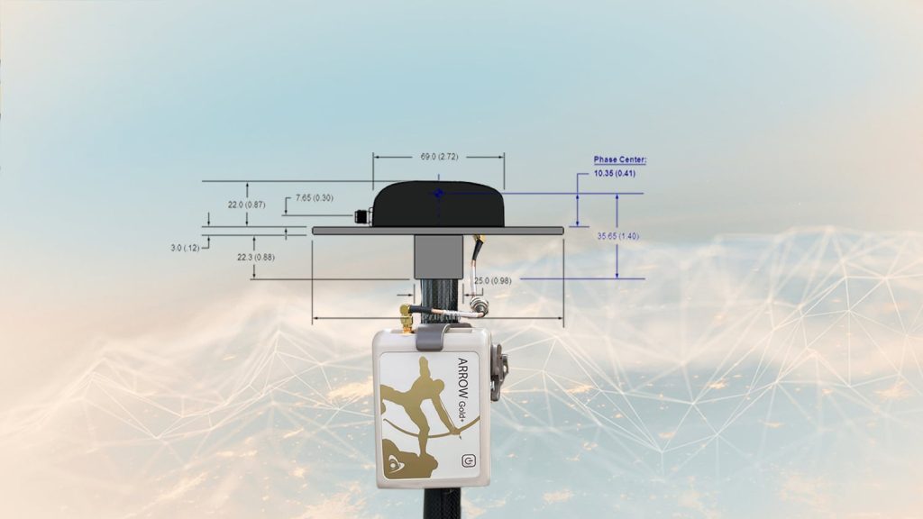
In these examples, we have used the standard-issue ANT-L1GNSS antenna, the standard 2-meter Eos range pole (POL-2MC4), and our standard-issue L1 antenna mounting plate. If you are using a different range pole or mounting plate, contact its manufacturer for the exact height measurements or measure them yourself carefully. If you are using another Eos antenna apart from the standard-issue ANT-L1GNSS (which would be very rare), view this article to determine the antenna phase center for other Eos antenna model measurements: “How Do I Calculate The Total Antenna Height (Including Antenna Phase Center) for RTK Applications?”
Add your three values together — remember to use meters as the unit — and you will have your true total antenna height. This is the value you will want to enter into your data-collection app before beginning data capture.
Lastly, do not add the antenna height in both Eos Tools Pro and in your data collection app. The preference goes to entering this value only in your field app if it offers this feature.


