/// Managing a construction site with UAVs, GNSS and web GIS

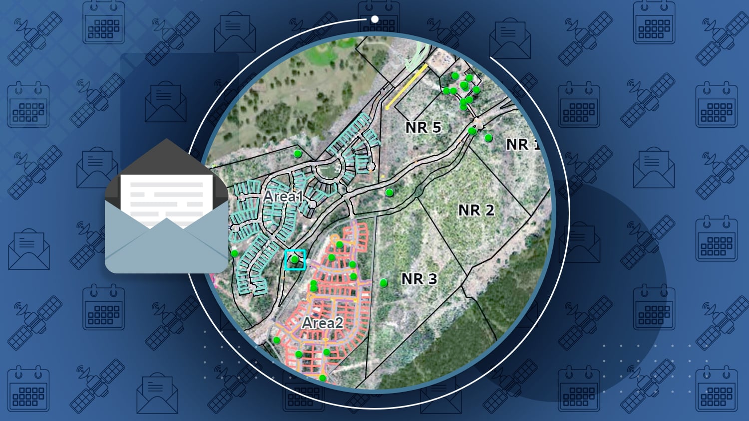
Recently, a large residential and commercial development project in Texas brought together imagery from drones (UAVs), accuracy from Arrow GNSS receivers, and spatial analysis from ArcGIS Online to facilitate the monitoring of new construction at the La Cima subdivision. The solution enabled reliable and near-real-time construction site monitoring, as well as the ability to share information with external stakeholders and even make measurements from the imagery.

Midland County Maps Flood Damage w/ OHM’s GPS Smart Bike
MiCAMP Presentation by OHM Advisors
On May 18th, the Edenville and Sanford dams failed during heavy rain. In this presentation, Midland County and OHM Advisors discuss how they used their GPS Smart Bike with Arrow Gold GNSS, Esri ArcGIS, and ArcGIS QuickCapture to assess damage.

Configuring Mock Location on Android with your Arrow GNSS receiver
Eos how-to article
Mock Location must be enabled on your Android device for location-aware apps to access survey-grade Arrow GNSS positions. Mock Location is available in the “hidden” Developer Mode menu on your Android device. Here is how to enable it.
New drone regulations at night
Do you fly drones at night? Learn about the FAA’s new requirements and how to request an authorization. Read more …

Michael Kolody Serves Clients with Cartographic Transformations
Michael Kolody is no stranger to maps. Captivated by cartography as a child, he turned his passion for people and places into a full-time career at Colliers Engineering & Design!

Underground Utility Mapping Workshop (with live outdoor demonstration)
Date: Thurs, April 29 from 9:30am-12pm PDT
ICYMI: Tomorrow, join Eos and Esri for a free, one-time training workshop in underground utility mapping. Expert panelists from Eos, Esri and various locator brands will stay for extended Q&A.
NEOGEO Virtual Conference
Date: May 6
Eos is pleased to sponsor the 2021 virtual GeoTalks, hosted by Northeast Ohio GIS Symposium. Join us for the lunch session to learn about survey-grade mobile data collection with Arrow GNSS receivers. (You must be registered to attend.)

Survey-Grade 123: Workshop with Arrow GNSS and ArcGIS Survey123
Date: Thurs, May 27 from 9:30am-12pm PDT
Join Eos and Esri for our next workshop: a live training event in using high-accuracy Arrow GNSS receivers with Esri’s form-based data-collection app: ArcGIS Survey123. After educational overviews and live training demonstrations, our expert panel will stay fort extended Q&A.