


Visit Eos Positioning Systems® (Eos) — a 2019 Esri Award-Winning Silver Partner and ArcGIS Online Specialty Partner — at the 2019 Esri GeoConX. This year’s event will be held at Cobb Galleria Center in Atlanta, GA. Eos will be exhibiting as a Gold Sponsor from October 28-29.
Eos is a Canadian company and Esri Silver Business Partner that specializes in simple, affordable, high-accuracy field solutions (GPS / GNSS) for the GIS and mapping community. Eos Arrow Series Bluetooth® GPS (GNSS) receivers fit directly into existing mobile GIS workflows and data-collection apps (e.g., Collector, Survey123, and even your own proprietary application!). Our solutions simply replace lower accuracy native device locations with higher-accuracy (submeter/cm) GNSS locations and metadata. The Arrow Series® GNSS (external Bluetooth® GPS) receivers work with any mobile device and field data-collection app.
Scroll down to learn how to find the Eos team. Ask for a demonstration of submeter and centimeter data-collection with Esri ArcGIS mobile apps!
Find Eos at the 2019 Esri GeoConX Conference!
The Eos team will be exhibiting in the expo hall at the 2019 Esri GeoConX conference. Look for us on the floor plan below setup to find our expert GNSS team:
Find Booth 321 toward the center of the Expo Hall:

Location
Cobb Galleria Center
2 Galleria Pkwy SE
Atlanta GA
Eos Booth
#321
Expo Dates and Times
Oct. 28, 12pm-6pm
Oct. 29, 9:30am-4pm
Social Media
Event Website
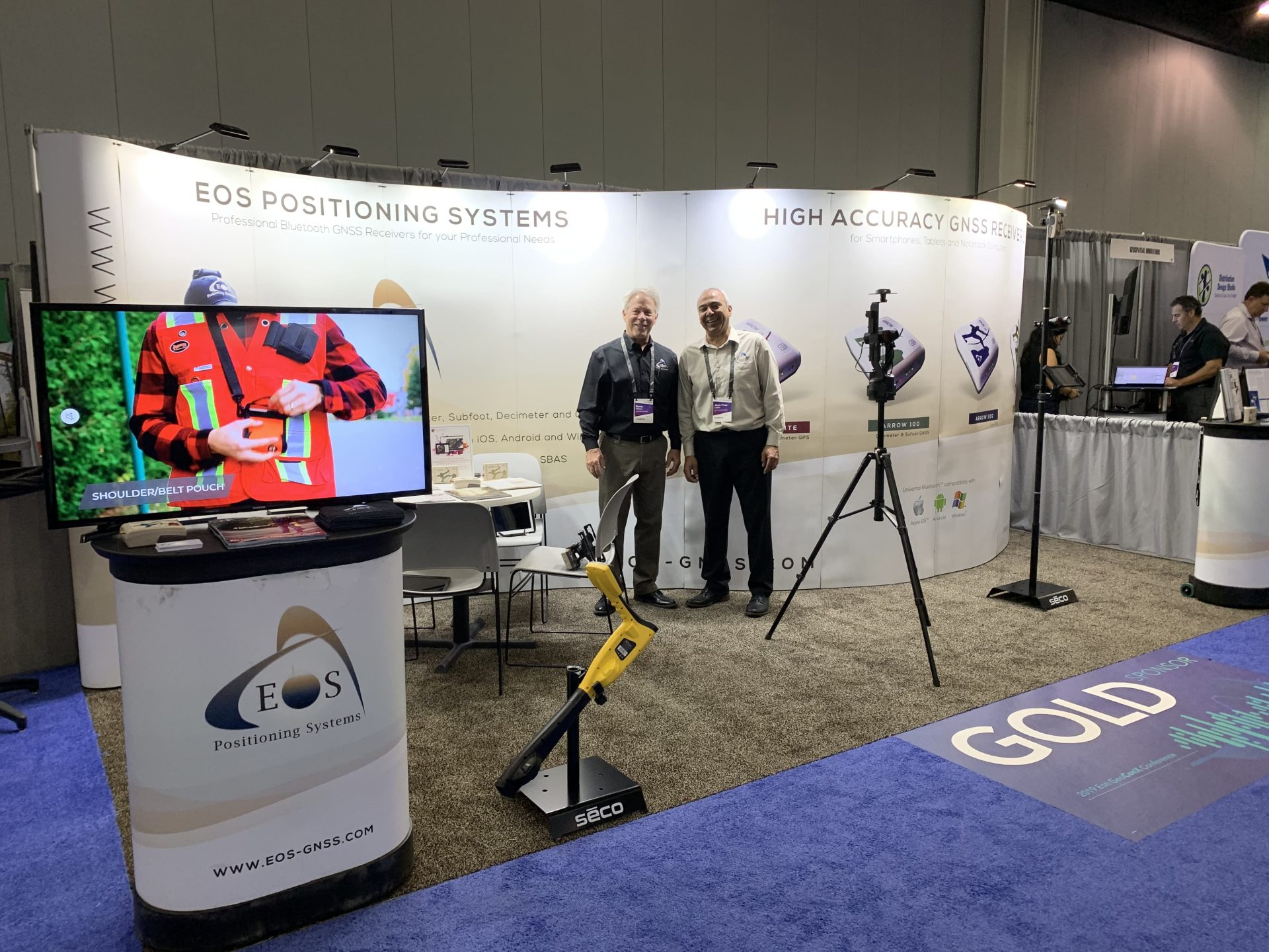
Look for the familiar Eos booth:

Featured AEC and Utility Case Study: DDSI
DDSI Increases Profit Margins with GNSS Laser Mapping Solution using Arrow Gold, Esri ArcGIS Collector, and LTI laser rangefinder
As a competitive consultancy, DDSI’s profit margins depend upon turning around timely and accurate surveys of telecommunications sites. With a goal of speeding up field work to increase profit margins, DDSI looked for a new GNSS data-collection system. Their biggest challenge with legacy handheld GPS devices was signal failure under canopy, and the time-consuming alternatives of using either a total station or manual measurements.
Featured Co-op Case Study: TCEC

TCEC Improves Customer Service with Real-Time ArcGIS Access using Arrow Gold and Futura GIS
The migration to an enterprise Futura GIS with high-accuracy location from Eos Arrow Gold GNSS receivers yielded tens of thousands of dollars saved each month from improvements to field staking, outage management and underground locate workflows.