Eos Esri UC 2022 team stands at the Eos booth

Esri UC 2022 Recap

The Eos Positioning Systems team gathers at their 2022 Esri UC Booth
The Eos Positioning Systems team at the 2022 Esri User Conference.

After two years of virtual events, the 2022 Esri User Conference (Esri UC) finally returned in person to San Diego, California. Eos Positioning Systems was thrilled to talk individually to approximately 500 of our partners, customers, and associates in the geospatial sector. It was so great to see everyone in person — that we wanted to put together and share a photo gallery of the highlights of the event for our team. In the below photos, browse our booth, sessions, and sponsored socials, and get to know a little bit more about our team through our most favorite captured moments from the July 2022 Esri UC.

2022 Esri UC Plenary: Our Team Reunites, and Jack Features Multiple Eos Customers

Did you know? The word “plenary” comes from the Latin root plenus, which means “full” or “complete.” For the Eos team, the 2022 Esri UC plenary epitomized the true meaning of the word, as this was the first time many of us had reunited in over two years.

Eos Positioning Systems Team Poses at the Esri UC Plenary
A few members of the Eos team gather at the 2022 Esri UC plenary on July 11, 2022.
Sea Turtle Patrol HHI featured at the Esri UC Plenary
During the morning plenary session, Esri President Jack Dangermond featured the work of multiple Eos customers. Sea Turtle Patrol HHI (circled in white) was included for their work protecting endangered sea turtles using Arrow 100 and Esri’s ArcGIS Field Maps. Click the photo to read their case study.
ADF Haiti featured at the Esri UC Plenary
ADF Haiti was featured for their nonprofit work. In the western hemisphere’s poorest nation, this nonprofit uses Arrow Gold®, ArcGIS apps, drones, and more to help farmers gain fair compensation for their yields, while also improving yield quantities. Click the photo to read their case study.

2022 Esri UC Sessions: Eos Customers Mark their Maps with Accuracy

A record-breaking number of Eos customers presented their work at the 2022 Esri UC. (Browse our pre-event list of sessions not to miss.) Representing both infrastructure and natural-resource sectors, these customers made our day by sharing how they use high-accuracy mobile mapping to save money, meet regulatory requirements, gain internal efficiencies, and much more.

Damon Nelton presents at the 2022 Esri UC
On Tuesday, Ellingson Companies Data Manager Damon Nelton showed how gas utilities are finding more efficiencies by capturing new pipe constructions with high accuracy.
Mathew Desbiens presents at the 2022 Esri UC
Later that day, Apex Utilities GIS Manager Mathew Desbiens demonstrated to peers how he helped lead his Canadian gas utility toward real-time, high-accuracy, digital as-builting. The workflow he developed in ArcGIS Pro, with ArcGIS Field Maps and Arrow Gold® GNSS base/rover configurations in the field not only ensures Apex Utilities meets ASTM f2897 tracking and traceability industry standards, but also resulted in significant annual cost savings.
Chris Kahn presents at the 2022 Esri UC
On Wednesday, American Water Director of Geospatial Services Christopher Kahn covered high-accuracy data-collection from soup-to-nuts. As one of the earliest adopters of high-accuracy data collection in ArcGIS Collector (now ArcGIS Field Maps), Chris and his team explained how American Water is saving multiple millions of dollars per year thanks in large part to having mapped millions of water-utility assets with centimeter-level RTK accuracy.
Eric Gakstatter presents at the 2022 Esri UC
Discovery Management Group Principal Consultant Eric Gakstatter also hit an ace on Wednesday, with his golf-course mapping presentation. Eric described how high-accuracy Arrow Gold® GNSS receivers, drones, and ArcGIS applications can be used to deliver 3D visualizations of golf courses.
Benson Crowell presents at the 2022 Esri UC
On Thursday, Texas Department of Health and Human Services CAD Manager Benson Crowell described his journey toward harmonizing the department’s GIS and CAD facility-management systems. In “Site Plans: ArcGIS Meets AutoCAD,” Benson described how he integrated facility management systems to consolidate disparate data into a central system and optimized workplace.

While not a customer, Eos and Esri came together to deliver a standing-room-only sponsored-lunch session on the state of high-accuracy mobile mapping for Esri users. Since the start of the pandemic, each company separately and in partnership released exciting expansions to their mobile offerings for Esri users.

Esri Product Engineering Lead Jeff Shaner speaks at the Eos Esri UC sponsored lunch
Esri Product Engineering Lead (Mobile Apps) Jeff Shaner presents an update on ArcGIS Field Maps, an app that was released during COVID. Jeff‘s presentation included exciting new developments in newly released features, such as Utility Network functionality in the mobile app, as well as what‘s to come on the app‘s roadmap.
Eos CTO Jean-Yves Lauture welcomes the crowd at the Eos Esri UC sponsored lunch
Eos CTO Jean-Yves Lauture welcomes the crowd and provides an update on the GNSS offerings Eos released during the pandemic. Topics included new hardware — such as the Arrow 100+™ GNSS receiver, Arrow Gold+™ GNSS receiver, and Eos Bridge™ — as well as the expansion of Eos Laser Mapping™ and Eos Locate™ solutions for ArcGIS.

SIGS, Socials, and a Special Release!

Eos was privileged, as an event Gold Sponsor, to sponsor several industry-based special interest groups (SIGs) and socials. We also had a special sneak peek video premiere for partners and customers who visited our booth and/or our sponsored lunch session.

Eric Gakstatter speaks at the Esri AEC team's Construction Management SIG
Early morning Tuesday, Eos sponsored the Esri AEC team’s Construction Management SIG. The early birds who joined Eos and the Esri AEC team at 7 a.m. engaged in passionate discussion about the opportunities in this sector (they also engaged in some breakfast goodies provided by the sponsorship).
Rob Laudati emcees the 2022 Esri UC Mobile SIG
On Wednesday, Esri Director of Global Partners & Alliances Rob Laudati emceed the 2022 Esri UC Mobile SIG, an open discourse on the state of mobile mapping in the Esri ecosystem. Panelists included multiple Esri mobile app experts, Esri mobile partners (including both hardware and software partners) and even our own CTO Jean-Yves Lauture, and two customers of many of the technologies.
Esri Water SIG at the Esri UC 2022
On Thursday the Esri Water team hosted a SIG focused on Lead and Copper Rule Revision compliance, which Eos was pleased to sponsor. Photo credit: Esri Water
An Eos sponsor signs sits at the Esri Electric & Gas Utilities Social at the 2022 Esri UC
On Tuesday, Eos sponsored the Esri Electric, Gas, and Telecommunications Utilities Social. The beautiful and familiar East Terrace of the San Diego Convention Center (SDCC) was filled with reunions as well as some first-encounters among groups who had known each other only through virtual meetings.
An Eos sponsor signs sits at the Esri Water social at the 2022 Esri UC
On Wednesday, Eos joined the Esri Water team on the just-as-beautiful SDCC West Terrace.
An Eos sponsor signs sits at the Esri State and Local Government social at the 2022 Esri UC
Also on Wednesday, the State & Local Government Social was back and as big as ever. Dancing on the lawn, DJs, and conversations surpassed in quality only by that terrific San Diego sunset were back in full, and sometimes literal, swing.

Last but far from least, Eos released a special sneak-peek preview of our brand-new, lighthouse, conservation video case study. Folks who joined Eos at our booth theatre and/or our sponsored lunch session got a first look at how Hawai’i startup Terraformation is using the latest mobile technologies from both Eos and Esri — ArcGIS Field Maps and the Arrow 100+™ GNSS receiver, to map tens of thousands of trees. Their end goal? To sequester enough carbon from the atmosphere — in a sustainable and scalable manner — to reverse the effects climate change. Play the video or read the case study to learn how high-accuracy digital maps enable Terraformation to prove to financial supporters and worldwide partners that sustainable reforestation is possible on a 10X scale.

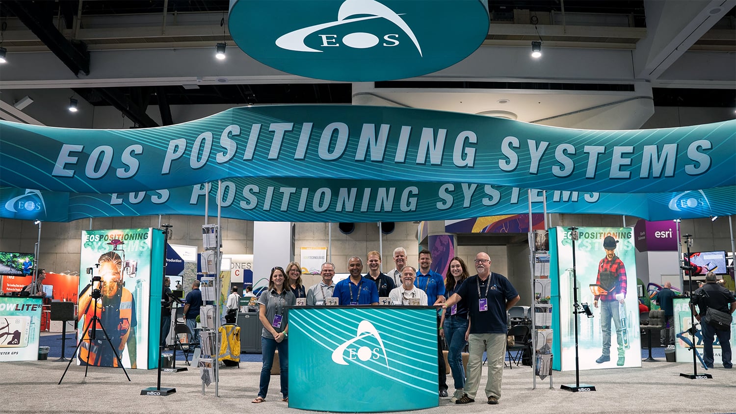
Expo Hours: Eos’s Favorite Part

The highlight of every Esri UC for Eos is the conversations we have in our booth. This year, they meant more to us as many, if not all, representatives in our booth were meeting for the first time some customers they had not seen in years, as well as professionals with whom they had been communicating only virtually. Reminisce with us in the photos below.

Steve Lawrence Talks to a Customer at the Eos Esri UC Booth
Steve Lawrence shows a GIS professional the Arrow Gold® GNSS receiver. All Eos Arrow Series® GNSS receivers and related solutions are ArcGIS System Ready.
Jake Holbert Speaks to a Customer at the Esri UC Booth
Jake Holbert describes the mechanisms of the free Eos Locate™ solution for underground utility mapping.
Stephen Nicholson speaks to a customer at the Eos Esri UC booth
Stephen Nicholson welcomes an attendee to the Eos booth.
David Pritchard speaks to a customer at the Eos Esri UC booth
David Pritchard discusses GNSS with an Esri UC attendee.
Marian Stalker speaks to a customer at the Eos Esri UC booth
Marian Stalker shows how the Arrow GNSS receivers send, via Bluetooth®, submeter and centimeter-level location accuracy to a mobile device running Esri ArcGIS apps.
Tyler Gakstatter speaks to a customer at the Eos Esri UC booth
Tyler Gakstatter answers questions about GNSS to a crowd of Esri UC attendees.
Esri employees watch the new Eos video case study with Terraformation
Esri’s Mathew Davis and Lo-Ruhama Westbrook get a first look at the July 2022 Terraformation video case study showcasing ArcGIS Field Maps and the Arrow 100+™ GNSS receiver. Booth visitors were able to watch the newest Eos video case study in the center of the Eos booth.
Marie-Joëlle Boivin speaks to a customer at the Eos Esri UC booth
Marie-Joëlle Boivin answers questions about the free Eos Laser Mapping™ solution for iOS and Android.
Jean-Yves Lauture at the Eos Esri UC Booth
Jean-Yves Lauture talks about ArcGIS Field Maps with an Esri UC attendee.
Eos Family Night Esri UC 2022
On Thursday night’s family night, the Eos booth was joined by a junior geospatial expert, the grandson of GNSS and drone expert Eric Gakstatter. The kiddo added a burst of energy to the demo theater when he noticed he was seeing double with a video playing on the monitor.

The week in San Diego flew by almost as fast as the past two years. Eos extends a warm thanks to everyone who stopped by the booth and said hello either again, for the first time, and in some cases for the first time in person. Subscribe to our monthly newsletter (sent the last week of each month) to find out which events Eos will be at next month!