Esri ArcGIS Collector: Capture High-Accuracy Data
Synopsis
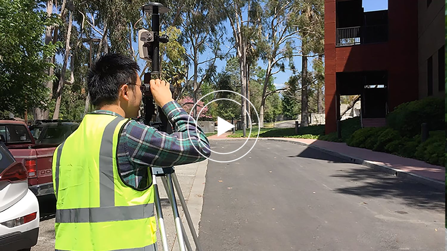
In this video from Esri, you’ll learn why it’s sometimes necessary to use high-accuracy GPS receivers, such as the Arrow Series® shown in the video, with mobile GIS. See how data-collection benefits from submeter and centimeter accuracy in “Esri ArcGIS Collector: Capture High-Accuracy Data in Esri Collector”.
Transcript for “Esri ArcGIS Collector: Capture High-Accuracy Data”
[Music]
ArcGIS Collector® is an app that’s available on smartphones and tablets that utilizes your GPS location to perform field data collection. Although applicable for certain workloads, the accuracy of these smartphones and tablets can vary, and often can’t meet certain project requirements for high accuracy. In these types of scenarios, you’ll require another GPS device that is capable of meeting these requirements.
My name is Kevin and I’m a product engineer on the Collector team. However, one of my specialties is working with high-accuracy GPS receivers. When we talk high-accuracy, we mean a project that is constrained by certain accuracy requirements. Some common projects that benefit from high accuracy include
- infrastructure data collection (such as capturing the locations of water valves with centimeter-level accuracy)
Often times, several water valves are clustered together that require much more precise positioning to ensure that the correct valve is being inspected. If you’re confirming the locations of building corners to match a particular design, you might only require sub-meter level accuracy.
In practice, accuracy is also influenced by the environment you’re in. You might be capturing data in
- an urban environment surrounded by tall buildings,
- in a forested environment under a heavy canopy,
- or in a rural environment without any cell or Wi-Fi connections.
Achieving higher levels of accuracy in these types of environments requires the use of real-time correction services to help mitigate any potential errors that can be introduced into the GPS measurements. To take advantage of the high-accuracy functionality in Collector, they are four things you’ll need to do:
- Obtain a GPS receiver that can meet your project accuracy requirements.
- Connect this GPS receiver to the smartphone or tablet running collector.
- Configure collector to use that GPS receiver directly.
- Finally, go out into the field and start collecting data.
The data that is collected in the field will even contain GPS specific metadata information, such as latitude and longitude, horizontal and vertical accuracy, fixed type, the number of satellites — and much more. By having captured this metadata with its corresponding data, it can aid with further analysis and decision-making that might take place back in the office.
With this high-accuracy functionality through Collector, you can be confident that you have collected quality data, and that your data collection standards have been met.
Explore Related Knowledge Base Items
 1")
Field Demonstration: 3 Eos Laser Mapping Methods
In these videos, we demonstrate data capture using 3 Eos Laser Mapping methods: Range-Azimuth, Range-Backsight, and Range-Range.
 2")
How to Evaluate Field GIS and GNSS Technology
Michael Cousins explains OHM Advisor’s best practices for evaluating field GIS technology, including software, hardware and staff training.