Eos Positioning Systems

Tel.: +1 (450) 824-3325 (CAN)
  • Technical Support
  • EnglishEnglish
    • Français Français
    • Español Español
  • Home
    • About
    • Contact
    • Technical Support
    • Subscribe
    • Testimonials
    • Users
  • Products
    • Arrow Series™
      • Arrow Gold
      • Arrow 200
      • Arrow 100
      • Arrow Lite
      • Comparison Chart
    • Accessories
      • Antennas
      • Mounting Equipment
      • Extra Battery & Power
      • Field Gear
      • Atlas® Service
    • Tools and Apps
      • Eos Tools Pro
      • Eos GNSS Tools
      • Eos Utility
      • Eos Server
      • Arrow USB Drivers
    • Solutions
      • Geoid Height
      • Eos Locate™ for ArcGIS
      • Laser Mapping
  • News
    • Latest News
    • Success Stories
    • Events
    • Newsletter
    • Press Releases
    • Blog
  • Learning Center
    • Arrow
      • How-To Articles and PDFs
      • Video Tutorials
      • Arrow Datasheets (PDFs)
      • Manuals (PDFs)
    • GNSS
      • GNSS Articles
      • iOS and Bluetooth®
  • Partners
    • Field Apps
      • Esri
      • AmigoCloud
      • CartoPac®
      • Corvallis Microtechnology (CMT)
      • DigiTerra
      • Futura
      • GeoMobile Innovations
      • GI Geoinformatik GmbH
      • mapitGIS
      • SPOT
      • SST Software
      • TAXUS IT
      • TerraGo
    • Hardware
      • iOS
      • Android
      • Windows
      • Laser Technology
      • Tablet EX Gear
CONTACT
  • Home
  • News
  • How to Collect Underground Assets with Eos Locate

How to Collect Underground Assets with Eos Locate

by Eos Positioning Systems / Friday, 10 July 2020 / Published in News
Feature Image 5 - How to Collect Underground Assets with Eos Locate

Synopsis

Eos Locate™ is a solution based within Eos Tools Pro that allows a field worker to collect georeferenced data of underground assets by using Esri’s ArcGIS Collector. The data collected includes all parameters from a locator device (such as depth below cover and frequency) along with high-accuracy GNSS locations and metadata from your Arrow receiver.

This video series will walk you through the steps required to perform your locate workflow. In this tutorial, you will learn how to locate an underground asset and perform your very first locate measurement.

Welcome to Eos Locate™ for ArcGIS Collector. This video series will walk you through the steps required to perform your locate workflow. In this tutorial, you will learn how to locate an underground asset and perform your very first locate measurement.

First, make sure your Arrow receiver is computing a valid position by looking at the GNSS Information section of the Eos Locate™ page. Confirm that the location is continuously updating and that the quality values are acceptable.

(Please note that your iPhone screen might differ slightly from this iPad screen.)

Now, you will locate an underground asset using the vLoc3-Pro. Then you’ll send the measurement to Eos Locate™ by pressing on the locator’s [i] button and then the [+] button.

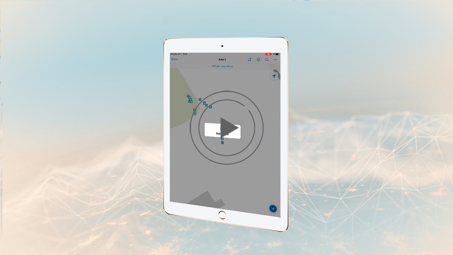
The Locator data will be displayed on the Eos Locate™ page. The GNSS location will also be logged. The entire measurement will be transferred to Collector, and then Collector will submit to the cloud. After this, Collector will call back Eos Locate to record the next point of your locate session. You will notice that the value in the field Distance from Last Log will start increasing as you move away from your last locate point. You can use this field to record assets at fixed distances from previous locations.

If the value entered in the settings is reached or exceeded, meaning the fieldworker has walked past the distance you set, the value displayed will turn to red.

Please click the Eos Locate Settings video in the description of the video for more information.

You can view the metadata for each point on ArcGIS Online or by selecting a collected point in Collector.

As an important note: All values (such as elevation, measurements, and metadata) will be submitted to Collector in metric format to stay consistent with the standards of ArcGIS Online. You can create fields in your layer to convert to imperial units (refer to your ArcGIS manual on how to create such fields).

Congratulations! You now know how to locate underground assets with the Eos Locate solution. You will find a complete manual on how to setup Eos Locate with your kit. For options on Field Gear, please refer to the manual, or the Eos website field gear section.

If you have any additional questions, please contact technical support on the Eos website.

Now, it’s time to go out in the field and locate all of your underground assets. Be sure to tag us in your Eos Locate pictures, on Instagram, Twitter, Facebook, or LinkedIn. Happy Locating!

If you have any additional questions, please contact Eos technical support.

Watch video 1: How to set up ArcGIS Pro with the Eos Locate™ Toolbox
Watch video 2: How to Configure Initial Settings in Collector and Eos Tools Pro
Watch video 3: How to pair your vLoc Locator to iOS via Bluetooth®
Watch video 4: How to configure settings for Eos Locate™ and ArcGIS Collector

Browse more Eos videos:

Feature Image - Best Practices for Evaluating Field GIS Technology for the Modern Professional
20/11/2020
Best Practices for Evaluating Field GIS Technology for the Modern Professional (2020 MiCAMP Presentation)
READ MORE
Feature Image 4 - How to configure settings for Eos Locate and ArcGIS Collector
09/07/2020
How to configure settings for Eos Locate™ and ArcGIS Collector
READ MORE
Feature Image 3 - How to pair your vLoc Locator to iOS via Bluetooth
08/07/2020
How to pair your vLoc Locator to iOS via Bluetooth®
READ MORE
Feature Image 2 - How to Configure Initial Settings in Collector and Eos Tools Pro_
07/07/2020
How to Configure Initial Settings in Collector and Eos Tools Pro
READ MORE
Feature Image 1 - How to set up ArcGIS Pro with the Eos Locate™ Toolbox
03/07/2020
How to set up ArcGIS Pro with the Eos Locate™ Toolbox
READ MORE
Eos Laser Mapping: How to configure initial settings in Collector for ArcGIS and Eos Tools Pro
10/05/2020
Eos Laser Mapping: How to configure initial settings in Collector for ArcGIS and Eos Tools Pro
READ MORE
Tagged under: Locate, Utilities

About Eos Positioning Systems

Our technical team pioneered the BYOD (Bring Your Own Device) high-precision Bluetooth GPS / GNSS market more than a decade ago when they designed the SXBlue product line. In early 2014, this same team founded Eos Positioning Systems® to design the next generation high-performance Bluetooth receivers, the Arrow Series, which includes the world’s first Apple approved iOS RTK GNSS receiver capable of real-time centimeter accuracy, the Arrow 200.

NEED TECHNICAL SUPPORT?

Contact support now >

Search

Categories

  • Arrow Series™
  • Blog
  • Bluetooth
  • Firmware
  • GIS Articles
  • GNSS Articles
  • How-To Articles
  • News
    • Event Archive
    • Latest News
    • Success Stories
  • Newsletters
  • Press Release
  • Sessions
  • Technical Bulletin
  • Video Tutorials
  • Webinar

Archives

Twitter

Tweets by EosGNSS
Follow @EOSGnss

CONTACT

Eos Positioning Systems®, Inc. (Eos)

1160 Rue Lévis, Suite 100
Terrebonne QC, J6W 5S6
Canada

call-answer : +1 (450) 824-3325

M-F : 8:30 a.m. to 5:00 p.m. (ET)

Follow Eos:

SITE MENU

  • Home
    • About
    • Contact
    • Technical Support
    • Subscribe
    • Testimonials
    • Users
  • Products
    • Arrow Series™
    • Accessories
    • Tools and Apps
    • Solutions
  • News
    • Latest News
    • Success Stories
    • Events
    • Newsletter
    • Press Releases
    • Blog
  • Learning Center
    • Arrow
    • GNSS
  • Partners
    • Field Apps
    • Hardware

QUICK LINKS

  • Get Fast Technical Support
  • Contact Eos for Sales Inquiries
  • Subscribe to the Eos Newsletter
  • Compare Arrow GNSS Receivers
  • Find Partner Apps & Hardware

logo-standard-eos-blanc

Eos Positioning Systems © 2014 - 2020
Website designed and created by Backside Pixels

TOP