This MDM guide will walk you through how to configure common Eos Tools Pro settings for multiple field workers across an organization. Includes sample code.
This MDM guide will walk you through how to configure common Eos Tools Pro settings for multiple field workers across an organization. Includes sample code.
Experts answer questions about datum transformations, RTK, ArcGIS Field Maps and more in Part 1 of Q&A from our October 2022 workshop.
Our panelists answer questions about datum transformations, RTK, ArcGIS Field Maps and more in this Q&A from our recent workshop.
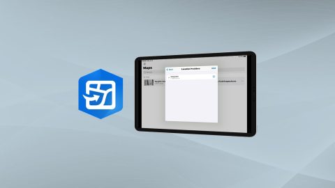
Learn how to configure location provider and location profile in ArcGIS Field Maps for Arrow GNSS receivers.

Everything from elevation, datum shifts and base stations to ArcGIS setup and ArcGIS Field Maps is coverd in this mobile GIS workshop Q&A.
Why Doesn’t My GPS Data Line up with My GIS? Eos explains common challenges to GNSS workflows on any device, and what to do to fix them.
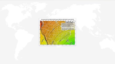
Knowing how to compute datum offsets is important for shifting between datums. The Eos Tools Pro app now supports computing datum shifts. Here’s how to use it.
This video walks you through how to use your Arrow GNSS receiver with iOS and the iCMTGIS PRO app. You’ll need your Arrow receiver, iOS device & iCMTGIS PRO.
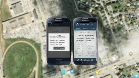
In this article, we show you how to configure ArcGIS Collector with Arrow GNSS receivers on any Android smartphone or tablet.