Feature Story
/// ADF Haiti Strengthens Local Farming Initiative with High-Accuracy Mapping (ArcGIS, UAV, Arrow GNSS)
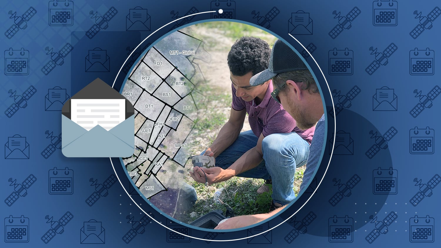
About 3.5 hours west of Port-au-Prince, Haiti, nonprofit ADF Haiti strives to empower regional communities with geospatial technologies. In one recent and ongoing project, the team deployed high-accuracy digital mapping technology to allow a local Haitian agricultural co-operative to remove physical land boundaries, thereby increasing crop yields — without sacrificing trust or verifiability.
Learn how ADF Haiti increased co-op yields while retaining transparency of land ownership>
Industry News

2021 Esri UC: Ask Me Anything! We Use Eos Arrow GPS with ArcGIS Apps
In this recorded session from the 2021 Esri UC, four customers share their expertise using Arrow GNSS receivers with Esri’s ArcGIS apps (e.g., Field Maps, Survey123). Hear about their real-life experiences, challenges, and best practices — across industries!

Mapping Boundaries: Investing in Data Quality Capture for The National Trust
The National Trust needed to upgrade their GPS technology so they could better map fence lines and check boundaries to show where land ownership ends. Learn how they gained submeter accuracy w/ the Eos Arrow 100 GNSS receiver!

[Webinar] Using High-Accuracy Arrow GNSS in Esri’s ArcGIS Field Maps
See how the City of Wilmington achieved real-time as-builts of their water system, in this latest webinar from Directions Magazine, Esri and Eos. View the on-demand recording and hear from the experts in GPS/GNSS, ArcGIS Field Maps, and more.

Request the Virtual Arrow GNSS / Esri ArcGIS Survey123 Training Workshop
Did you miss the May 2021 Eos high-accuracy mobile GIS training workshop with special guest Esri? No problem! Just fill out the form to request a free copy of the workshop. Note you must use a work email address.
NGS data is now accessible via ArcGIS Online
By: Galen Scott, NOAA
The new NGS Map has been released for beta testing, so please check it out and let NGS know what you think! Beta NGS Map:
Al’s Corner: Technical Tips

How Do I Calculate The Total Antenna Height for RTK Applications?
Ensure high-accuracy elevations during data capture. Learn how to calculate your total antenna height for RTK accuracy — including phase center, mounting plate height, and range pole height.

Eos Welcomes vGIS AR in November
Welcome to the Eos website, vGIS! Explore our newest partner page to learn about this leading high-accuracy augmented reality and extended reality visualization platform.
Current GNSS constellation status for November 29, 2021:

Customer Spotlight

Customer Spotlight: Dmitri Bagh Brings Geospatial Data to Life with AR
Dmitri Bagh is committed to putting the “real” in augmented reality (AR). As a passionate Scenario Creation Analyst at Safe Software, Dmitri is helping to pave the way for visually powerful, high-accuracy data collection with AR.
Upcoming Events

Hyderabad, India | December 7-9
Visit Eos in person during the GeoSmart India 2021 expo in Hyderabad, India. Our staff will be available to answer questions about high-accuracy data collection with Arrow GNSS receivers.