Visit Eos Positioning Systems® (Eos) and Esri at the 2023 WaterPro conference. This year’s event will be held at the Gaylord Rockies Resort & Convention Center in Aurora, Colorado. Eos and Esri will be in booth #309 from September 25–26, and the following day we will present a free two-hour mobile mapping session that will train you in getting started with GPS and GIS technologies. You must be registered for the event in order to attend the training session.
Expo Dates & Times
Sep 25, 2023 / 9:30am – 6:00pm
Sep 26, 2023 / 7:00am – 12:00pm 2023-09-25 09:30:00 2023-09-26 12:00:00 America/Denver 2023 WaterPro Find Eos at 2023 WaterPro Aurora, CO Eos Positioning Systems
Location
Gaylord Rockies Resort & Convention Center
6700 N Gaylord Rockies Blvd.
Aurora, CO 80019
United States
Social Media
Find us on the floorplan:

Our Conference Sessions
The Eos team will be participating in the following sessions during the conference. Please join us for some informative discussion.
Session 1: Web GIS: Enabling Digital Maps & GPS Field Data Collection
Sep 27, 2023 / 1:30 pm - 3:45 pm |
Valley 2
Join this two-hour educational presentation to learn about web GIS, mobile mapping applications, the foundations of GPS for water utilities, and more. This workshop will include an outdoor hands-on exercise using real, professional-grade mapping hardware and software.
- Matt Groves, Esri
- Mike George, Eos Positioning Systems
- Brittany Metz, Esri
Who are Eos and Esri, and what do we offer National Rural Water Association members?
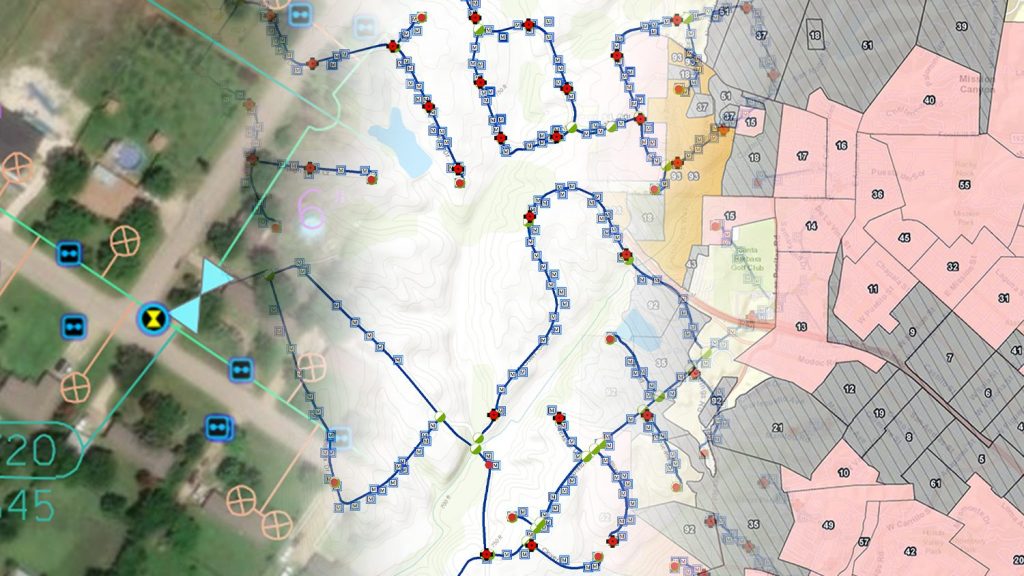
Eos and Esri partner with NRWA to bring rural water professionals easy-to-use mobile mapping applications. With our combined hardware and software, NRWA member organizations are able to collect, use, and share geospatially aware information with everyone who needs it. Maps have always been essential to understanding and improving the delivery of safe, clean drinking water and reliable sewer and stormwater services. Today, digital maps enable field crews to quickly view and collect data with mobile devices, and user-friendly GPS receivers ensure this data is accurate. Eliminating paper forms, unreliable maps, and manual data entry improves workflows across your organization. Learn how you can use GIS and GPS to resolve common business challenges by visiting Esri and Eos at our joint booth in WaterPro.
Browse Eos and Esri Customer Success Stories:

Webinar: Beginners Guide to Mapping with High-Accuracy GPS, with NRWA and Esri
Industry experts and a real-life use case teach best practices for mapping water assets with high-accuracy GPS / GNSS.
Warren County Water District Looks to “Elevate” Its Hydraulic Modeling with Survey-Grade Maps
Warren Water mapped wastewater assets with centimeter-level accuracy to help engineers with hydraulic modeling.
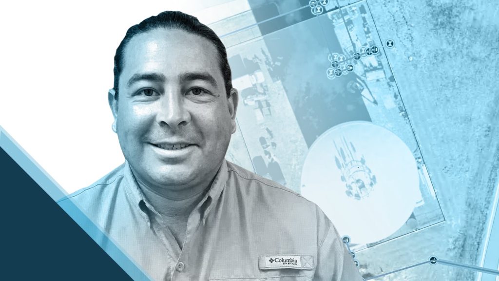
Customer Spotlight: Dave Babicki, One-Man GIS Team
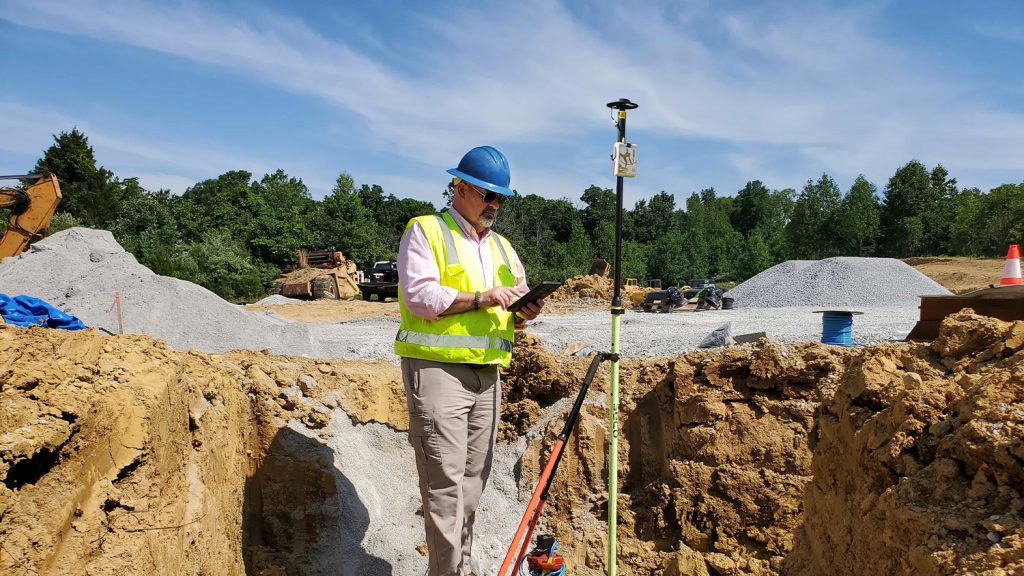
Dave Babicki uses the Arrow Gold® GNSS receiver with Esri ArcGIS Field Maps to ensure quicker repairs, inform decision-making, and promote collaboration across his water district.
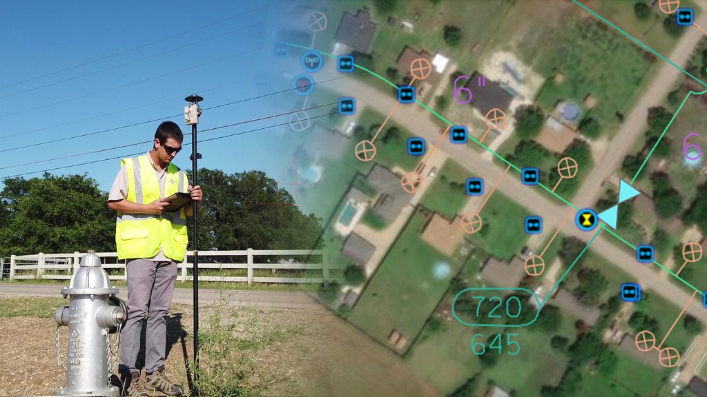
Mapping a Rural Texas Water System with High Accuracy
Rockett SUD streamlined field work and freed up office staff with a new rural water GNSS mapping solution that combines hardware and software from Eos and Esri.
5 Water Utilities Using Bluetooth GNSS Receivers
Five water utilities are using high-accuracy Bluetooth® GNSS receivers to transform their mobile data collection. Here’s how.
Rural Utilities Get Higher Accuracy Asset Data in Appalachia
In 2018 Ohio began requiring public water utilities to maintain a detailed AMS. RCAP is simplifying compliance with ArcGIS and Arrow Gold for Asset Management.

Alaska Utility Pinpoints Water and Wastewater Assets
Anchorage kicked off a 5-year GIS master plan with a GPS project using Arrow 100 for asset acquisition with Esri’s ArcGIS Collector and ArcGIS Enterprise.
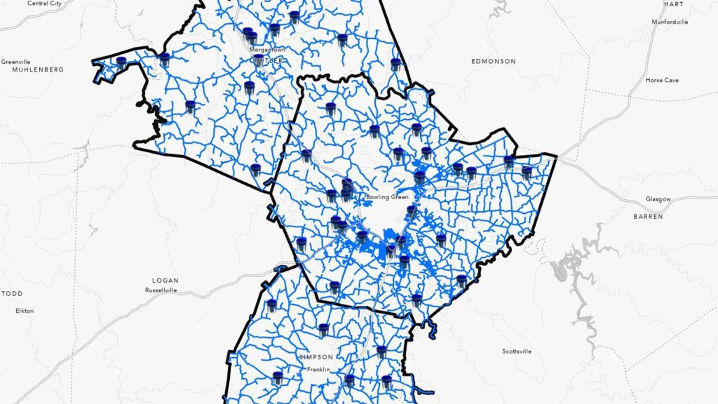
Kentucky Water District Cuts Meter Installation Costs in Half
Using Arrow Gold for rural water data collection helped a Kentucky utility reduce meter-installation cost by 50% on the Esri ArcGIS platform.