After the groundbreaking announcement of the new Galileo High Accuracy Service (HAS), the European Union Agency for the Space Programme (EUSPA) welcomed leading experts to exchange knowledge about the current performance and future of this exciting new differential-correction service. They did so at the inaugural Galileo HAS Days event in Madrid, Spain, during the summer of 2023.
Eos Positioning Systems’ (Eos) Chief Technical Officer (CTO) Jean-Yves Lauture traveled to Madrid to discuss the initial results of using Galileo HAS with the Arrow Gold+™ GNSS receiver. Participants were delighted to welcome the only Canadian participant to the stage — nearly as delighted as he was to be there! Jean-Yves’ recorded presentation is reposted here with permission from the EUSPA team.
Introduction
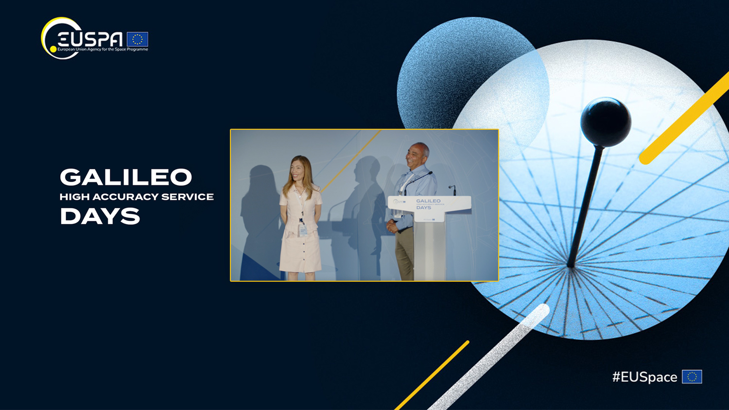
CARMEN AGUILERA, OPERATIONAL MARKET DEVELOPMENT OFFICER, EUSPA: So now we’ll change topics, and from this place we will go back to Earth [segment]. The next presentation will be from Jean-Yves Lauture, CTO of Eos Positioning Systems. He’s going to introduce the Arrow Gold+ GNSS receiver from Eos Positioning Systems, implementing high-accuracy locations for agriculture, surveying, and other applications. So please, Jean-Yves.

JEAN-YVES LAUTURE, CTO, EOS POSITIONING SYSTEMS: Good afternoon, everyone. I want to thank EUSPA for this invitation to be here today. I was told that I’m the only non-European Union person in this room. Have you guys ever felt lonely? [audience laughter]
Thanks, and it’s wonderful to be in the beautiful city of Madrid, where people are very warm. And thank you again, Victor [Alvarez] and Emilio [González], for making this happen.
The presentation is going to be high level. I’m warning you: you guys have been asking very technical questions. You seem to be technical gurus. If that’s the case, I recommend you go get a triple shot of espresso. Otherwise, if you might fall asleep in your chairs, and I’m not responsible. [audience laughter]
Okay, so you were warned.
The History of Eos and High-Accuracy GNSS

So, I’ll tell you a little about Eos Positioning Systems: We’re based in Montreal, Canada. The company is 10 years old. I personally have been designing receivers since the year 2000. And the mission of the company, basically, is to bring high-accuracy technology to the GIS market, where people are not as familiar with GNSS.
I will start by going back to 1992, when I began personally doing GPS. I also will tell you about the customer base that we have, because this presentation is all about the users, and about their adoption of Galileo HAS. Additionally, I will tell you what I think Galileo HAS means for those outside of the European Union. Galileo HAS is a European system. So how is the adoption happening outside of Europe? Our user base consists of people with little GNSS experience — they likely don’t know what a datum is. But they have to go map points with high accuracy. So, Eos has demystified high-accuracy technology, and we’ve made it easy to use in any mapping applications.
The First Submeter Bluetooth® GNSS Receiver
I personally developed the very first submeter Bluetooth® receiver on the market, back in the year 2000. That was even before the Wide Area Augmentation System, or WAAS, was commissioned in the United States. And people didn’t believe in that type of technology. They didn’t even know how to spell “Bluetooth” at that time, let alone understand what WAAS or a Satellite-based Augmentation System (SBAS) was. They knew nothing about this type of technology. And I can tell you, there was a challenge there with educating the market. It took patience. It took years.
And then, even after that, we were constantly tuning the receivers we made so that we could help our end users make the best possible use of SBAS. At that time, that meant about 60-centimeter accuracy, where other GNSS receivers could provide only one to three meters.
Also at that time, there was the proliferation of Windows Mobile™ devices. There was Pocket PC, for those of you who are as young as I am to remember that. Now, bringing a receiver like this to the market — where everything was detached and in different components — that was the evolution of GPS-only accuracy at the time. And then eventually we got the second constellation, GLONASS, also.
I even remember — Reinhard [Blasi, Market Downstream and Innovation Manager at EUSPA], if you’re listening — when the European SBAS European Geostationary Navigation Overlay Service, or EGNOS, was in testbed, I remember a EUSPA person saying, “Okay, and you say you’re working with EGNOS?” I said, “Yes, we’re working with EGNOS.” So he said, “How come nobody’s talking about this in Europe?” You see, I was pushing SBAS, but a lot of users still didn’t believe that we were getting 60-centimeter accuracy with EGNOS. But again, over time and through education, we were able to bring these customers into the world of real-time accuracy, with services like EGNOS, and away from post-processing.
For example, in forestry applications, end users were accustomed to post-processing. If their GNSS data turned out to be wrong, though, which they could only discover after post-processing their data in the office, then they would have to go back 300 kilometers into the forest and do that mapping again. With the black flies that we have in Canada, nobody wants that. When those flies bite you, they take part of your skin with you!
So basically, after around the year 2000, everybody was rushing to get away from post-processing, and for a time they tried to use consumer-grade receivers. They tried to have these consumer GPS devices do the same job they needed for high-accuracy mapping. But soon they realized the inaccuracies. They might be mapping their polygons in the forest, but all their polygon locations would fall in the lake when they reviewed the data back at the office. So, there was this big problem here. They needed some form of correction, and nobody wanted to go back to post-processing. The answer, at that time, was real-time differential corrections with SBAS.
So that’s how Eos came onto the market. We had a mission to make mapping simple without post-processing or egregious errors. And the key to that was accurate, real-time positioning and making use of the best-available differential corrections systems. We tell the majority of our end users to forget about post-processing. Forget everything complicated and put accuracy in the hands of the end user — no matter what their familiarity with the technology is. All they have to learn is the mapping software. And that was the mandate upon which Eos was founded.
Who are Eos Positioning Systems’ End Users?
Our customers in the infrastructure sectors are primarily utilities, municipal governments, and small local governments. In other words, they are usually not already familiar with advanced or sometimes basic GNSS concepts. We’ve even had one customer during COVID ask administrative employees to map city infrastructure because it was easy enough to do, and they wouldn’t have had enough work otherwise. They were able to do this with minimal training.
More and more, over the years, I saw that our end users went from being satisfied with submeter-level accuracy to entertaining centimeter needs. The demand has only grown and continues to grow. Now, all utilities, AEC firms, and anyone managing infrastructure can see that need for centimeter positioning. We also have end users adopting this technology in various natural-resources sectors, such as vineyards mapping every single vine with centimeter accuracy, archaeology sites using high-accuracy, and even cemetery mapping. There are all sorts of applications. Anywhere an accurate location is needed for mapping, this is our potential and oftentimes current customer.
SBAS Paved the Way for Galileo HAS
Over the past two decades, EGNOS and other SBAS have paved the way for Galileo HAS. We’ve come a long way. And those of you can see that; you’ve been here long enough. You can see the evolution of this.
Making a GNSS Receiver for GIS Users to Adopt Galileo HAS: The Arrow Gold+™

So, because we knew that Galileo HAS was coming, we decided to create a GNSS receiver for our target user base that could make use of this new correction system. Not knowing when the Galileo HAS release date would be, we announced the Arrow Gold+ GNSS receiver in 2021. This receiver was ready to support Galileo HAS, whenever it would be available.
When we learned in early 2023 that Galileo HAS had entered its next phase, and that end users could begin testing it, we very quickly released a firmware update so that our users who already had this receiver could begin using and testing Galileo HAS. We announced this in a global press release.
[Describing the video] In this video, Eos Beta Tester Dmitrii Demianchenko braves the cold winter of Canada with five meters of snow, doing data collection with Galileo HAS and the Arrow Gold+.
You guys don’t get this type of winter in Spain, right? No? Nah, okay. All right. That’s why I feel so lonely. [audience laughter]
Once our own testing was done to a good enough quality to release publicly, we tuned our software for our users, and even called a couple of users who had the right receiver model and asked them to share their testing results with us. Once we announced this early support for Galileo HAS, people showed a lot of interest. They wanted to try it. I’ll tell you more stories about this later.
Our Initial Testing Results with Galileo HAS and Arrow Gold+
We started doing some initial testing and mapping and realized we had to learn more. We had to try to find a couple of contacts at EUSPA and ask some questions like, “Why are some things not working?”
But after your team helped us find all the necessary documentation, we saw what stage the system was really at, and what was not available for our receivers to make use of in this current phase. For instance, we realized phase biases and atmospheric corrections were not available. Once we understood this, we could figure a few things out in our testing.

For example, these are some samples our team collected in Europe, where we would reach roughly 30 centimeters after 20 or 25 minutes. After that length of time, the signals will normalize and get better. There are multiple 60-minute runs represented in this graphic. I even took my own personal receiver with the antenna on our roof and logged some results for 18 hours. I did that a couple of times and post-processed the raw data with precise point positioning (PPP). Galileo HAS is using GTRF as its datum, which is very close to ITRF, so I was able to use the NRCan datum, which is based on the ITRF.

These are some of our results. The concentric circles in these graphics represent ten centimeters each. So basically when we started, the receiver went down to about 40 centimeters immediately, and then stayed there for a time. After waiting about 30 minutes longer, we could see our accuracy go down to about 30 centimeters. Then, after another 15 or 20 minutes, slowly it moved toward about 20 centimeters. After sustaining a continuous connection for a couple of hours at our Montreal office, I was able to achieve an astonishing 5 to 7 centimeters, which remained for the rest of the 18-hour session. I didn’t expect that at all!
Initial Testing: Europe vs. North America

Now in these graphics, we have two plots. On the left you see one in North America (Canada), and on the right you see one in Europe (Italy). Since we are in Europe, let’s look at that plot first. In Italy, our plotted data represent about 193 test runs, each of which lasted about 60 minutes. And you can see in the curve on the right, that value for 2DRMS [which is a way to measure a 2D distribution] is still roughly close to 20 centimeters. Does the 2DRMS fluctuate up and down? Yes, but I would say it normally remains very close to the 20-centimeter value on average. That is very, very good for now, considering everything that’s missing in the signal during this deployment phase.
Drawing your attention to the data plotted on the left graphic, we’re not that fortunate in North America. In fact, I think everybody from the western United States should come and do their mapping in Europe. But in seriousness, what we see is that we also get that 20-25 centimeter value, sometimes fluctuating back to about 30 centimeters, and then finally stabilizing over time until it gets better and better. Of course, the longer it runs, the better it gets, hovering at about that 20-centimeter level on average, excepting some outliers. This is very consistent with the data that we saw in other presentations this morning.
Now: looking at this, all I can say is … I mean, when is the next phase going to be available? [audience laughter] Hurry up, please?
Challenges with Galileo HAS: Performance Under Canopy, Data Gaps, and Clock Jumps
So, after Eos made the announcement that we can support Galileo HAS in this beta phase, we did more testing. Actually, we did a lot of testing. But what we still have to do as a team is improve the performance under forestry. Most of our end users are actually under trees when they do their field data collection. This can be a light or heavy canopy. In these environments, they want to see their results be at least equivalent to what they get with an SBAS like EGNOS.
And yes, there are flaws. We know that. There are some data gaps in the signal, for instance. Personally, I need to analyze that further to see if the data gaps are happening between 1-4 p.m. when Spain is taking its siesta. [audience laughter]

But seriously, we do see some issues such as data gaps and clock jumps. These are very, very difficult to deal with in the current phase. That said, I had some conversations this morning, and I know that there is more to come on this, including how it might be addressed in the future. But let’s just say we understand there are some flaws in the system today, and I hope they will be fixed very soon as we go forward.
User Adoption of Galileo HAS: Who is Using Galileo HAS Today?
Now, going back to our end users, I wanted to discuss a bit how some organizations have been adopting Galileo HAS with our receivers already. Here, you have pictures of the National Park Service (NPS). The quote that you see here is from Neil Winn, who is the Acting GNSS PostNav Coordinator for the entire National Park Service in the U.S. Also, you’ll see photos of Tim Smith, who is the guy on the top left. Tim must have been born in the National Park Service. I don’t recall ever seeing him outside of the National Park Service. He is retired now, but he still is acting as a partner for the NPS. He’s a very nice guy, and he did a lot to push forward the adoption of GPS in the early days, so we are pleased to have him testing this technology today.
So, what are they doing? When the NPS saw we could support Galileo HAS, they wanted to try it. Naturally, I told them, “You guys, watch out, please. This is not ready. This is just beta testing. There are a lot of components missing in the signal. This is only phase one. Everybody understands?” They said, “Yes, we understand.”
From my perspective, I didn’t want to get a call from the National Park Service asking me why this isn’t working, you know? That said, we completed a firmware update that gave the NPS access and allowed them to begin testing. And they’ve actually done a lot already. I even spoke to Neil this week, and he said that people have been using Galileo HAS. He said that when you leave it long enough, and respect that convergence time that is required today, it gets you exactly the accuracy that most people need to do their job.
And for those of you not familiar with the U.S. National Park Service, they are mostly in the middle of nowhere where there is no signal, no phone reception — nothing. And in these places, they have to map archaeological sites, they have to map trails, they have to do a whole bunch of different things that require high accuracy. And on top of all of this, they also want everything to be centimeter-level accuracy.
Now, I want to take a minute now to talk about user adoption in the future. Where are we going? I want to discuss where I personally think Galileo HAS fits among all the other real-time corrections available. So, at this precise moment, everything from here till the end is my personal opinion. Please do not throw any rotten tomatoes at me. No rocks, especially no rocks, and no eggs. Please. [audience laughter]
Opinions on the Future Niche Demands for Galileo HAS
Now, my views might change in the future. But I think that Galileo HAS is a game changer. It changes a lot on the market. Yes, using it requires carrying a bigger antenna and a more sophisticated receiver to track the E6 signal. (As a side note, I believe most of our users will never use the internet for Galileo HAS. In my opinion, they will use the signal in space (SIS) option, because they will be use this in remote areas.) So here is where I think the biggest demands will be.
Galileo HAS for Remote Areas
First, how does Galileo HAS compare to RTK? In terms of availability, what you’ll find in North America is that a lot of the of the states’ Departments of Transportation (DOTs) already offer free differential corrections via RTK networks. So, for a lot of customers doing work in these states, if RTK is free, they’ll first go with RTK. Now if they have access only to a paid network, they will choose this if they have the available budget and if they require centimeter accuracy. RTK will be the first choice in these cases.
But even in just in one industry, you will find a lot of variation in each of those factors (RTK availability, free or paid, whether they have the budget and need for centimeter-level accuracy). Let’s take water utilities, for example. One big water company in the United States is American Water. They happen to do everything at the centimeter level. This makes sense, because they could have five valves within a one-meter radius. So, they have a clear need to map each one with centimeter-level accuracy.
A rural water utility, on the other hand, might have one valve here, and the next one might be over five kilometers away. These assets aren’t close enough together to warrant paying for RTK. So, submeter-level accuracy with free SBAS is perfectly fine for them. So, within the same type of industry, you’ll find different adoptions of accuracies. This is very common in North America.
Meanwhile, I can tell you that, as the price of GNSS receivers has gone down and the ease of use and availability of RTK networks has gone up, customers have naturally adopted RTK more frequently. But again, a lot of the time you’ll see that cell connectivity is spotty. In a lot of areas, even if there is a free or paid RTK network, the users don’t have proper cell reception to make use of this. What will they do in these situations? Do they have to pay for a private PPP correction service? Not anymore, I would say. In fact, I would argue that Galileo HAS comes to the rescue in this scenario.
Users in areas with spotty cell coverage are not the only ones who can benefit from Galileo HAS, though …
Galileo HAS: Bridging the Gap Between Submeter and Centimeter Accuracy
There has always been this gap between submeter and centimeter solutions. In fact, a lot of end users I talk to need something in between. In North America, we call this “subfoot.” In Europe, you might call it “decimeter level.” No matter what you call it, this is exactly what Galileo HAS does. It covers that big gap of today’s users who don’t really need centimeter accuracy, but they might need accuracy at the level of about 15 centimeters. These are customers for whom one meter or 60 centimeters is not enough, but RTK is overkill. There are tremendous numbers of these users, I can tell you.
So, just as SBAS filled a clear need, so too will Galileo HAS. There is definitely a clearly defined place for this in today’s market.
The Unique Advantage of Galileo HAS: All Satellites Participate in the Broadcast, Instead of the Few Satellites of SBAS
Another advantage of Galileo HAS is that all of the satellites in the Galileo constellation participate in the message broadcast. When using EGNOS, it’s not uncommon for the satellite signal to be blocked by a building, and in this case you cannot do anything until you regain a clear signal connection. But with Galileo HAS, you can keep on working because when one signal is blocked by a building, there will most likely be other Galileo satellites available that are also broadcasting the corrections. Your productivity will be increased because of this.
Galileo HAS vs. RTK in Challenging Environments
There is one other unique value that Galileo HAS brings when compared to RTK, and that is in challenging environments. Maybe you have a field worker using an RTK network to receive corrections via the internet. In some situations, this person might have to use Galileo HAS because of the phase performance of RTK. Beyond the light canopy and the latency and the time of convergence, you might not be productive with that in some challenging conditions. These are my personal views.
Galileo HAS: What I Look Forward to After This Event
Now, what can be done with all the processes, in the algorithms, in the firmware — in my opinion, this is where the magic will happen soon. There are a lot of things for all of us in this industry to explore. Some of what really excites me is to think about a lot of applications in countries where there’s absolutely nothing in terms of SBAS and RTK. I’m thinking about large regions of Africa, Latin America, and a lot of parts of Asia — in many places today, there’s still been nothing regionally built. There’s no SBAS, there’s not even any RTK infrastructure. These are places that can see a lot of value from adopting Galileo HAS. People performing work in these regions will be able to map things with an expected accuracy of 15 centimeters in real time. We are really looking at a game changer.
Concluding Thoughts on Galileo HAS Today and Tomorrow:
So, to summarize, I can tell you that the adoption of this European technology in North America is booming right now and will continue. You’ve got all the western eyes looking at you guys in Europe — looking at what you could do. The adoption thus far has been extremely positive. The feedback that we’ve gotten from our customers who already owned an Arrow Gold+ receiver and have been able to start testing is that they have a high interest in using this. We’ll be collecting a little bit more feedback and probably sharing it with some of the folks at EUSPA soon.

If you want to stay connected to what Eos is doing in Canada and worldwide, you can visit our website or subscribe to our monthly newsletter. You can also use these QR codes to connect with our team for any sales or technical support questions.
Everybody still alive? Good.
Q&A
CARMEN: Thank you very much, Jean-Yves. I’m sure there are questions. Are there any questions for Jean-Yves?
JEAN-YVES: Non-technical. [audience laughter]
AUDIENCE MEMBER: Thanks a lot for the presentation. One question I have is about the connectivity you mentioned. Nowadays there are opportunities to receive data through [low earth orbit] LEO [satellites]. These would also allow you to receive data for corrections or these kinds of things. Have you tried anything like that, or compared solutions using this?
JEAN-YVES: No, and the reason for this is, you are talking about the low-earth-orbiting commercial satellites, the small ones. There were a couple of companies that tried some satellite receivers; I forgot the name of one company I’m thinking of in Canada. They were able to receive some corrections, while they were basically in the middle-of nowhere in northern Canada. So, they tried to use that type of solution in that very remote environment, but the technology itself was not particularly accessible. These satellites are not as easily accessed as the GNSS constellations we pull from. It would be a lot to expect the majority of our users to adopt this type of technology. Galileo HAS is much more appealing.
That’s why I would say that, currently, in North America, most end users we have will choose either free SBAS for submeter accuracy or free or paid RTK-level accuracy, except in remote areas where they don’t have these options.
There has not been a lot of effort otherwise being put into custom-made or non-conventional signal reception like you’re mentioning, but it is interesting. We also offer a private PPP service [called Atlas®] with our GNSS receivers for this type of use case. So, overall, what I’m saying is that we try to keep our offerings simple and not complicate the technology for our user base. Otherwise, it tends to be a bit too complex for them to achieve widespread adoption.
AUDIENCE MEMBER: Thanks a lot. Thank you very much.
CARMEN: I propose we break for a quick coffee, and then we can be back at four to continue with the last set of presentations. So, thank you very much.
JEAN-YVES: Thank you, everyone. Thank you.
Explore Related Content
Eos Positioning Systems Announces Support for Galileo HAS with its Arrow Gold+™ GNSS Receiver
The Arrow Gold+ GNSS receiver is the first in the GIS market to support Galileo HAS, providing free 20 cm accuracy worldwide.