Differential Correction Source: Base Station

  • Home
  • Archive for "Base Station"
  • Page 2

Customer Spotlight: Chris Kahn, with Eos from the beginning

Customer Spotlight Feature Image Chris Kahn

Customer Spotlight: Chris Kahn was one of Eos’ earliest customers and has found a sweet spot of efficient CAD, GIS, GNSS, and UAV field work.

Vineyard Maps 500,000 Vines with Survey-Grade Accuracy

Harlan Video Case ArcGIS QuickCapture Arrow Gold GNSS RTK base station California wine

Learn how one premium-wine producing vineyard saved over a half-million dollars by choosing RTK cloud-based mapping over physical barcode IDs.

Managing a construction site with UAVs, GNSS and web GIS

LaCima web map ArcGIS Online construction GNSS UAV Drone management

See how stakeholders in Texas benefitted from real-time UAV data captured and shared using ArcGIS Drone2Map, ArcGIS Online, and Eos GNSS receivers.

Mapping Amache Internment Camp with High Accuracy

Arrow Gold for Ground Control Points: Mapping Amache Internment Camp with Extreme Accuracy for Augmented Reality Experience

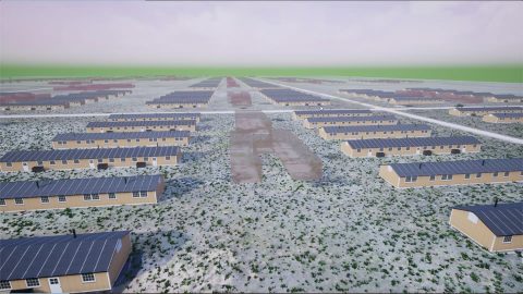
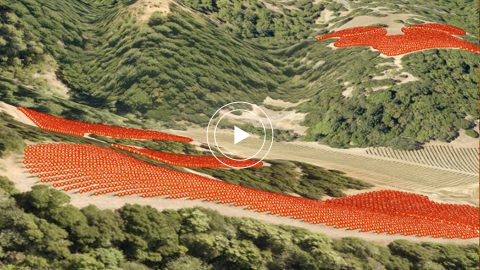
Arrow Gold for Ground Control Points: Over 110,000 Japanese Americans were interned in WWII. One man is using GIS, GPS, and AR to make sure we remember.

Texas Co-op Improves Customer Service with Futura and Arrow

Arrow Gold for Field Staking: TCEC Improves Customer Service with Real-Time ArcGIS Access via Futura GIS; Eos Positioning Systems case study - TRI COUNTY ELECTRIC COOPERATIVE TCEC in TEXAS uses Eos Arrow Gold and Arrow 200 for field staking of electric construction sites with Futura Systems' FieldPro staking app on iOS; shown here is part of the TCEC team performing field staking

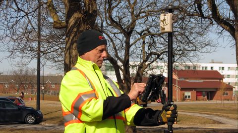
Real-time access to enterprise ArcGIS via Futura & FieldPro helped TCEC achieve 4-hour as-builting. They used Arrow Gold for field staking GNSS locations.

Video Case Study: Niagara Region and GPS Precision

Video Case Study: Niagara Region and GPS Precision with Arrow Gold and Collector for ArcGIS for Water Locates; shown here is their interview with GPS Precision of Canada

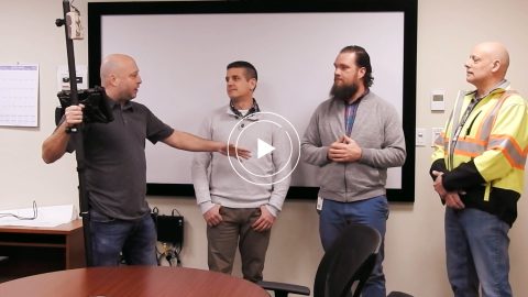
Niagara Region and GPS Precision get together to discuss how they put together an Arrow Gold RTK base station for pipe locates at Ontario water facilities.

Niagara Region Keeps Infrastructure Safe with RTK Locates

Arrow Gold for Locates: Niagara Region Keeps Infrastructure Safe with Centimeter Accuracy from RTK Base Station and Arrow Gold Locations in Collector for ArcGIS®; shown here they test the rover

Niagara Region used Arrow Gold for locates, deploying real-time GNSS data collection with their own RTK base station and Esri ArcGIS Collector.

Texas Drone Consultancy Maps Enchanted Rock with UAVs and GNSS

FIELD PHOTO - CASE STUDY - RAPTOR AERIAL SERVICES - Setting Ground Control Points (GCP); Texas Drone Consultancy Uses Arrow Gold for Ground Control Points (GCP)

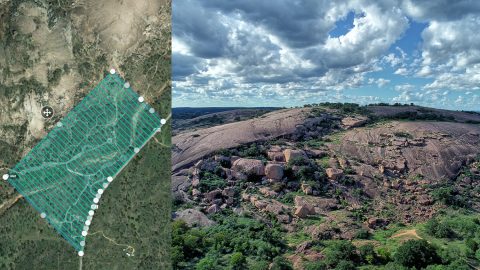
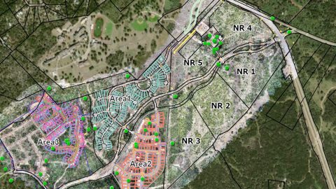
A Texas consultancy provided 3D topo maps and digital elevation models to a park by using Arrow Gold for ground control points, DJI drones & GPS Tracker.

CSU Monterey Bay Tackles High-Accuracy Campus Mapping

CSU Monterey Bay Feature Image Campus mapping GIS Arrow

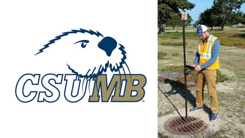
California State University-Monterey Bay increased positional accuracy for campus assets with the Arrow 200 for RTK elevation collection on Esri Collector.