Synopsis:
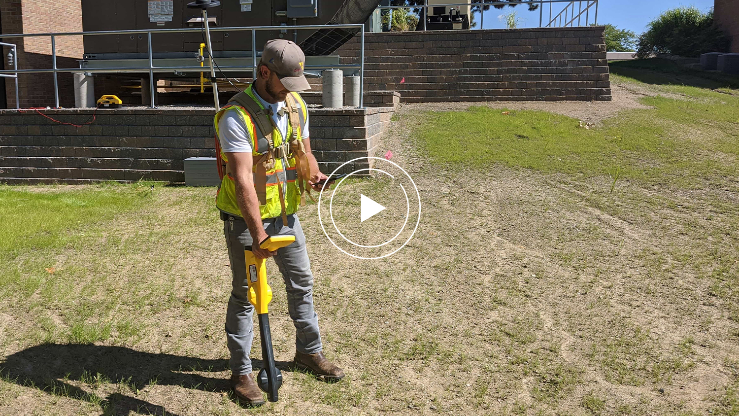
In this video session, Michael Cousins of OHM Advisors explains how he and his team deployed Eos Locate™ for ArcGIS® during an underground utility mapping project in Oakland County, Michigan. Mike shows the value of using high-accuracy RTK precision Arrow GNSS equipment with Esri ArcGIS Collector and an underground locate device to track a buried gas main, and how the asset’s actual location is misrepresented in legacy CAD records as compared to its real-world location.
Read below for the written transcript of the video above.
This presentation was originally given as part of the 2020 Michigan Communities Association of Mapping Professionals (MiCAMP) virtual event. Learn more about MiCAMP here.

Locating underground mapping with Eos Locate™ for ArcGIS® at Oakland County

OHM won our contract with Oakland County; we were hired to map out all of the following utilities on the campus – water, sanitary, storm, gas power, telecom (which is copper, fiber, CCTV) and steam tunnels. Originally we were going to attempt to use their as-built plans as well as associated drawings to attempt to locate all of their assets.
We would have brought along our trusty metal detector and stick probes to locate these and just walk the ground up to see what we see. The goal and purpose of this was to update all the utilities in GIS, the camera system, and for the field staff to be able to use it for asset management purposes. But once the project got started, we were like, ‘There has to be a better way.’
We were going to use our Eos Arrow Gold® units regardless, and we heard about the Eos Locate™ instead and decided to give it a try. We demoed the hardware and software and it proved to be the right solution.
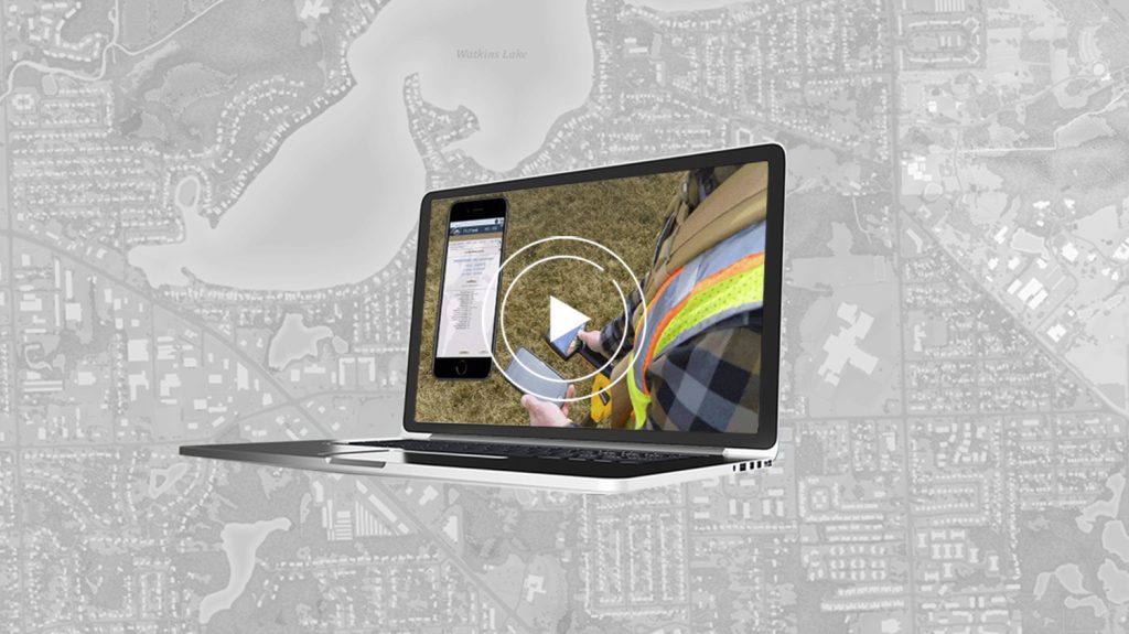
How it works: It allows us to hook up a traditional utility, locate to the tracer wire or metal pipe itself or a hydrant or a valve whatever it might be. The transmitter, which is seen over here on the left, up top, transmits a signal and down the general trace wire and then the receiver which is in his hand detects the signal and gives us a depth. Paired with an Arrow Gold®, both units communicate to the phone or tablet and utilizing Eos Locate™, we’re able to capture a precise three points of the assets below ground within Collector, this can be easily exported out to AutoCAD Civil 3D as a 3D network. It’s a game-changer solution.


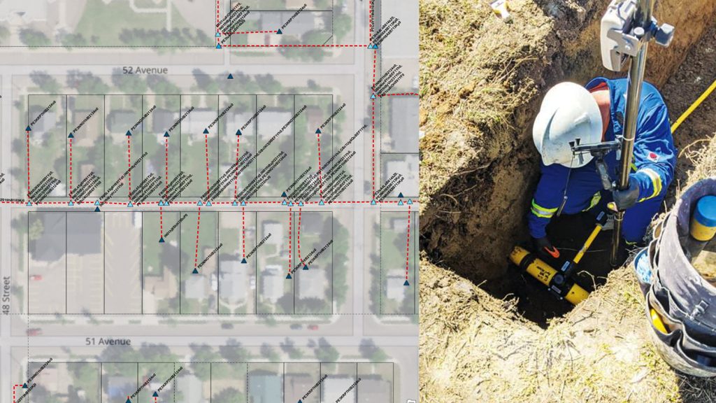
Here’s an example of a dash line being the recorded record plan line, the solid line is our Eos Locate™ line, the pink line would have been what we would have had to create had we not had located. It’s very schematic looking, but when you turn on the aerial view you’ll see that there’s this giant oak tree sitting right in the middle, so by using a locate we’re able to accurately record the location of the gas main as it bent down and round the tree. Here’s a different location but you know it creates a 3D profile of your assets.

You can see the varying elevations along the line, up, down, left and right. It really got us a concrete answer as to truly where the assets were.
Why is that a game-changer, though?

In a traditional locating scene, this guy visits the site, locates the utility, paints it on the ground with the depth as shown, we’ve all seen before. When a two or three-man survey crew comes back, they survey it, record the depth along the line then that gets converted from a point to a point or a line feature that then might go to the CAD group and maybe — big maybe — might come back to us at the GIS team to actually update the utilities. But with Eos Locate™, you visit the site once, get the desired accuracy required and it’s all captured with one click on the same locator directly into your GIS as a 3D network. So it’s actually putting the point below ground, below the surface at the depth of that asset. Once it’s in GIS, we can easily export to Civil 3D or Workstation for as-built purposes. By using locate, we’re literally able to achieve locating at half the time we originally planned for and if we were to have used a locate service this location, the process is a third of the time because we only had one person working on versus up to two to three sets of other people touching the same data.
Using Eos Locate™ with an eye toward Augmented Reality (AR) in the future

Using Eos Locate™ the goal for Oakland County is ultimately to get their data into vGIS. You’ve probably seen me talk about this in the past, but with our high confidence and accuracy in the final data they’re going to be able to utilize this Augmented Reality (AR) / mixed reality application on the tablet phone or Hololens to visually see the assets on the ground — as if they were really there. I mentioned that the Eos Arrow receiver actually works with vGIS, too, and so when you visit the same site, you’re going to get that same centimeter accuracy level on your tablet if you’re paired to an Arrow when you relocate those assets.
Now imagine being able to use a system like that to go out and do your mystics. It’s so much faster.
Applying this solution to lead-pipe removal in Michigan
Due to another project we worked on with Flint Watercress, many of us have had to do a bunch of projects to locate our service lines. However, the state of Michigan enacted strict new laying copper rule that went into effect on June 18. It’s a very complex rule but basically, by the year 2041, every municipal government must remove any line that contains or ever contained any lead or galvanized pipe from the system. This includes both the public and private side.
This applies to the water service line that comes into the house goes from the water main through your tap valve and into the house and then into the meter.
First, what’s already in the ground?
So the first step we have to perform is a desktop inventory based upon plans or tap cards like this. The goal is basically to figure out what is in the ground where it is. This is going to help field verification steps, which includes potholing to know where to send crews in the most efficient manner and will allow the community to estimate the cost.
Next, we field verify.

As crews are on-site, we GPS curve shutoff boxes and mark what was seen on both the public and private sides. This location information was critical for our future visits, where we were going to remove that water service line. We then mapped operations for internal uses and created a public story map for the public to find out more information about the community.
The ultimate goal is to get the lead.
Would you like to learn more about Eos Locate™ for ArcGIS®?
You may also contact our sales team for specific inquiries.
You May Also Like One of These Success Stories
Canada Gas Utility Meets Tracking and Traceability Requirements
Apex Utilities uses an Arrow Gold® RTK GNSS base/rover configuration with Android tablets and ArcGIS Field Maps for tracking and traceability.
Bring Your Buried Assets to Life: Webinar with Esri Electric and OHM Advisors
In this webinar, Esri, OHM Advisors and Eos explore underground utility mapping with Eos Locate™ for ArcGIS®, including a utility case study.
