Eos Product: Arrow Gold®

  • Home
  • Archive for "Arrow Gold®"

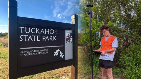
Trail Mapping at Tuckahoe State Park

Trail Mapping at Tuckahoe State Park with Eos Arrow Gold GNSS Receivers and ArcGIS Field Maps

The GIS Program at Washington College created accurate digital maps to update those available for Tuckahoe State Park visitors. They used an Arrow Gold and ArcGIS Field Maps.

Resort Municipality of Whistler Empowers Departments with Accurate GNSS Data

Resort Municipality of Whistler in British Columbia, Canada

The Resort Municipality of Whistler equips departments with a high-accuracy mobile data collection workflow to support grant applications.

Mapping Dreams: Detroit Students Empower Their Futures with GNSS

GIS Pathways program teachers high school students in Detroit, Michigan about GIS, GNSS, and GPS all while earning college credits and skills for their futures

Discover how this pivotal program teaches public high schoolers how to use GIS, GNSS, drones, and related technology.

Customer Spotlight: Revisiting David Malm at the 2023 Esri UC

David Malm Video Feature Image3

Hear how David Malm maps city infrastructure with high-accuracy GNSS in this exclusive video interview!

Customer Spotlight: Will Forker Represents Reality in Accurate 3D Models

Customer Spotlight Will Forker Represents Reality in Accurate 3D Models using High Accuracy Drone Imagery with Ground Control Points GCPs from the Eos Arrow Gold GNSS Receiver

Using drones, high-accuracy Eos GNSS receivers, and ArcGIS, Will is creating geospatially referenced 3D models for his clients.

Customer Spotlight: Papillon Romero Increases GIS Accuracy at a Texas Pipeline Operator

Papillon Romero Customer Spotlight - Kinetik Uses Eos Arrow Gold GNSS Receivers for High-Accuracy Pipeline Utility Mapping

Papillon empowers employees to collect high-accuracy pipeline data efficiently and easily at the largest midstream provider in the Delaware Basin.
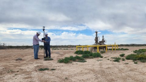
Kinetik Employees Embrace Comprehensive, High-Confidence Enterprise GIS, Usage Increases 5,000%

Kinetik GNSS for pipeline operations asset management, Camron Hull and Papillon Romero, Arrow GNSS, ArcGIS, Texas

In the Delaware Basin, Texas midstream pipeline operator Kinetik has transformed GIS and location accuracy in the field and office.
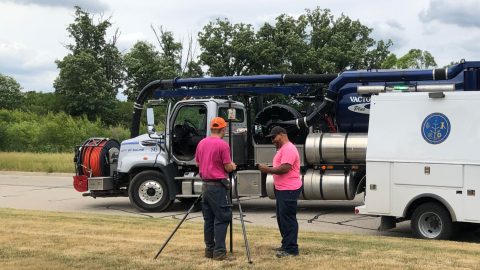
A Forward-Thinking Michigan Municipality Implements High-Accuracy Maps for Program Management

City of Saline, Michigan, Arrow Gold GNSS receiver, field data collection, ArcGIS

The City of Saline brought GIS in house, deployed high-accuracy GNSS receivers, and is working toward a streamlined longterm master plan.

Customer Spotlight: David Malm Empowers Clients with Accuracy at Bolton & Menk

David Malm Empowers Clients with Accuracy at Bolton & Menk

David provides community infrastructure solutions to municipalities using high-accuracy GNSS and GIS technologies.

Customer Spotlight: Emily Jane Murray Preserves Florida’s History Through High-Accuracy GNSS

Emily Jane Murray preserves Florida's history by mapping heritage-at-risk archaeological sites with high-accuracy Eos Arrow GNSS receivers

Emily Jane Murray maps coastal archaeological sites before their valuable history is lost to rising sea levels.