
In This Issue
Skadi Smart Handle: Electrifying utility field work
Mapping Meadows, Music Festivals, and More: See GIS pros in action
New Accessory Now Shipping
Some Skadi GNSS models now ship with the new Skadi Handle Range Pole Bracket. Read all about it!
Featured Customers
- Lee County Electric Cooperative
- Jack Braunschweiger of Candlestick Mapping
- San Francisco State University Professor Jerry D. Davis
NISC and High‑Accuracy GNSS: The Workflow Upgrade Powering LCEC’s Growth
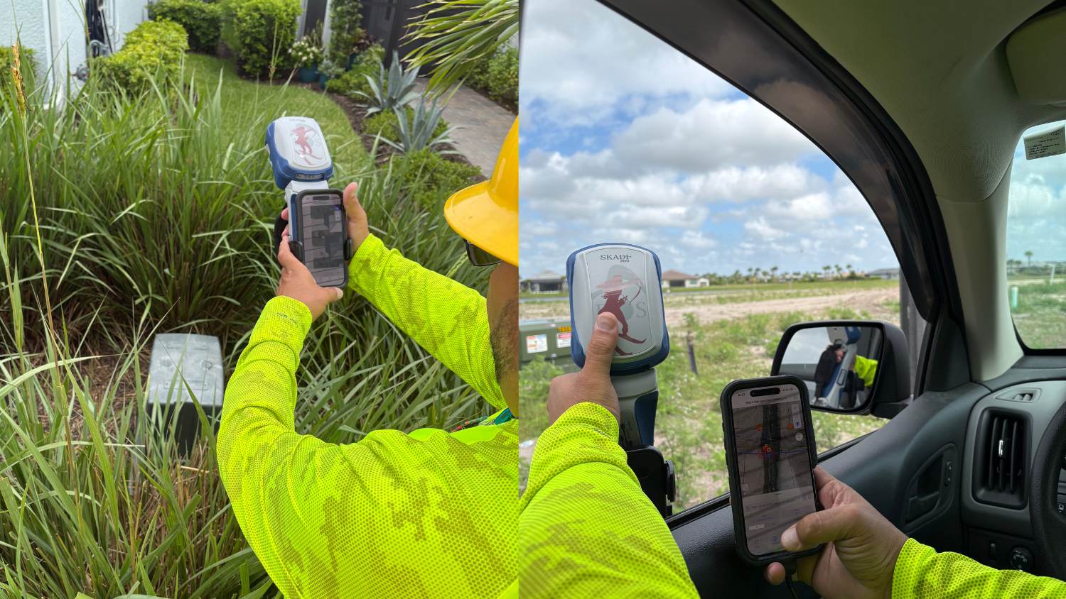
Serving more than 268,000 members across six Florida counties, Lee County Electric Cooperative (LCEC) recently upgraded its GIS data collection workflow by deploying the NISC mobile app with a Skadi 300™ GNSS receiver and Florida’s RTK network. The shift from roughly 2-foot accuracy to high-accuracy 3D positioning gives LCEC more precise asset locations and elevation data for storm response, flood assessment, planning, and daily operations.
To support rapid growth and an expanding utility network, LCEC also adopted the Skadi Smart Handle™. The smart handle enables crews to capture accurate locations from a distance — across canals, behind obstacles, and even from a vehicle. The result is faster field mapping, more accurate GIS, and improved asset visibility, helping crews locate infrastructure more quickly during outages and restore power faster.
Introducing the Skadi Handle Range Pole Bracket
A small accessory making a big difference
The new Skadi Handle Range Pole Bracket enables quick transitions between range-pole and handheld workflows while simplifying your field setup. Reduce the number of accessories you need, mount your handle directly to a range pole, and seamlessly transition between setups. This new accessory is now included with every Skadi 200™, Skadi 300™, and Skadi Gold™ GNSS receiver. Watch the video to see how it works or read the press release below.
Customer Spotlight: Jack Braunschweiger’s Mappy Method Behind Building a Music Festival
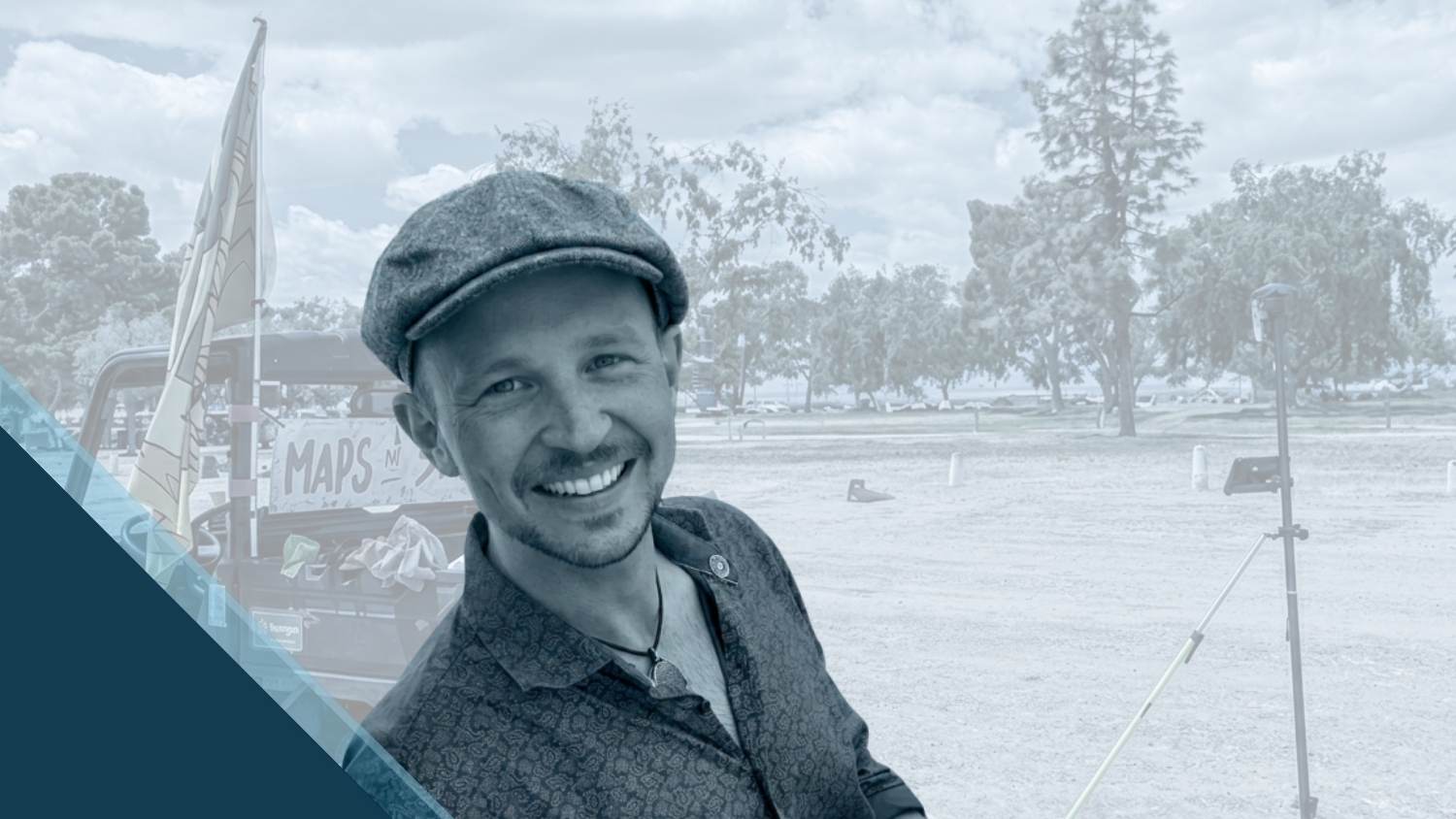
Jack Braunschweiger is no stranger to maps. As owner of Candlestick Mapping, Jack uses GIS, CAD, and an Arrow Gold+ GNSS receiver to accurately position thousands of assets for large-scale music festivals — from stages and fencing to lighting and art installations. His recent workflow upgrade helps crews build complex event sites exactly as designed while improving coordination across teams. See how — and why — Jack replaced tape measures and line-of-sight methods with real-time, high-accuracy mobile maps.
Current GNSS Satellite Status for August 20, 2026
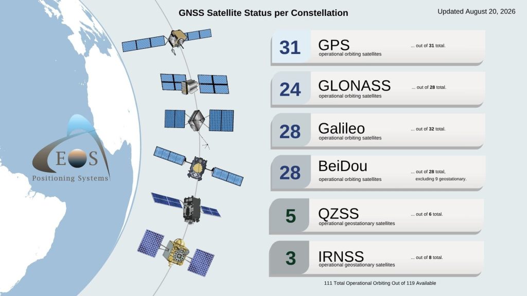
Current GNSS Satellite Status: August 20, 2026
Since last month: Total global operational orbiting GNSS satellites remained the same at 111. Also, our team was also able to access the GLONASS constellation website for the first time since December 2023.
More News
Ebook: Modernizing Water & Wastewater GIS with High-Accuracy GNSS
Download our latest ebook: Discover how water and wastewater professionals use Eos Positioning Systems’ GNSS technology to build smarter utility networks, reduce field time, strengthen data integrity, and ultimately deliver more reliable service to their communities.
Browse the ebook now >
Video: GIS Beyond the Classroom: Mapping Meadows with Jerry D. Davis
San Francisco State University Professor Jerry D. Davis uses high‑accuracy GIS to support field‑based learning and applied research. Whether mapping stream corridors or collecting spatial data in challenging terrain, his approach centers on curiosity, mentorship, and giving students the confidence to work with professional‑grade geospatial tools. In a recent meadow restoration project, Professor Davis taught his students how to observe, measure, and understand the world — with accuracy and intention.
Watch the 1-min Video>
Upcoming Events
Here’s where to find our team in the coming weeks:
Esri India UC
Sept. 2-3 | New Delhi, India
Find Our Team >
WaterPro
Sept. 14-15 | Phoenix, AZ, USA
Don’t Miss Our Sept. 15 Workshop >
NISC MIC
Sept. 15-16 | Las Vegas, NV, USA
Find Eos in Booth #504 >
INTERGEO
Sept. 15-17 | Munich, Germany
Find Eos in Hall B6 in Booths #F004 (Eos) & #D009 (with Esri) >
GeoDataDays
Sept. 16-17 | Tours, France
Find an Authorized Eos Representative in Booth #81 >
WEFTEC
Sept. 28-30 | New Orleans, LA, USA
Find Eos with Esri in Booth #1817 >
KAMP
Sept. 29 – Oct. 1 | Lexington, KY, USA
Find an Authorized Eos Representative Booth #19 >