Questions and Answers from “Mapping Made Easy with GIS and GPS,” an Eos workshop with special guests from Esri Water
On October 20, 2020, Eos hosted a workshop with Esri Water. The workshop included an overview of the ArcGIS Platform, an indoor demonstration of setting up an ArcGIS Online web map for high-accuracy data collection, an outdoor data-collection demonstration, a roadmap of ArcGIS Field Maps, and a Q&A wrap-up.
If you did not attend the above workshop, please sign up for our monthly newsletter to be notified about upcoming opportunities.
Below is a transcript of the questions submitted during the workshop, with answers from our panelists:
Meet Our Panelists
Tyler Gakstatter
GNSS and Mobile GIS Expert, Eos Positioning Systems
Jeff Shaner
Product Manager, Esri
Matt Groves
Solution Engineer, Esri
On This Page: Table of Contents
- Case Studies Shared
- ArcGIS Collector
- Please discuss setting the proper map projection coordinates when setting up Collector.
- What would happen if you forget to set data transformations?
- When setting up the Location Profile in Collector, which GNSS Map and Map Projection should be selected when using CRTN RTK using 2017 Epoch 50?
- Our base station broadcast data in WGS84 Datum, how do we get our GPS data converted to NAD83 Datum and Local Coordinate system? Is that done in Collector?
- What file format can we export the GPS data collected in Collector? E.G. GeoPackage, CSV?
- Our water data (valves, hydrants) is currently in a Geometric Network model. Will we run into any problems with updating these locations? (Is Collector able to edit the Geometric Network in a service?)
- Did the last presenter say that it would not create polygons? (just at the end)
- Can we create and use our own map in case your location loses internet connection, where you have no connection with your web map?
- In Collector, can I see the developer schema? We have an enterprise geodatabase, [so I am wondering] when using Collector, can I be able to see the developer schema?
- ArcGIS Field Maps
- Jeff, will Field Maps replace Collector?
- Can we connect Arcgis Field Maps with Operations Dashboard for real time monitoring?
- Jeff, are there plans to include Survey123 within Field Maps. If not, when is using the Field Maps “smart forms” feature you mentioned appropriate, and when is Survey123?
- Can the smart “Forms” feature that Jeff showed create reports?
- Will smart forms have the option for webhooks, like Survey123 does, so you can have the form emailed to someone?
- Will you be able to have more than 3 relationships [deep] in the new Field Maps?
- What is required to leverage Tracker in Field Maps? We have Enterprise GIS 10.6.1 and will be migrating to 10.8.1, but currently do not have Tracker server established.
- Can both Level 1 and 2 users have access to Field Maps? What view/edit features will each have?
- Jeff, does Field Maps have the ability to collect breadcrumb trails outside of the distance-based/motion approach? Essentially, can it collect points at 1 second intervals?
- Jeff, can you create new relationship classes with existing hosted feature classes?
- ArcGIS Platform
- Is Matt utilizing the Esri Utility Network solution for the hydrant inspection demo?
- For the map Tyler just created, did he use Web Mercator for his coordinates for his map?
- How do I add GNSS data to existing layers?
- Great demonstration on collecting new data in the field! What about updating existing features? My data is in SDE and I can access it through our ArcGIS Portal.
- Do you recommend ArcGIS Pro to manage and script the data across to the desktop?
- How can you publish your created layer from ArcGIS Pro to your enterprise geodatabase / ArcGIS Server? We would like to make our map services from the enterprise geodatabase and not have them hosted in ArcGIS Online.
- RTK/Base Stations
- Is it possible to use RTK with the Arrow 100? We can usually get submeter accuracy with SBAS with our Arrow 100, but I want to know if we could do better with RTK. Our nearest state-maintained RTK base station is about 15km away. Thanks!
- Without an RTK network, what datum would you set for your receiver in your profile?
- Tyler mentioned base stations can’t be “too far away”? How close does the RTK base station need to be? 1 mile or 30 miles?
- Tyler, you mentioned using a free RTK for Oregon. Where can that be accessed?
- With RTK, you can capture 1cm accuracy horizontally, but what about vertical? Could you please quantify the vertical accuracy?
- Can the Arrow Gold be used as an RTK base station for other receivers, such as the Arrow 100?
- GNSS, Elevation and Related Solutions
- So with a GNSS device, we can connect to Russian and EU satellites?
- Is there a good website to go to check what satellites are available?
- Tyler, is there a way to grab the compass heading off of the GNSS and/or phone for a calculated field like you did with the ortho heights?
- Using Eos Arrow and Collector, how accurate is the data can we obtain for the Z value?
- We have had a lot of difficulty collecting Z values in NAVD88 in feet. Will the settings for getting this set up properly be reviewed? I’ve found online help, but none that completely solves the issue of properly getting the height in feet.
- We have an Arrow 100. What are some tips for eeking out the maximum accuracy possible with this unit.
- We recently purchased an Eos Arrow receiver. Can you give me a contact for the Delaware area that I can get in touch with about some possible training to help us get it set up and working correctly.
- I’m thinking that the Eos Arrow receiver has a SIM card. Is it compatible with all cellular technologies? E.G. GSM, GPRS, EDGE, UMTS?
- We are looking for an underground cable detector can we find it?
- What solution do you have when you are in challenging areas? E.G tall buildings, trees?
- Are there any tools available that will allow us to use a TruPulse Laser Range finder with Collector?
- Will all the technology you are showing be available and supported on the current Windows tablets?
- I have access to a CORS in my town. Can an Eos receiver connect to it?
1. Case Studies Shared
1.1 PETER: Could we please have the links to case studies Christa Campbell shared?
Absolutely! Christa shared 4 case studies:
- Northern Gila Sanitary District preserves institutional knowledge
- Rockett Special Utility District sets up its base station for rural accuracy
- Oldham County Water District StoryMap shows OCWD’s transition from legacy to modern data-collection
- City of Santa Barbara transitions to Collector and Arrow Gold (with base/rover config)
2. ArcGIS Collector
2.1 TODD: Please discuss setting the proper map projection coordinates when setting up Collector.
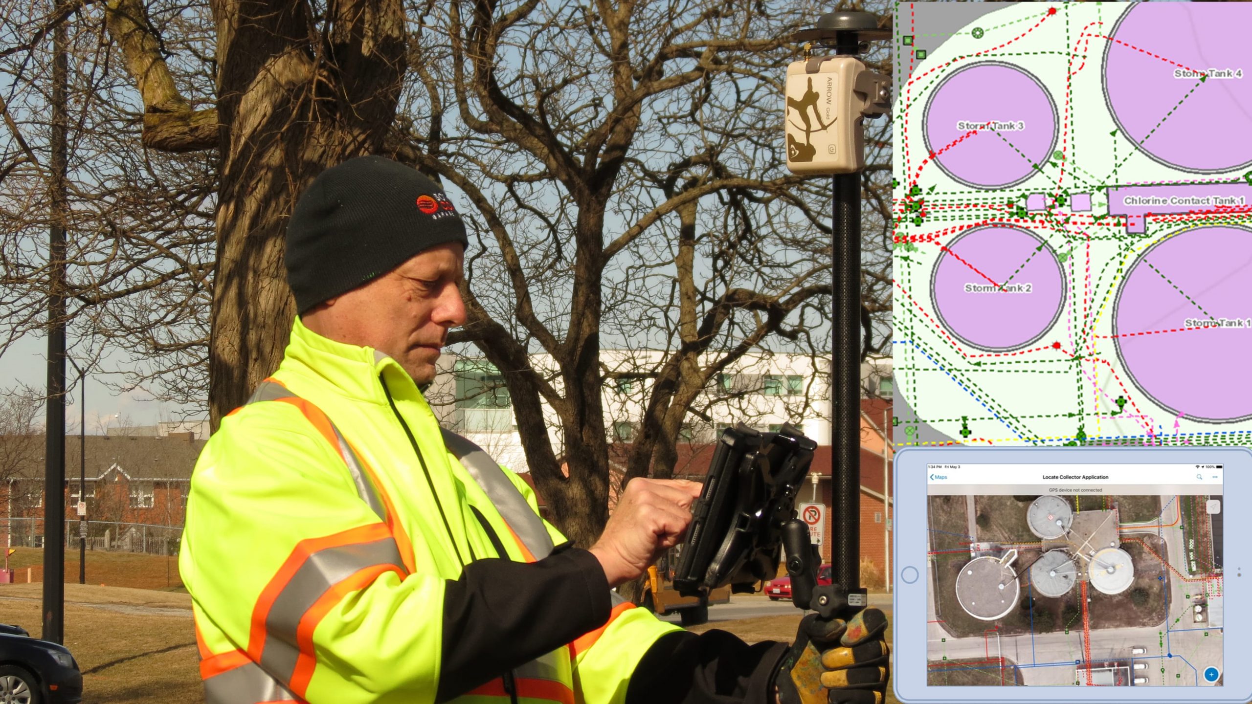
TYLER: ArcGIS Collector offers the ability to set up an on-the-fly datum transformation. You must configure this in Collector’s “Location Profiles” setting before beginning your data collection. A Location Profile just translates the Arrow GNSS coordinates to the datum of your published map, so that the asset location falls in the right place.
Let’s take an example in the U.S. If your Arrow is receiving corrections from an RTK network, it’s almost certainly referenced to NAD83 2011. However, your ArcGIS Online maps will most likely be published in the latest edition of WGS84. Without a Location Profile set up, your NAD83 coordinates will be different than the coordinates in WGS84, so your features might look “off” on your map. The amount and direction of the shift will be constant across your data collection, so you can pretty quickly see that it’s a datum mis-configuration. You can easily avoid this issue by setting up your Location Profile in Collector beforehand, to handle the NAD83-to-WGS84 datum transformation on-the-fly.
It’s good to note that the Arrow will always output coordinates in the same datum as the differential correction it is receiving, so you will need to set (or switch) profiles accordingly in Collector.
Once you set the Location Profile transformation, we recommend verifying the settings by occupying a known coordinate, like a survey monument, and then ensure the location matches in your web map. If you see a constant shift, it means you have a datum configuration problem in your location profile.
2.2 FRAN: What would happen if you forget to set data transformations?
TYLER: Sure, so we showed in Collector that you can set a Location Profile without the datum transformation, if one is required. Now, in the event that you didn’t set up the Location Profile before starting field data collection, then you would have to shift your data back in the office. The good news is, it can be rectified; there’s just a little bit of post-processing you’d have to do. As long as you’ve captured your GNSS metadata fields, you can use the Lat/Long fields to correct your features with a shift. If you haven’t captured those metadata fields, it’s a little trickier, but it can still be done. Current customers can contact our technical support if you suspect this has happened.
2.3 TODD: When setting up the Location Profile in Collector, which GNSS Map and Map Projection should be selected when using CRTN RTK using 2017 Epoch 50?
TYLER: California uses a slightly different Nad83 datum than the rest of the US. It is basically the same as Nad83 (2011) (epoch 2010.0) but with an epoch of 2017.50. This means there’s a difference of 7.5 years in the tectonic plate velocity model. Please refer to the California Spatial Reference Center (CSRC) for more information on the CSRS Epoch 2017.50 (NAD83) datum.
This CSRC datum is not yet supported in Esri apps, but you can use the Datum Shift features of Eos Tools Pro to compensate for the difference and reconcile the two. The shift values are not constant in California. For example, based on the velocity model, a location near San Francisco can move about 32mm/year to the north, 21mm/year to the west and about -1.35mm/year in the elevation; in Southern California, the shift rate can be 14mm/year north, 8mm/year west and -1.25mm/year up. You will need to compute the XYZ shift for the area in which you will be working.
Before computing this shift for Eos Tools Pro, the first thing you need to know is that when you are receiving corrections from a base station referenced to CSRC Nad83 (2017.5), the Arrow will also output positions in the same datum. Since Esri only supports transformations from Nad83 (2011) to WGS84, Eos Tools Pro Datum Shift feature will transform from Nad83 (2017.5) to the Nad83 (2011) that Esri is expecting.
To compute the required shift for your area, refer to this article “How to Compute Datum Offset Values for Eos Tools Pro” and follow the steps. The only differences are that you will select:
- Nad_83(2011/CORS96/2007) datum for both input and output values, and
- Reference date for input position should be set to 2017.5 and the date for output position to 2010.0.
Once you activate the Datum Shift in Eos Tools Pro, the Arrow will then output positions in Nad83 (2011) datum to Collector.
So yes, this can be done in Collector. Your location profile would be left at default. Your layers will need to be published in your local coordinate system. If you would like the web map to use the same coordinate system, then you’ll need to publish and use a custom basemap as the web map’s basemap. If you don’t use a custom basemap, the web map will operate in WGS 84 but the data in the layers will be stored in your local coordinate system, so you should see a slight but constant shift.
2.4 FERNANDO, BRYAN: Our base station broadcast data in WGS84 Datum, how do we get our GPS data converted to NAD83 Datum and Local Coordinate system? Is that done in Collector?
JEFF: Collector has a Compass tool, which gives you a bearing and distance measurement for how far away a feature or location is. The caveat is, this tool uses your phone/tablet’s integrated compass, so the accuracy is limited by the quality of the compass.
We did add a little bit more to Field Maps, so that the app can now show you the bearing in degrees, which we don’t have in Collector. I believe there’s a lot more we can do with this, and we’ve even talked about providing some haptic feedback or voice guidance.
TYLER: To add to that, like Jeff mentioned, if you’re standing still and using the compass mode, it will have a hard time directing you. But once you start walking in a direction, it gets a lot better. So if you just start moving, then it will kind of guide you. If you turn left, right, and so on, you can get within a couple inches, pretty easily.
2.5 FERNANDO: What file format can we export the GPS data collected in Collector? E.G. GeoPackage, CSV?
JEFF: All data captured using Collector is managed in a Feature Service — the feature service can either be managed by Esri inside of ArcGIS Online or inside of your enterprise geodatabase and exposed using ArcGIS Server. Once you’ve collected data in the field, you can export from ArcGIS Online/ArcGIS Enterprise to a variety of formats, including CSV, geodatabase, and shapefile.
2.6 ALYSA, DAVID: Our water data (valves, hydrants) is currently in a Geometric Network model. Will we run into any problems with updating these locations? (Is Collector able to edit the Geometric Network in a service?)
JEFF: We treat the Geometric Network as simple features, so while we don’t edit the network topology itself, you can edit the features that participate in that network. It’s not until you sync that data back, that it will fire the logical network. So you can do this, but just be aware that network topology is not maintained in the field.
2.7 JIM: Did the last presenter say that it would not create polygons? (just at the end)
TYLER: Great question. To be clear, you can absolutely capture polylines and polygons with high accuracy using external GNSS receivers. In this section, I was referring to the collection and storage of GNSS metadata specifically. Right now, Collector doesn’t support the capture of GNSS metadata for polyline and polygon features. This functionality would require some way to relate the GNSS metadata to each vertex.
2.8 FERNANDO: Can we create and use our own map in case your location loses internet connection, where you have no connection with your web map?
TYLER: Collector supports using maps in offline mode. This requires a little bit of planning because the map must be downloaded before the loss of internet connectivity. Offline areas for offline maps can be added on the ArcGIS Online side, or on the device within the Collector app.
2.9 MENZI: In Collector, can I see the developer schema? We have an enterprise geodatabase, [so I am wondering] when using Collector, can I be able to see the developer schema?
JEFF: The schema of the map layers you’re collecting are managed in a feature layer. You can view/modify the schema using ArcGIS Online or ArcGIS Pro. The schema dictates what your form will look like and how the collection capabilities will work inside of Collector. If you want more clarification, you can email Doug Morgenthaler.
3. ArcGIS Field Maps
3.1 PAMELA: Jeff, will Field Maps replace Collector?
JEFF: Absolutely, it will. We released Field Maps on Monday November 2nd and all of our development efforts are pouring into Field Maps. We will maintain ArcGIS Collector for the foreseeable future and provide you with ample time to migrate your workflows to Field Maps, but we will not add any new features to it. Please check out our new Field Maps migration guide to help you move from Collector to Field Maps.
Right now, we’re planning to continue supporting Collector through 2021. Support includes:
- Resolving any “showstopper issues” that could impact a workflow
- Fix issues that cause the application to crash
Basically, anything that impedes your work, we’ll fix. 🙂 But all new development will go into Field Maps.
3.2 ABDELGHAFOUR: Can we connect Arcgis Field Maps with Operations Dashboard for real time monitoring?
JEFF: You bet. Operations Dashboard works really well with feature layers and supports the layer-refresh property, so as you collect and update features using Field Maps they will update in your Dashboard. In fact if you are using the same feature services that you have previously used in Collector, you don’t even need to update your Dashboards!
3.3 ROLIH, JOHNATHAN, VICTOR, REN, CHRISTIAN: Jeff, are there plans to include Survey123 within Field Maps. If not, when is using the Field Maps “smart forms” feature you mentioned appropriate, and when is Survey123?
JEFF: Great question. There is no plan to include Survey123 in Field Maps. Survey123 uses an open-standard approach for smart forms called “XLS Forms.” Our Survey123 product has grown in capability since it was first released in 2015, and it will continue to grow. Survey123 is a robust, specialized solution for specific field workflows and can be used in combination with other apps — including Field Maps if you like.
We’ve also realized that the time has also come for us to bring “Smart Form” capabilities to the rest of the platform. With Field Maps, our primary goal is to provide a map-centric experience where you can still collect attribute information using smart forms; you now shouldn’t have to use two apps (Collector and Survey123) to accomplish your map and form workflows. We’re seeing this being driven by Utilities wanting to perform inspection workflows, and we will be growing the forms capability a lot over the next year. We’ll be bringing in new platform features like attribute rules and contingent values — which will greatly enhance the experience of form editing.
So we will have two separate form implementations: the existing, open standard approach taken with Survey123, and a new ArcGIS Smart Forms approach adopted within the ArcGIS platform and used by ArcGIS Field Maps along with web apps and ArcGIS Pro.
3.4 REN: Can the smart “Forms” feature that Jeff showed create reports?
JEFF: Reports are coming across the ArcGIS platform and usable with any feature service. You can generate reports using ArcGIS Pro and publish a reporting service that can be used to automate reports. The Smart Forms that are being developed for use within ArcGIS Field Maps will utilize this standard approach.
3.5 LINDSEY: Will smart forms have the option for webhooks, like Survey123 does, so you can have the form emailed to someone?
JEFF: Today all feature services support web hooks; this capability is not unique to Survey123. What Survey123 does, however, is simplify the process of creating web hooks. This development work is in our product backlog but will not be a part of the first release. Given the capability is available with all feature services though, you could implement your own web hook logic today.
3.6 JOHNATHAN: Will you be able to have more than 3 relationships [deep] in the new Field Maps?
JEFF: This is a feature-service limitation today, and we would need to extend this capability with the underlying service first. I’d really love to understand what workflow you’re working on that led to this question. Please email Doug Morgenthaler to provide more information on your workflows.
3.7 DEENA: What is required to leverage Tracker in Field Maps? We have Enterprise GIS 10.6.1 and will be migrating to 10.8.1, but currently do not have Tracker server established.
JEFF: ArcGIS Tracker is a premium capability that utilizes the location tracking capability in ArcGIS Enterprise (and ArcGIS Online). It is available with ArcGIS Enterprise 10.8 and higher and you will need to stand up the proper infrastructure to support it. Please see this documentation topic for details on the infrastructure and contact your account manager for licensing details.
3.8 BETH: Can both Level 1 and 2 users have access to Field Maps? What view/edit features will each have?
JEFF: Yes. Please check out the newer Esri User Types, which were introduced in 2018 that supersede Level-based licensing. What’s important to know for this question is that Level 1 equals a “Viewer User Type,” and Level 2 equals a “Creator User Type,” and Field Maps supports them both.
- As a Viewer / Level 1 user, you can sign into ArcGIS Field Maps and view maps. You can open, view and query web maps. You can take map areas offline as well. You can also download mobile map packages that were created by your GIS team for dedicated offline use. You can even markup maps using the markup capabilities if you like. Viewers (or level 1 named users) are not able to collect, update, or edit features.
- As a Creator / Level 2 user, you have all the viewing capabilities provided to Level 1 named users plus you can edit features.
The only capability of Field Maps not included with both Level 1 and Level 2 is Location tracking. Location tracking is a premium add-on license. So if you need tracking functionality, you’ll have to purchase that add-on license to unlock tracking functionality.
3.9 ARTHUR: Jeff, does Field Maps have the ability to collect breadcrumb trails outside of the distance-based/motion approach? Essentially, can it collect points at 1 second intervals?
JEFF: So there’s 2 approaches for capturing data in motion …
- First is the GPS streaming approach. This is when you’re actively capturing a line or polygon, and you can use a time-based or distance-based approach to log data every X seconds or X distance units. I believe this is what you are asking for. It does not have the ability to capture a breadcrumb trail of points though.
- Second is the location tracking approach. Field Maps uses the location tracking capability that was added to the ArcGIS platform last year. This method uses the distance-based/motion approach. This approach is designed to conserve battery life where capturing points at a 1 second interval will drain your battery very quickly.
3.10 JARED: Jeff, can you create new relationship classes with existing hosted feature classes?
JEFF: There is no way to do this today using hosted feature layers. You can only create relationship classes using ArcGIS Pro (which will overwrite an existing schema). You could create a new feature service and load existing data into the service if you like.
4. ArcGIS Platform
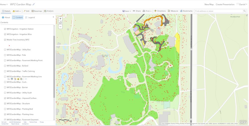
4.1 CHRIS: Is Matt utilizing the Esri Utility Network solution for the hydrant inspection demo?
MATT: Actually, no. I was using ArcGIS Online, and specifically our Water Distribution Foundation solution. This solution actually has two options. You have the ArcGIS Online version, which is our hosted data management solution (that’s what I was using). And then you have the Utility Network solution, which lives in ArcGIS Enterprise and enterprise databases. That said, you could do a very similar workflow in the Utility Network by using a related table to capture inspection records. That functionality is built into the data model for the Utility Network.
4.2 TODD: For the map Tyler just created, did he use Web Mercator for his coordinates for his map?
TYLER: Yes! I was using the imagery basemap provided by Esri. All of these basemaps are referenced to WGS 1984 Web Mercator Auxiliary Sphere. If you want to use a different coordinate system, a custom basemap must be used in the web map.
4.3 DANI: How do I add GNSS data to existing layers?
TYLER: Another great question. You can add GNSS fields to existing layers. All you have to do is use the same tools I showed in ArcGIS Pro, and go through that same process to add the GNSS fields. The next time your field workers go out and collect data, you’ll see all the data they collected, including the new GNSS metadata, populated when you open ArcGIS Pro. Pro will just append those fields to the end of your attribute table. I’ve even done this to hosted feature services. Not that I’d necessarily recommend that! But it works too. 🙂
4.4 Great demonstration on collecting new data in the field! What about updating existing features? My data is in SDE and I can access it through our ArcGIS Portal.
MATT: Absolutely. If you’re using a high-resolution GPS receiver, you could just go in with Collector or Field Maps. Go to those existing points, and choose to update those features. Recapture them using the GNSS accuracy, and that would edit them and make them essentially have that higher accuracy you’re looking for.
TYLER: Exactly right. We work with a lot of people who do that because most of our customers, in fact, already have data in a GIS. So that’s a very common approach. They’ll use an Arrow with Collector just to move those features to be more accurate, not necessarily to create new data or modify a form.
JEFF: If you’re updating existing features (inspecting features for example) you should consider multi-user editing workflows. ArcGIS Collector, and ArcGIS Field Maps, supports both a non-versioned archiving transaction model as well as a versioned transaction model against your enterprise geodatabase. With non-versioned editing, it is a “last one in wins” approach. With versioning your edits are isolated so you can minimize conflicts and reconcile changes. Please consider the transaction model approach that best suits the way your mobile workforce operates.
MATT: I can add one more option. I talked about solutions in my presentation. We have a lot of solutions for water utilities, and one of our most popular ones is the Map Change Request Solution. It’s perfect if you don’t want your field crews editing your actual system of record. They can go out with this map, use the change request to capture a point that basically says “this is the corrected location for this asset.” They kick that into ArcGIS Online or ArcGIS Enterprise, and then back in the office, the GIS technician can use ArcGIS Pro to pull in that layer and do a QA/QC to choose the valid edits.
4.5 RICHARD: Do you recommend ArcGIS Pro to manage and script the data across to the desktop?
JEFF: It is definitely one approach you can take, yes, but also consider automating data transfer and QA/QC processes using python. If you haven’t spent time with them yet, also consider using ArcGIS Notebooks.
4.6 DUANE: How can you publish your created layer from ArcGIS Pro to your enterprise geodatabase / ArcGIS Server? We would like to make our map services from the enterprise geodatabase and not have them hosted in ArcGIS Online.
JEFF: Once your data is in your enterprise database, you can publish it to your ArcGIS Enterprise portal by reference using ArcGIS Pro or to your Enterprise portal data store. It’s a very similar workflow to the way Tyler published his layer using ArcGIS Online earlier.
MATT: Also, it’s important that if you don’t want to use hosted feature services, you can use ArGIS Server, in the same manner as Jeff mentioned and Tyler showed.
JEFF: Yes, and one of the things to consider when using ArcGIS Server with ArcGIS Online is to ask, “How is identity managed?” If you’re using database authentication, then what does that mean if those feature services are edited using ArcGIS Online? Apps like Collector and Field Maps will challenge you to authenticate or you can embed credentials in the item itself. We have lots of customers using ArcGIS Server feature services within ArcGIS Online.
MATT: To add to what Jeff said about embedding user credentials, you will see that that editor is just that person whose user you’re using, so that’s important to know. Secondly, you’ll also find that a service layer that’s been pushed out through the item workflow Jeff mentioned doesn’t have all the same functionality as a hosted feature layer. So you may run into situations where you’ve taken this route, and then find that some of the functionality you’re used to having with the hosted feature layer is not there. Usually in these cases, we’ll ask people to publish to ArcGIS Online, and then potentially use Python scripts, or some other mechanism, to append/sync their data from ArcGIS Online back to their enterprise database.
That seems to work more smoothly right now. And as Jeff said, we’re looking to build that functionality to be more frictionless. Right now, you’re better off hosting the data in ArcGIS Online and appending the data.
JEFF: Yes, and one last point I’d like to make, is that if your ArcGIS Server is inside your corporate network, you need to think about how you’ll access information behind the firewall on a smartphone when you’re not on the corporate network? There’s a number of different approaches. But just know, if you’re going down this path, there’s a lot of information on the trust.arcgis.com site to help you find the best ways to set up your enterprise environment for mobile use.
5. RTK/Base Stations

5.1 CHRISTOPHER: Is it possible to use RTK with the Arrow 100? We can usually get submeter accuracy with SBAS with our Arrow 100, but I want to know if we could do better with RTK. Our nearest state-maintained RTK base station is about 15km away. Thanks!
TYLER: The Arrow 100 is most commonly used with SBAS, but it can also receive corrections from an RTK base station or network. This will improve your accuracy to below 30cm (subfoot).
5.2 JIM: Without an RTK network, what datum would you set for your receiver in your profile?
TYLER: The default location will work okay. If you want to be absolutely correct you’ll need to set the GNSS datum to WGS84. This is assuming your receiver is using WAAS, and that you’re in North America. If you’re outside North America, Eos can help you ID the most likely datum.
5.3 TODD, FERNANDO: Tyler mentioned base stations can’t be “too far away”? How close does the RTK base station need to be? 1 mile or 30 miles?
TYLER: Yes, so if you’re using a single-baseline, which is your rover connected to a single base station, there’s not so much a drop-off point where you stop getting accuracy. It’s just that your ability to get centimeter accuracy is going to start to degrade the farther away from the base station you rove. A good rule of thumb is that you can expect 1cm accuracy per 10km of baseline (distance between the rover/field worker and the base station). So if you go 20km out, expect 2 cm. 30km out, 3cm. And so on.
Now, if you’re using an RTK network, then it’s a little different because you’ve got a network of base stations, which allows you to go for a longer baseline without deprecating accuracy as much. Eos can help you figure out if you’ve got a local RTK network, or guide you to setting up your own base station pretty easily.
5.4 SUE: Tyler, you mentioned using a free RTK for Oregon. Where can that be accessed?
TYLER: You can access the Oregon RTK network here. We’re lucky enough because our state DOT provides this free; you just have to request a login. This is how most, but not all, RTK networks operate around the U.S. Some are free, others aren’t; and some aren’t run by a DOT, and it will differ internationally too. If you’re not in Oregon, Eos can help you identify if there’s a RTK network in your area. You can also check out this GPS World article.
5.5 NEAL: With RTK, you can capture 1cm accuracy horizontally, but what about vertical? Could you please quantify the vertical accuracy?
TYLER: The rule of thumb with GPS, just in general, is that the vertical accuracy is going to be twice that of your horizontal accuracy. So, if you’re getting 1cm horizontally, expect a couple cm vertically, and that goes with sub meter receivers or consumer grade receivers. So if you want to use augmented reality, 3D data, or capture say vertically stacked assets, we recommend a centimeter-grade receiver, like the Arrow Gold.
5.6 ANTONIO: Can the Arrow Gold be used as an RTK base station for other receivers, such as the Arrow 100?
TYLER: Yes, so the Arrow Gold can be set up as a base station to output RTCM3 corrections, which can be consumed by any GNSS receiver. It’s an open format. The Arrow 100 will also be able to receive this differential correction signal and provide with better than 30cm (subfoot) accuracy (depending on the distance it is operating from the base station).
6. GNSS, Elevation and Related Solutions
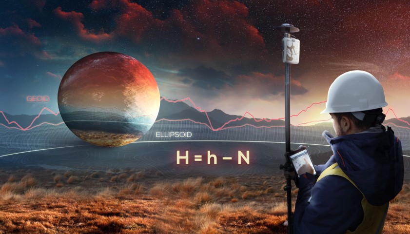
6.1 KAITLIN: So with a GNSS device, we can connect to Russian and EU satellites?
TYLER: Generally, you’ll want to check the GNSS manufacturer specifications to confirm which GNSS satellites it will be compatible with. An Arrow 100, Arrow 200, and Arrow Gold are all 4-constellation receivers, so that means they’ll receive signals from all 4 global constellations, including not just the Russian GLONASS and EU Galileo satellites, but also the U.S. GPS satellites and China’s BeiDou satellites. This makes a big difference under canopy, especially, and in certain other challenging field conditions.
6.2 ERIC: Is there a good website to go to check what satellites are available?
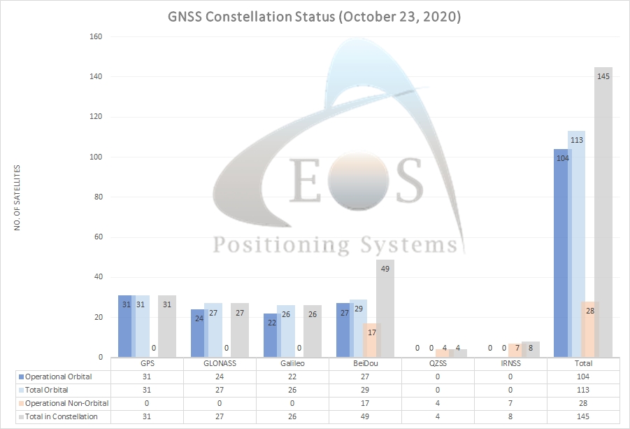
TYLER: Each GNSS constellation is managed by a different governmental body, so each one has its own official website containing satellite statuses. Each of the global GNSS constellation websites are here:
To make it easy for our customers, Eos aggregates the latest satellite statuses for all constellations in our monthly newsletter. Below is a sample of the status chart:
6.3 JARED: Tyler, is there a way to grab the compass heading off of the GNSS and/or phone for a calculated field like you did with the ortho heights?
TYLER: Collector does capture a heading field in the GNSS metadata, but this value does not come from the GNSS receiver but from the phone. This is a relatively new field so if you set up your GNSS metadata fields a year or so ago it may not be in there. Here is the documentation.
JEFF: Tyler is correct. We do capture the compass information into a field called “esrisnsr_azimuth”. The compass value heading comes from the phone itself and is based upon Magnetic North.
6.4 MANUEL: Using Eos Arrow and Collector, how accurate is the data can we obtain for the Z value?
TYLER: Similar to question 30, your Z value is going to be a factor of the GNSS receiver’s horizontal accuracy. An Arrow receiver using RTK will get you around 2-3cm vertical accuracy on average. You’ll also be able to choose from collecting either ellipsoidal or orthometric heights in real time.
6.5 MICHAEL: We have had a lot of difficulty collecting Z values in NAVD88 in feet. Will the settings for getting this set up properly be reviewed? I’ve found online help, but none that completely solves the issue of properly getting the height in feet.
TYLER: Unfortunately storing elevation values in feet is not supported natively (at this time), but you can use the Arcade expression to query the Z-value and convert it to feet simultaneously though. Refer back to the recording at 1:14:20 where I set up the web map with Arcade expressions.
6.6 CHRISTOPHER: We have an Arrow 100. What are some tips for eeking out the maximum accuracy possible with this unit.
TYLER: First, make sure the antenna cable connections are snug, not loose but not too tight either. Then make sure the antenna is properly placed over the target and in clear view of the sky. If the receiver is moving from target to target quickly, give the receiver a moment to “catch up” after getting to the next target. 1 or 2 seconds is about right. Lastly, enable averaging, set it up to average from 5 to 15 seconds or more depending if you are under trees or not.
My experience with the Arrow 100 has been that with an open view of the sky and the Arrow 100 sitting statically I can obtain ~1ft accuracy quite consistently.
6.7 RYAN: We recently purchased an Eos Arrow receiver. Can you give me a contact for the Delaware area that I can get in touch with about some possible training to help us get it set up and working correctly.
TYLER: You can always reach out to the Eos representative who worked with you on the purchase to request training, but if you’ve lost their information or have a specific technical question, you can also contact our Tech Support team directly. They generally reply within 1 business day and are fluent in English, Spanish and French. The technical support form will ask for your Arrow serial number.
6.8 FERNANDO: I’m thinking that the Eos Arrow receiver has a SIM card. Is it compatible with all cellular technologies? E.G. GSM, GPRS, EDGE, UMTS?
TYLER: The Eos Arrow receivers don’t have built-in SIM cards. It is not needed. The Internet connection to receive RTK corrections is handled by your data collector, smartphone or tablet running Eos Tools Pro.
6.9 ELMOIZ: We are looking for an underground cable detector can we find it?
TYLER: Yes, the Eos Tools Pro app that I showed earlier had the primary function to connect to the Eos GNSS receiver, and provide RTK corrections. But Eos Tools Pro also offers additional capabilities, including a free underground utility mapping solution called Eos Locate™ for ArcGIS®. This Eos Locate™ solution will work with both ArcGIS Field Maps and Collector on iOS®, provided you have a compatible locator model.
Essentially, Collector (or Field Maps) integrates with the Arrow GNSS receivers and compatible utility locators to capture both the real-time, high-precision GNSS metadata and locator metadata, so you can accurately map your buried assets in your GIS. Right now, Eos Locate™ works with specific Vivax-Metrotech, Subsite, and RadioDetection locate models.
6.10 FERNANDO: What solution do you have when you are in challenging areas? E.G tall buildings, trees?
TYLER: I like to carry a chainsaw with me for trees. 🙂
No, I mean, it’s a very real issue most folks who use GPS run into at some point. First, make sure you are utilizing all four constellations. This will give you the best chance at obtaining precise positions in tough GNSS environments. GNSS isn’t perfect for every place on Earth. In places where you can’t physically occupy a point and capture it accurately with a GPS receiver, like under dense canopy or with building overhangs, right against building corners—anywhere where your satellite view is cut—you need a different solution.
In this case, you can use a laser to do GNSS offsets, and that’s a pretty common approach. It even works when you want to capture assets with a clear view of the sky, but maybe you can’t safely occupy them, like a manhole in a busy intersection. Eos worked with Esri and Laser Tech to develop an iOS solution, so you can stand safely in a place with clear sky-view to satellites and capture an asset from afar while retaining survey-grade accuracy.
6.11 ERIC, MICHAEL: Are there any tools available that will allow us to use a TruPulse Laser Range finder with Collector?
TYLER: Yes, the LTI TruPulse laser rangefinders are already compatible with Collector via the Arrow GNSS and its sister app, Eos Tools Pro. You will need the Arrow receiver for high-accuracy. Then you just Bluetooth both the TruPulse and Arrow to your iOS device, and use Collector to capture features from afar. We have a lot of how-to videos and case studies on people using this solution across industries on our website.
6.12 ANET: Will all the technology you are showing be available and supported on the current Windows tablets?
TYLER: On the GNSS side, all Arrow GNSS receivers are compatible with all Windows devices, and any mobile apps that work on Windows. I’ll turn it to Jeff for the Esri app side.
JEFF: ArcGIS Collector is currently supported on the Windows 10 platform. However, we are not actively developing ArcGIS Field Maps for Windows at this time.
6.13 KARYN: I have access to a CORS in my town. Can an Eos receiver connect to it?
TYLER: Yes, but I want to add some clarification, primarily because of what CORS stations are typically used for. A continuously operating reference station (CORS) is actually doing 2 things at once. Sometimes, it’s being used in an RTK network to broadcast real-time corrections to rover receivers, which consume those corrections to increase their accuracy.
But more typically, when people say CORS they’re talking about a base station that’s not being used to broadcast corrections to rovers. Instead they mean a station that’s storing raw data, like in an FTP server or similar. And typically in this case, the field worker collects raw data on their rover, comes back to the office, downloads the raw data from the rover and CORS, and pairs them up with a post-processing software. So the answer is yes, but it’s nuanced.

