Priyesh Patel uses Eos Arrow 100® GNSS receivers with Esri ArcGIS® apps to aid the preservation of one of Earth’s most precious animals: bats.
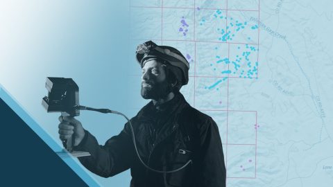
Priyesh Patel uses Eos Arrow 100® GNSS receivers with Esri ArcGIS® apps to aid the preservation of one of Earth’s most precious animals: bats.
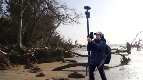
Learn how the South Carolina Department of Natural Resources uses high-accuracy GNSS to excavate artifacts before they are lost to climate change.
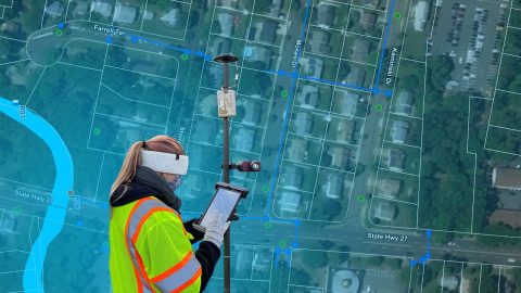
The City of Rahway upgraded from a paper-based workflow to digital GNSS mobile mapping for the city’s sanitary sewer and stormwater systems.

Bat Conservation International locates bat-friendly habitats with a combination of Esri ArcGIS Apps (e.g., Survey123) and Arrow GNSS receivers.

In this Eos / Directions Magazine webinar, two users of high-accuracy GNSS receivers demonstrate how they implemented and improved high-accuracy data collection.
Four panelists share their experiences using Arrow GNSS receivers with ArcGIS apps and take audience questions.

GIS is more than just a job to Ronald Stith Lopez. It’s a way to improve people’s lives. Learn how Ronald uses GNSS across Peru and Colombia.

In a ground-breaking U.K. project, Arcadis captured accurate data efficiently in a live rail environment and shared in real-time to the client.

Join Eos, Esri and friends for this interactive panel from 2020 Esri IMGIS on mobile GIS and high-accuracy GNSS, including recorded Q&A.

Zac Petix is VP of Geospatial Services at Palmetto Engineering. Learn how he uses high-accuracy GIS to help clients determine sound solutions.