Our panelists answer questions about datum transformations, RTK, ArcGIS Field Maps and more in this Q&A from our recent workshop.
Our panelists answer questions about datum transformations, RTK, ArcGIS Field Maps and more in this Q&A from our recent workshop.
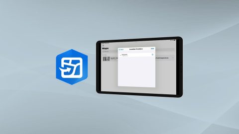
Learn how to configure location provider and location profile in ArcGIS Field Maps for Arrow GNSS receivers.
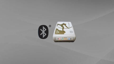
Want to use external Bluetooth® GPS receivers in your work, but not sure where to start? Eos has compiled five resources to help you get started on your journey.
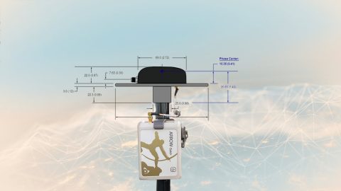
This article will show you how to calculate your total antenna height, including phase center, mounting plate height, and range pole, for use with RTK elevations.

Got CartoPac and GPS? CartoPac and Eos have partnered to bring a complete high-accuracy mobile data-collection solution to customers in gas, utility, and related industries.
Arrow 100+™ datasheet: Key features and technical specifications for the Arrow 100+™ (plus model) GNSS receiver from Eos Positioning Systems.
The Arrow Series® Quick Start Guide explains in 3 steps how to turn on, Bluetooth® pair, and mount your Arrow to your field gear of choice.
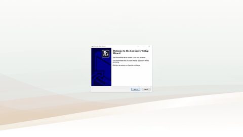
Eos Server User Guide: Set up Eos Server to broadcast your own Arrow GNSS base station corrections when an RTK network is not available.
Arrow Series® User Manual (SBAS): Familiarize yourself with the Arrow GNSS receiver, accessories, Bluetooth® pairing and operation with SBAS.
Arrow Series® Comparison Chart: Compare technical specifications for the Arrow Gold®, Arrow 200®, Arrow 100® and Arrow Lite® receivers.