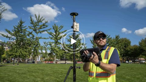
This is step 3 of 3: How to mount your receiver & antenna with range pole for centimeter Arrow GNSS receivers (Gold, Gold+, 200).
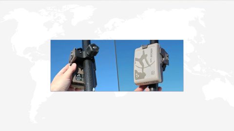
This is step 3 of 3: How to mount your receiver & antenna with range pole for centimeter Arrow GNSS receivers (Gold, Gold+, 200).
This is step 2 of 3: Pair the Arrow GNSS receiver with Windows 10 via Bluetooth Install & run the Eos Tools Pro application (Windows).
This is step 2 of 3: Pair the Arrow GNSS receiver with Android via Bluetooth Install & run the Eos Tools Pro application (Android).
This is step 2 of 3: Pair the Arrow GNSS receiver with iOS via Bluetooth Install & run the Eos Tools Pro application (iOS).
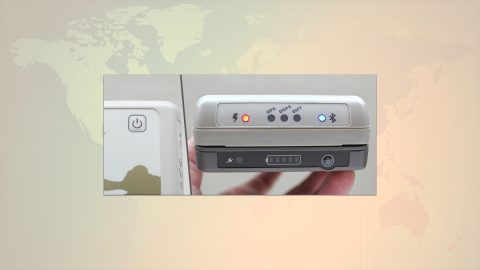
This is step 1 of 3 in the initial setup for your Arrow Series® GNSS receiver: Inventory & Power Up your Arrow receiver (any model).
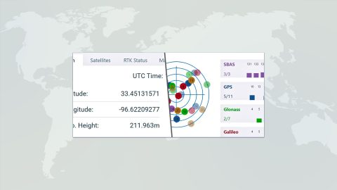
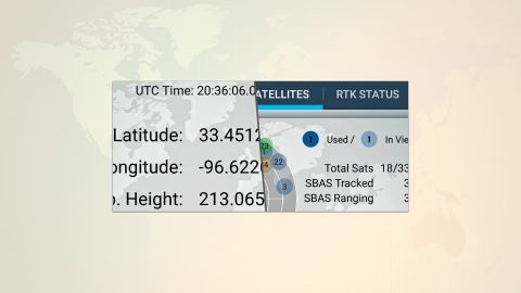
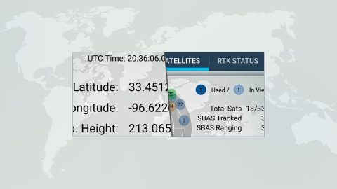
What do “SBAS,” “RTK,” “GNSS” and other GPS terms stand for, and what is their significance? This article explains important GNSS acronyms.
Step-by-step guide to using ArcGIS Collector offline, including how to set your area, monitor your GPS accuracy, and sync data after work.
Run multiple Esri mobile apps on Android while concurrently consuming Arrow GNSS location metadata. This guide will show you how (for Android only).

Everything from elevation, datum shifts and base stations to ArcGIS setup and ArcGIS Field Maps is coverd in this mobile GIS workshop Q&A.
Michael Cousins explains OHM Advisor’s best practices for evaluating field GIS technology, including software, hardware and staff training.