Why Doesn’t My GPS Data Line up with My GIS? Eos explains common challenges to GNSS workflows on any device, and what to do to fix them.
Why Doesn’t My GPS Data Line up with My GIS? Eos explains common challenges to GNSS workflows on any device, and what to do to fix them.
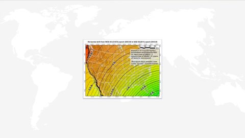
Knowing how to compute datum offsets is important for shifting between datums. The Eos Tools Pro app now supports computing datum shifts. Here’s how to use it.
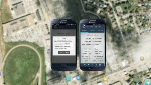
Wondering how to know if your mobile device GNSS accuracy is correct? This article will break down common issues and how to fix them on iOS or Android.
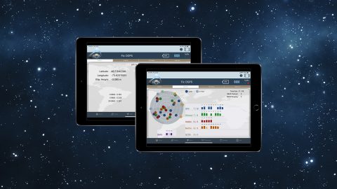
This article shows you how to use the four constellations for sub-meter GNSS mapping with Arrow. Using GPS, Glonass, Galileo, and BeiDou increases accuracy.
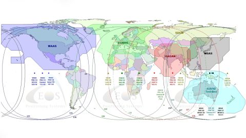
This article gives you an overview of the available global SBAS systems, as well as their coverage areas and what accuracy to expect.

This article shows you how to record GNSS metadata in ArcGIS Collector by adding metadata fields to the feature service, either via python or manually.
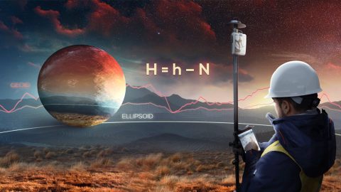
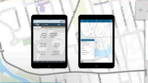
This article shows you how to set up Eos Tools Pro to collect survey-grade orthometric heights in real time with ArcGIS Collector.