Our panelists answer questions about datum transformations, RTK, ArcGIS Field Maps and more in this Q&A from our recent workshop.
Our panelists answer questions about datum transformations, RTK, ArcGIS Field Maps and more in this Q&A from our recent workshop.

Learn how to verify your GNSS receiver’s performance by using a survey monument in this video.

This quick video shows you how to configure elevation (orthometric vs. ellipsoidal) output in Eos Tools Pro, including a complete list of currently available GEOID models by region.

This article will show you how to calculate your total antenna height, including phase center, mounting plate height, and range pole, for use with RTK elevations.

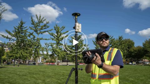
This is step 1 of 3 in the initial setup for your Arrow Series® GNSS receiver: Inventory & Power Up your Arrow receiver (any model).
What do “SBAS,” “RTK,” “GNSS” and other GPS terms stand for, and what is their significance? This article explains important GNSS acronyms.
Step-by-step guide to using ArcGIS Collector offline, including how to set your area, monitor your GPS accuracy, and sync data after work.

Everything from elevation, datum shifts and base stations to ArcGIS setup and ArcGIS Field Maps is coverd in this mobile GIS workshop Q&A.
Michael Cousins explains OHM Advisor’s best practices for evaluating field GIS technology, including software, hardware and staff training.
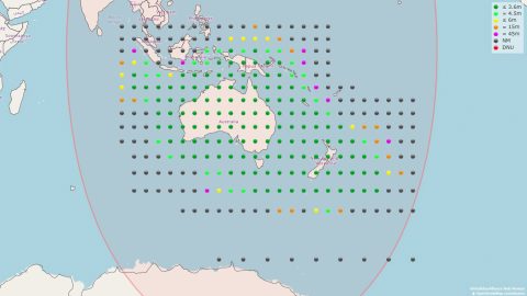
The Australia-New Zealand SBAS is among the most advanced (dual frequency, multi-constellation, PPT). History and performance are reviewed in a guest post.