This article provides step-by-step instructions for setting your Eos GNSS receiver as the location provider in ArcGIS Field Maps on iOS devices.
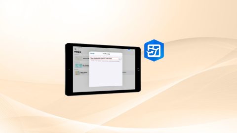
This article provides step-by-step instructions for setting your Eos GNSS receiver as the location provider in ArcGIS Field Maps on iOS devices.

This MDM guide will walk you through how to configure common Eos Tools Pro settings for multiple field workers across an organization. Includes sample code.
Follow this article to create an ArcGIS web map from scratch with the correct settings for Eos GNSS receivers and related metadata.
Experts answer questions about datum transformations, RTK, ArcGIS Field Maps and more in Part 1 of Q&A from our October 2022 workshop.
Our panelists answer questions about datum transformations, RTK, ArcGIS Field Maps and more in this Q&A from our recent workshop.
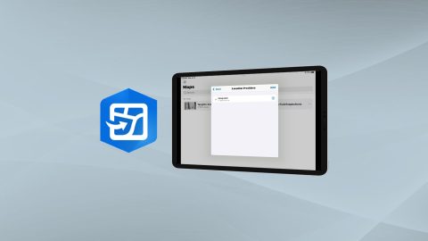
Learn how to configure location provider and location profile in ArcGIS Field Maps for Arrow GNSS receivers.
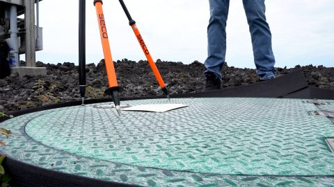
Learn how to verify your GNSS receiver’s performance by using a survey monument in this video.

Why is the Range-Backsight laser mapping method the most efficient and most accurate? This article breaks down everything you need to know about this popular workflow.

Dans cette présentation, nous vous proposons également une démo et discussions autour de la solution/workflow : Eos Locate™ en lien avec ArcGIS Field Maps.

Eos is pleased to offer a free training workshop for those who wish to use Arrow GNSS receivers with Esri’s ArcGIS Field Maps. Request the recording here.