Experts answer questions about datum transformations, RTK, ArcGIS Field Maps and more in Part 1 of Q&A from our October 2022 workshop.
Experts answer questions about datum transformations, RTK, ArcGIS Field Maps and more in Part 1 of Q&A from our October 2022 workshop.
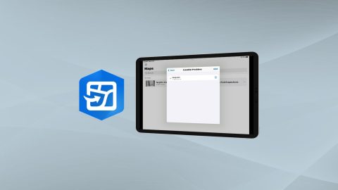
Learn how to configure location provider and location profile in ArcGIS Field Maps for Arrow GNSS receivers.
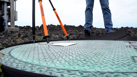
Learn how to verify your GNSS receiver’s performance by using a survey monument in this video.
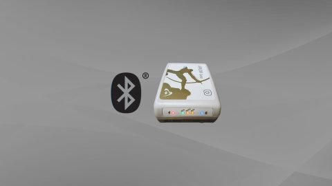
Want to use external Bluetooth® GPS receivers in your work, but not sure where to start? Eos has compiled five resources to help you get started on your journey.
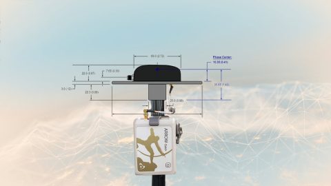
This article will show you how to calculate your total antenna height, including phase center, mounting plate height, and range pole, for use with RTK elevations.

High-accuracy data collection has come a long way since the USA launched the first GNSS constellation, GPS, in the 1970s. Today, all you need to get started with submeter or centimeter data collection is a smart device, a collection app, and a GNSS receiver that works with both.
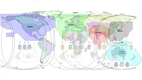
What is SBAS? In this article, discover how to get real-time submeter differential corrections for free, and where it’s possible.

How can you get high-accuracy data corrections in the world’s most remote areas? In this article, Eos explains two options: Atlas® service or SafeRTK®.

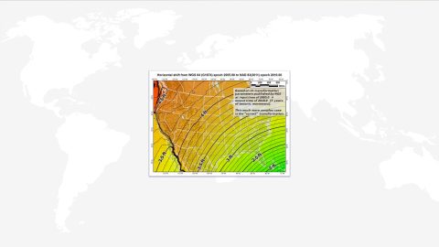
What is the difference between the ellipsoid, mean sea level, geoid, geoid height, and orthometric height? Here’s everything to know about elevation.
Why Doesn’t My GPS Data Line up with My GIS? Eos explains common challenges to GNSS workflows on any device, and what to do to fix them.