Mapping Topic: GIS

  • Home
  • Archive for "GIS"
  • Page 2

20 Posts Our Readers Loved in 2020: Stories, Releases and More!

20 posts our readers loved GPS GNSS GIS Eos Positioning Systems blog post

To celebrate the end of 2020, here are the top 20, most-read posts about high-accuracy mapping from Eos Positioning Systems in 2020.

How to Use Multiple ArcGIS Apps on Android Concurrently with Arrow

(Android) How to use Multiple Esri Mobile Apps Concurrently TCP IP Protocol Survey123 QuickCapture Field Maps ArcGIS

Run multiple Esri mobile apps on Android while concurrently consuming Arrow GNSS location metadata. This guide will show you how (for Android only).

2020 Esri and Eos Mobile GIS Workshop: Panel Q&A Responses

Esri and Eos Mobile GIS GPS GNSS Workshops ArcGIS

Everything from elevation, datum shifts and base stations to ArcGIS setup and ArcGIS Field Maps is coverd in this mobile GIS workshop Q&A.

How to Evaluate Field GIS and GNSS Technology

Best practices for evaluating field GIS and GNSS Technology (a 2020 MiCAMP Presentation) Esri

Michael Cousins explains OHM Advisor’s best practices for evaluating field GIS technology, including software, hardware and staff training.

How to Use Multiple ArcGIS Apps on iOS® Concurrently with Arrow

ArcGIS Collector, Field Maps, offline, data collection, field, mobile mapping, water utility, Arrow GNSS GPS

Run multiple Esri mobile apps on iOS while concurrently consuming Arrow GNSS location metadata. This guide will show you how (for iOS only).

ArcGIS Field Maps: A List of Our Favorite Resources (So Far)

ArcGIS Field Maps roadmap Jeff Shaner Esri ArcGIS Mobile mapping apps Collector

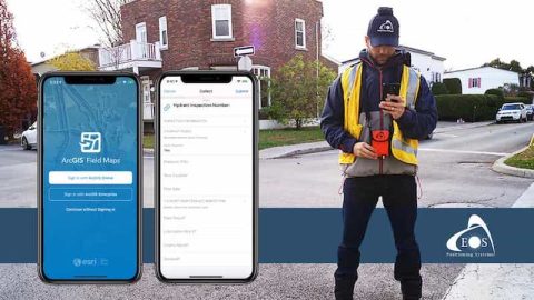
Access download links for ArcGIS Field Maps on iOS, Android. Review account requirements, migration plans. Compare GNSS features, and more.

Eos Locate™: How to configure settings for ArcGIS Collector

Eos Locate™- How to configure settings for ArcGIS Collector Esri GPS GIS GNSS

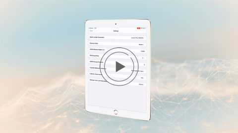
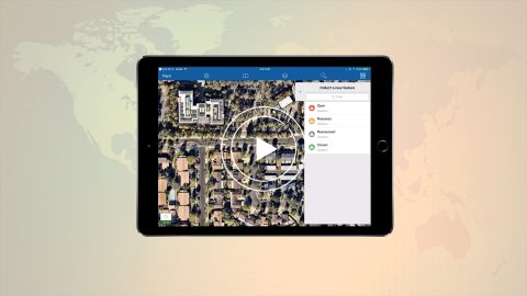
In video 4 of the Eos Locate underground mapping tutorials, you’ll learn how to configure mobile app settings for Eos Locate and ArcGIS Collector.

ArcGIS Collector: High-Accuracy Data Collection Overview (Esri)

ArcGIS Collector - Overview of capturing high-accuracy data Esri video GPS GIS GNSS

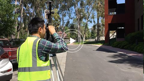
Learn why you’d want to capture high-accuracy data in Esri Collector in this short video from Esri, including sample field-data collection scenarios.

Is Your Utility’s GIS a “Digital Twin” … or a Digital Mutant”?

Is your utility's GIS a Digital Twin ... or a digital mutant GPS GNSS Bill Meehan Esri Electric Utilities ArcGIS

The increasing capabilities of GIS to serve as a digital twin is creating an opportunity for, and desire among, many utilities to re-evaluate data quality.

High-Accuracy Data Collection for Beginners: Choosing a Field Solution

High-Accuracy Data Collection for Beginners- How to Choose a GNSS Field Solution GPS GIS

High-accuracy data collection has come a long way since the USA launched the first GNSS constellation, GPS, in the 1970s. Today, all you need to get started with submeter or centimeter data collection is a smart device, a collection app, and a GNSS receiver that works with both.
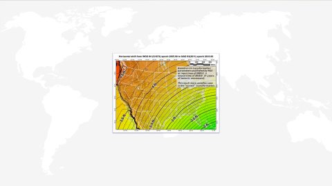