City of Santa Barbara is using an Arrow Gold® Base Station to map meters with centimeter accuracy, as city staff replace assets to respond to drought.
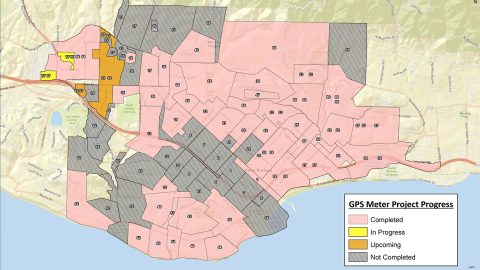
City of Santa Barbara is using an Arrow Gold® Base Station to map meters with centimeter accuracy, as city staff replace assets to respond to drought.
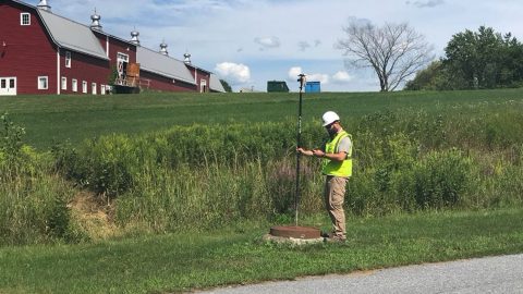
Vermont Gas Systems doubled their efficiency by switching to Arrow Gold® GNSS receivers and ArcGIS mobile apps for as-built mapping.

Join Eos, Esri and friends for this interactive panel from 2020 Esri IMGIS on mobile GIS and high-accuracy GNSS, including recorded Q&A.

Zac Petix is VP of Geospatial Services at Palmetto Engineering. Learn how he uses high-accuracy GIS to help clients determine sound solutions.

In this Customer Spotlight, we explore David Gigliotti’s use of a GPS system—comprised of Arrow Gold, iPad and ArcGIS—in upstate New York.

Theresa Maier of Esri Deutschland partner GI Geoinformatik shares the endless opportunities of GPS for GIS clients.
In this presentation, David Gigliotti of explains how high-accuracy data collection (Arrow Gold® GNSS, ArcGIS) to cut mobile labor costs.
Rockett SUD streamlined field work and freed up office staff with a new rural water GNSS mapping solution that combines hardware and software from Eos and Esri.
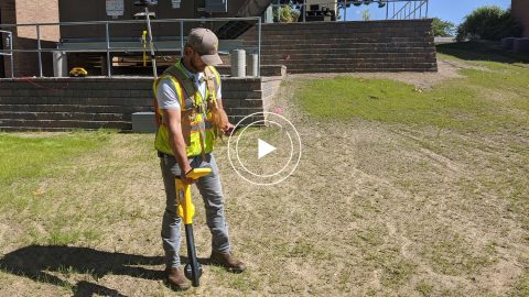
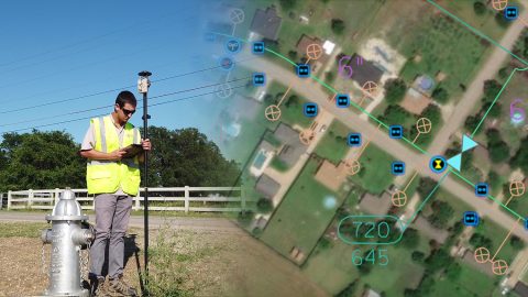
In this recorded Eos Locate case study, Michael Cousins explains how underground mapping (Arrow Gold®, Collector) improved legacy buried-asset records.

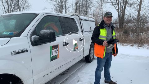
In the Nov. 2020 Eos customer spotlight, we feature Michael Cousins who pushes data-collection to new speeds at OHM Advisors in Michigan.