App Used: ArcGIS Collector

  • Home
  • Archive for "ArcGIS Collector"
  • Page 6

New Zealand Org Tracks Orchards Re-levelling Success

Mapping orchards with Australian-New Zealand SBAS page bloomer associates

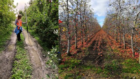
A NZ agricultural research team uses Arrow 100 w/ Australian-New Zealand SBAS to get 30cm accuracy among 5m-tall trees. Their work may change orchard ops.

Rural Utilities Get Higher Accuracy Asset Data in Appalachia

Great Lakes RCAP helps utilities in rural Appalaicha map assets with high accuracy using Arrow Gold GNSS and Esri ArcGIS Collector Field Maps

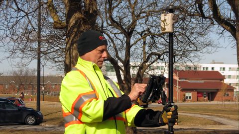
In 2018 Ohio began requiring public water utilities to maintain a detailed AMS. RCAP is simplifying compliance with ArcGIS and Arrow Gold for Asset Management.

Seattle Zoo uses Lasers to Build Basemap around Lions

Dann Block maps zoo assets safely from afar using Arrow 100 GNSS and Eos laser mapping for ArcGIS Collector on iOS

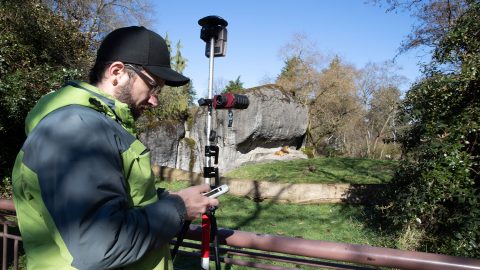
Laser Mapping with ArcGIS Collector allows one zoo to create its first basemaps in 120 years with cm accuracy, amid heavy foliage, buildings and animals.

Woodland Park Zoo Transforms GIS with Laser Mapping

Woodland Park Zoo Esri UC presentation Dann Block

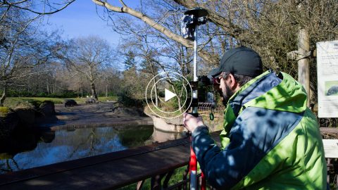
The Woodland Park Zoo Laser Mapping project enabled infrastructure (utility, gardens, etc.) basemaps with submeter accuracy for the first time in 120 years!

Eos and Esri Make Urban Forestry Easy

EPC Eos Montreal case study Esri Forestry urban forestry GPS mapping invasive species

Eos and Esri go together in Montreal, where Arrow GNSS and Collector help fight an invasive species. Montreal is also special to Eos CTO Jean-Yves Lauture.

DDSI Increases Profit Margins with GNSS Laser Mapping

DDSI uses Eos Laser Mapping solution with Arrow Gold, LTI TruPulse 200X, and ArcGIS Collector to map mixed utility assets (electric, telco, water) for client projects

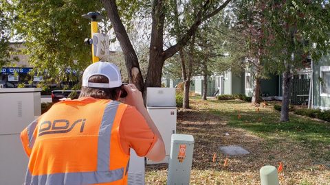
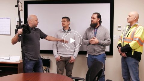
Denver’s DDSI maps utilities in tough-to-reach areas with Eos Laser Mapping for ArcGIS Field Maps during construction design phases.

DDSI Presents at Esri GeoConX

Video Case Study: DDSI Laser Mapping Presentation at Esri GeoConX; DENVER DDSI laser mapping for utility locates at telecommunications sites with Eos Positioning Systems RTK laser mapping solution, ESRI GIS, and laser technology inc TRUPULSE 200x rangefinder in Colorado

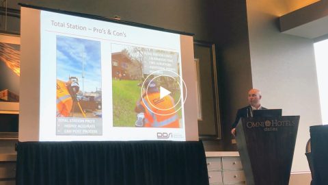
DDSI at Esri GeoConX explains how they accelerated field work, enabled real-time QA/QC and reduced accuracy error for utility field work with laser mapping.

Ports of Auckland Demonstrates Arrow Gold with ArcGIS

Port of Auckland uses Eos Arrow Gold RTK receiver with Esri Collector to verify port construction is being performed according to designs, down to the cm.

Ports of Auckland uses Eos Arrow Gold RTK receiver with Esri Collector to verify port construction is being performed according to designs, down to the cm.

Video Case Study: Niagara Region and GPS Precision

Video Case Study: Niagara Region and GPS Precision with Arrow Gold and Collector for ArcGIS for Water Locates; shown here is their interview with GPS Precision of Canada

Niagara Region and GPS Precision get together to discuss how they put together an Arrow Gold RTK base station for pipe locates at Ontario water facilities.

Niagara Region Keeps Infrastructure Safe with RTK Locates

Arrow Gold for Locates: Niagara Region Keeps Infrastructure Safe with Centimeter Accuracy from RTK Base Station and Arrow Gold Locations in Collector for ArcGIS®; shown here they test the rover

Niagara Region used Arrow Gold for locates, deploying real-time GNSS data collection with their own RTK base station and Esri ArcGIS Collector.