App Used: ArcGIS Collector

  • Home
  • Archive for "ArcGIS Collector"
  • Page 2

Sea Turtle Patrol Hilton Head Island Protects Endangered Hatchlings with GIS

Sea Turtle Patrol Hilton Head Island - Sea Turtle Hatchlings on Beach

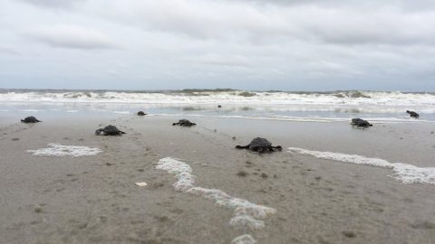
A nonprofit group in South Carolina uses location-based technology to protect sea turtles, so they can safely hatch and go home to the ocean.

Webinar: High-Accuracy GPS 101: How to Design Your Mobile GIS Data Collection System

Webinar - High-Accuracy GPS 101- How to Design Your Mobile GIS Data Collection System Directions Magazine Palmetto Engineering City of Sarasota Florida COVID response

In this Eos / Directions Magazine webinar, two users of high-accuracy GNSS receivers demonstrate how they implemented and improved high-accuracy data collection.

2021 Esri UC Session: Ask Me Anything! We Use Eos Arrow GPS with ArcGIS Apps

Esri UC 2021 Panel - Ask Me Anything! We Use Eos Arrow GPS with Mobile ArcGIS Apps

Four panelists share their experiences using Arrow GNSS receivers with ArcGIS apps and take audience questions.

Mapping boundaries: An investment in data quality capture for The National Trust

National Trust land boundary mapping for ownership verification, Stock image from MGISS

The National Trust upgraded their GPS technology to accurately map fence lines and check boundaries to show where land ownership ends.

5 Municipalities Using SBAS Corrections for Submeter Accuracy

5 Cities Using SBAS for Submeter GPS Accuracy, local governments employ GIS mapping with Eos Arrow GNSS receivers

Browse 5 of our favorite examples of municipalities improving their communities by using SBAS corrections with the Arrow 100®.

ESI increases wetlands mapping project profits by 20% using Arrow GNSS and Ecobot

ESI video case study feature image with Arrow 200 GNSS receiver, iOS, and Ecobot app for wetlands delineations mapping projects

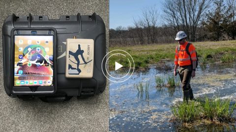
Environmental Solutions & Innovations switched to Ecobot app and Arrow GNSS to replace a slow and cumbersome legacy mobile mapping solution.

Customer Spotlight: Scott Denham Navigates Wetlands with Mobile GNSS

Scott Denham Customer Spotlight - Wetlands GPS, GNSS, GIS ESI Ecobot app Esri partner

Scott Denham uses Arrow GNSS and the Ecobot app for wetlands management projects. Learn what drives Scott to find the most efficient tech.

5 Water Utilities Using Bluetooth GNSS Receivers

5 Ways Water Utilities are Transforming Data Collection GPS GIS GNSS Esri ArcGIS Field Maps, ArcGIS Collector, Eos Tools Pro, Arrow

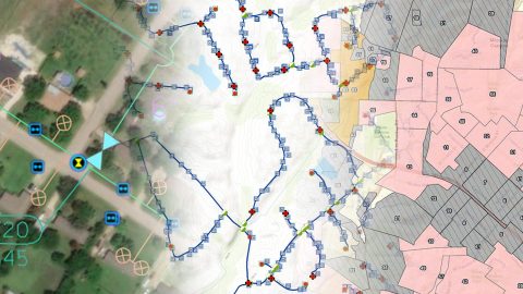
Five water utilities are using high-accuracy Bluetooth® GNSS receivers to transform their mobile data collection. Here’s how.

Timber Operations Go Digital In Northern Canada

Mobile crews use geospatial technology to verify the locations of protected topographic features, such as this watercourse

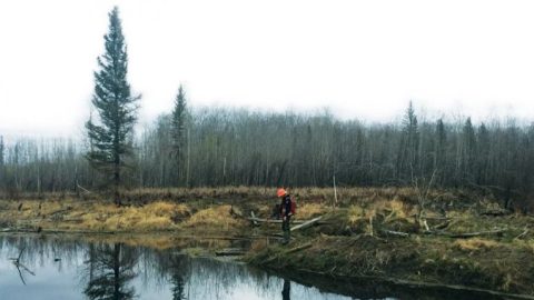
Tolko is always modernizing its mapping technology. They recently increased timber harvest by adopting Arrow 100® GNSS w/ GLONASS & Esri apps.

Customer Spotlight: Michael Kolody Serves Clients with Cartography

Eos customer spotlight GNSS GIS

Mike Kolody turned his childhood love of cartography into a career. Today he helps clients modernize mobile GIS and GNSS mapping workflows.