NSBU on the Florida coast needed a real-time, easy-to-use high-accuracy data collection system to replace paper redlining.
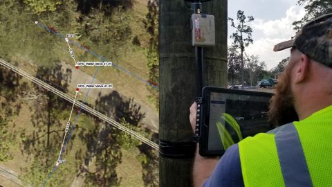
NSBU on the Florida coast needed a real-time, easy-to-use high-accuracy data collection system to replace paper redlining.

KimPro Energy uses Arrow Gold® GNSS — mounted on backpacks and vests — to innovate with their field data collection for energy / environmental use cases.
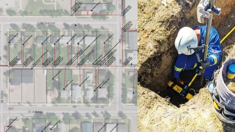
Apex Utilities uses an Arrow Gold® RTK GNSS base/rover configuration with Android tablets and ArcGIS Field Maps for tracking and traceability.
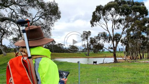
Hear how one Australian company uses Arrow 100® for heritage management alongside ArcGIS Collector. Originally presented at Ozri 2020.

National Park Service is using Arrow Gold® RTK GNSS receivers at LAVO national park to clear tens of feet off alpine roads with cm accuracy.

In our Sept 2020 customer spotlight, Jim Casey shows us how he is putting his Arrow Gold® GNSS receiver to good use with his drone and AR.

Customer Spotlight: Chris Kahn was one of Eos’ earliest customers and has found a sweet spot of efficient CAD, GIS, GNSS, and UAV field work.
When some City of Sarasota employees were temporarily idled by the COVID-19 shutdown, the city found an innovative way to transition them to high-accuracy GIS field work by renting 14 Arrow 100® GNSS receivers.

Customer Spotlight: Josiah Thomas uses Arrow Gold and ArcGIS Collector to mark farmland, through his nonprofit ADF Haiti, across the Haitian island.

Meet our newest Customer Spotlight: Mike George of DDSI! Mike adopted laser offsets with Arrow & ArcGIS Collector, helping increase DDSI’s project margins by 20% per project!