The City of Rahway upgraded from a paper-based workflow to digital GNSS mobile mapping for the city’s sanitary sewer and stormwater systems.
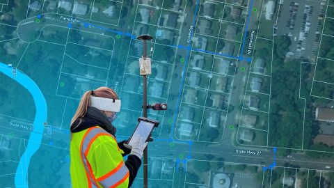
The City of Rahway upgraded from a paper-based workflow to digital GNSS mobile mapping for the city’s sanitary sewer and stormwater systems.

Did you know GIS might be behind your glass of wine? Learn how Summer Roberts uses GNSS to map vineyard properties in California.
Zack Henry uses an Arrow Gold® with ArcGIS Field Maps for efficient data collection for utilities. When his clients succeed, Zack succeeds — and he brings that attitude to all his work.

In this Eos / Directions Magazine webinar, two users of high-accuracy GNSS receivers demonstrate how they implemented and improved high-accuracy data collection.
Dmitri Bagh is committed to putting the “real” in augmented reality (AR). As a passionate Scenario Creation Analyst at Safe Software, Dmitri is helping to pave the way for visually powerful, high-accuracy data collection with AR.
Four panelists share their experiences using Arrow GNSS receivers with ArcGIS apps and take audience questions.
Learn best practices for deploying high-accuracy Arrow GNSS receivers with Esri’s ArcGIS Field Maps. This webinar includes a customer presentation about his deployment, including demonstrations and Q&A.
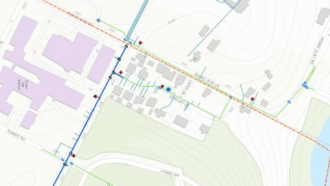
Previously it took 3rd-party contractors 1+ year to deliver Wilmington’s CAD as-builts. Now with ArcGIS Field Maps and Arrow GNSS, it’s near real time.