Thomas Shifflett uses high-accuracy GNSS to help locate hidden cave entrances in the dense jungles of Oaxaca, Mexico.

Thomas Shifflett uses high-accuracy GNSS to help locate hidden cave entrances in the dense jungles of Oaxaca, Mexico.
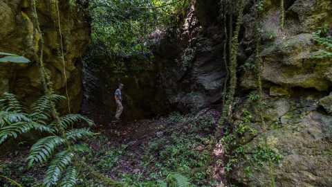
PESH is on a mission to explore and map México’s Sistema Huautla. The Arrow 100 GNSS receiver is helping them prove their survey findings.
After updating several nearby cave locations with the Arrow 100® coordinates, I recompiled the overland survey and calculated an azimuth and distance from a cave that I thought should be close. This led right to the lost entrance!

Aaron Krohn prepares his utility for the future by improving field accuracy and efficiency, in part thanks to GNSS.

Ryan Key uses high-accuracy location data to enhance inspections, improve maintenance responses, and increase confidence in utility data.

Learn how Sarah uses GNSS and GPR to map gravesites at Indigenous Residential Schools with precision and respect.

Charles amps up accuracy for his electric utility clients through easy-to-implement GNSS and GIS solutions.

Discover how Gideon improves data collection on railways projects using real-time, high-accuracy GNSS solutions.
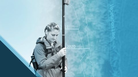
Emily Jane Murray maps coastal archaeological sites before their valuable history is lost to rising sea levels.