National Park Service is using Arrow Gold® RTK GNSS receivers at LAVO national park to clear tens of feet off alpine roads with cm accuracy.

National Park Service is using Arrow Gold® RTK GNSS receivers at LAVO national park to clear tens of feet off alpine roads with cm accuracy.

In our Sept 2020 customer spotlight, Jim Casey shows us how he is putting his Arrow Gold® GNSS receiver to good use with his drone and AR.

Customer Spotlight: Chris Kahn was one of Eos’ earliest customers and has found a sweet spot of efficient CAD, GIS, GNSS, and UAV field work.
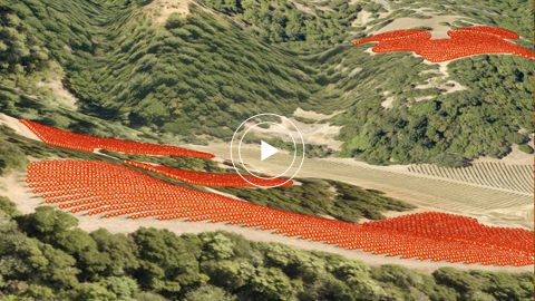
Learn how one premium-wine producing vineyard saved over a half-million dollars by choosing RTK cloud-based mapping over physical barcode IDs.

Customer Spotlight: Josiah Thomas uses Arrow Gold and ArcGIS Collector to mark farmland, through his nonprofit ADF Haiti, across the Haitian island.

Meet our newest Customer Spotlight: Mike George of DDSI! Mike adopted laser offsets with Arrow & ArcGIS Collector, helping increase DDSI’s project margins by 20% per project!
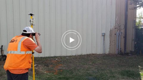
In this Esri AEC webinar, DDSI Global shares how per-project ROI increased by 20% thanks to the use of Eos Laser Mapping for Collector during site surveys.
See how stakeholders in Texas benefitted from real-time UAV data captured and shared using ArcGIS Drone2Map, ArcGIS Online, and Eos GNSS receivers.

Meet GPS power user Kenny Ratliff, whose work has brought ROI on Oldham County Water District’s GIS investment and improved service to county residents.

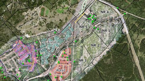
Arrow Gold for Ground Control Points: Over 110,000 Japanese Americans were interned in WWII. One man is using GIS, GPS, and AR to make sure we remember.