Laser Mapping with ArcGIS Collector allows one zoo to create its first basemaps in 120 years with cm accuracy, amid heavy foliage, buildings and animals.
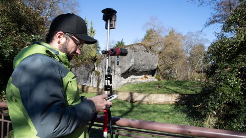
Laser Mapping with ArcGIS Collector allows one zoo to create its first basemaps in 120 years with cm accuracy, amid heavy foliage, buildings and animals.
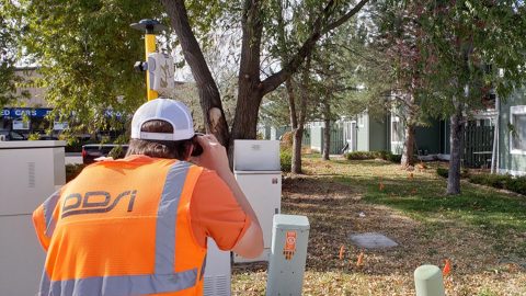
Denver’s DDSI maps utilities in tough-to-reach areas with Eos Laser Mapping for ArcGIS Field Maps during construction design phases.
Real-time access to enterprise ArcGIS via Futura & FieldPro helped TCEC achieve 4-hour as-builting. They used Arrow Gold for field staking GNSS locations.
Niagara Region used Arrow Gold for locates, deploying real-time GNSS data collection with their own RTK base station and Esri ArcGIS Collector.
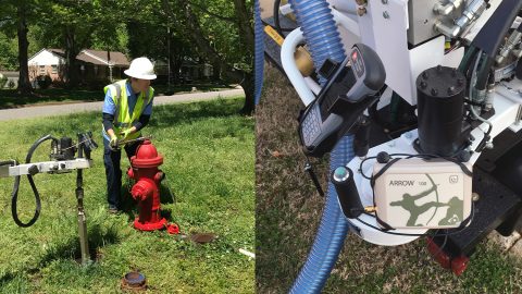
Using Arrow 100 for valve exercising let Two Rivers Utilities add hundreds of valves to their GIS and prepare for tracing on the Esri Utility Network.

Anchorage kicked off a 5-year GIS master plan with a GPS project using Arrow 100 for asset acquisition with Esri’s ArcGIS Collector and ArcGIS Enterprise.
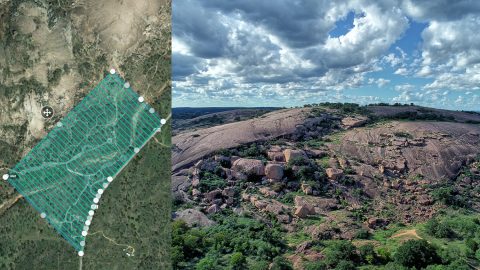
A Texas consultancy provided 3D topo maps and digital elevation models to a park by using Arrow Gold for ground control points, DJI drones & GPS Tracker.
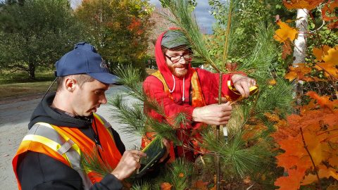
Students hold contractors responsible for $270,000 in warranty-covered replacements by using Arrow 100 for tree inventory with Esri Collector.
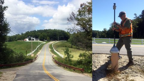
Faced with a retiring workforce, Northern Forest clients began mapping assets. See how one consultancy helps them deploy Arrow 100 GNSS and ArcGIS.
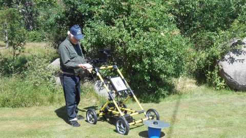
Swedish historians are using Arrow 100 for archeology. They’re locating ancient historically important buried monasteries with ground penetrating radar.