When some City of Sarasota employees were temporarily idled by the COVID-19 shutdown, the city found an innovative way to transition them to high-accuracy GIS field work by renting 14 Arrow 100® GNSS receivers.
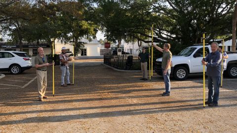
When some City of Sarasota employees were temporarily idled by the COVID-19 shutdown, the city found an innovative way to transition them to high-accuracy GIS field work by renting 14 Arrow 100® GNSS receivers.
In celebration of this international biodiversity day, we’re highlighting how Arrow handheld GPS receivers are being used to save species worldwide!
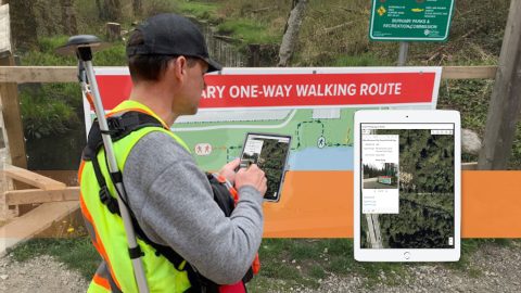
The City of Burnaby pivoted its GPS and GIS technology during COVID to map new social-distancing signs and keep the public informed.
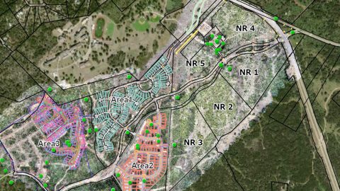
See how stakeholders in Texas benefitted from real-time UAV data captured and shared using ArcGIS Drone2Map, ArcGIS Online, and Eos GNSS receivers.

For Women’s History Month, join us in celebrating women who make a difference in data collection, emergency response, workflow optimization & more.

Arrow Gold for Ground Control Points: Over 110,000 Japanese Americans were interned in WWII. One man is using GIS, GPS, and AR to make sure we remember.
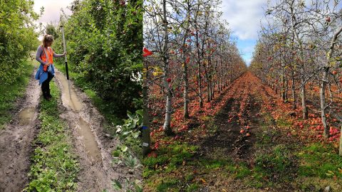
Veritas provides fertilizer and seed prescriptions by using Arrow 100 for soil sampling and processing the results in ArcGIS Pro. See how they work!
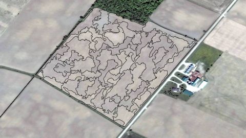
A NZ agricultural research team uses Arrow 100 w/ Australian-New Zealand SBAS to get 30cm accuracy among 5m-tall trees. Their work may change orchard ops.
In 2018 Ohio began requiring public water utilities to maintain a detailed AMS. RCAP is simplifying compliance with ArcGIS and Arrow Gold for Asset Management.
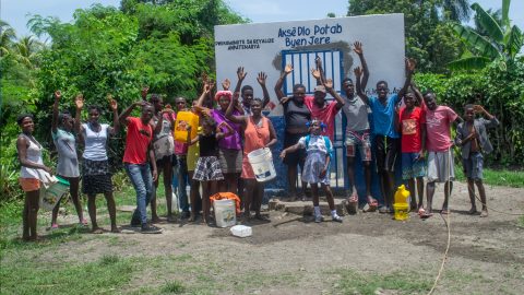
Haiti Outreach involves locals in its water mission. They use mWater to prioritize work and Arrow Gold with Atlas to model distribution systems in EPANET.